
| Memorials | : | 0 |
| Location | : | Cornucopia, Bayfield County, USA |
| Coordinate | : | 46.8330917, -91.1030197 |
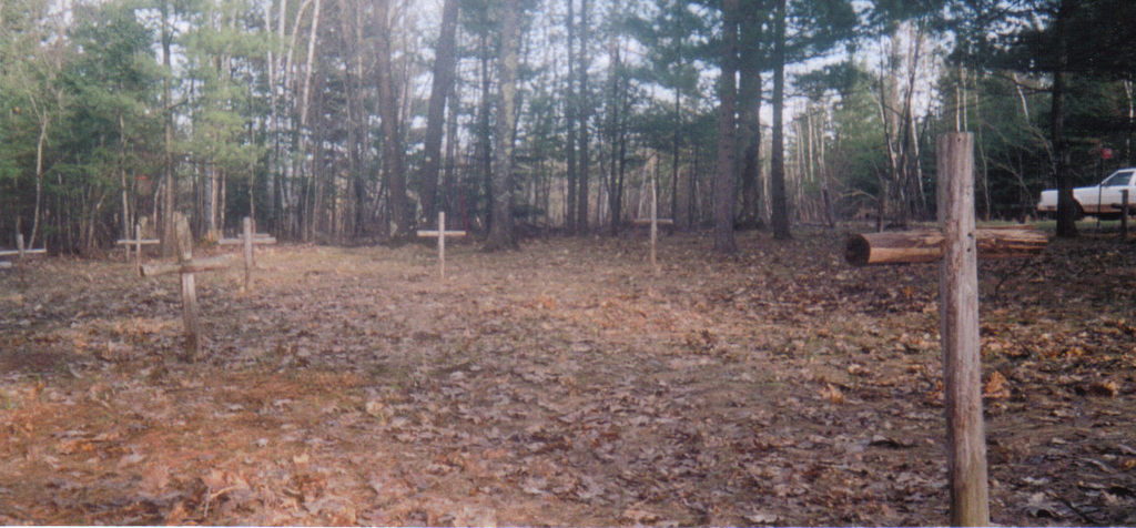
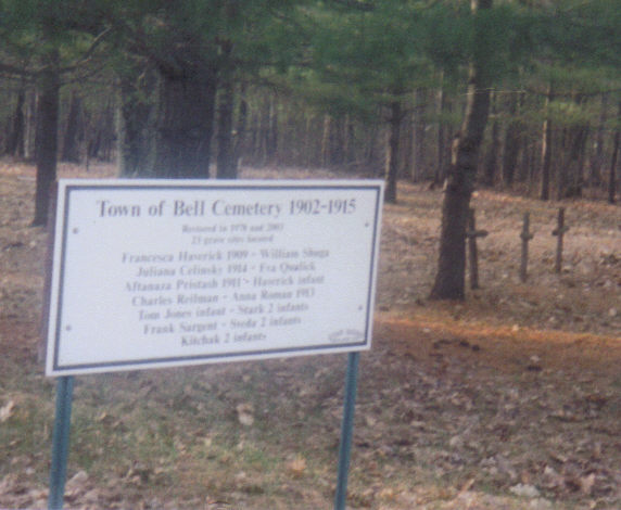
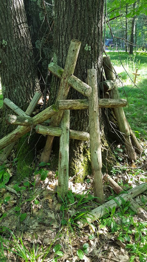
| Description | : | This is the original Town of Bell Cemetery. It was in use from 1902 until 1915, and burials are no longer made here. Please don't confuse it with the newer and current Bell Cemetery, which is located about a mile south, on a different road. Restoration of this cemetery occurred in 1978, and again in 2003. There are 23 known graves here, but not all the identities are known of the people buried here. The Town of Bell is also known as Cornucopia, and is at the northern tip of Wisconsin. |
frequently asked questions (FAQ):
-
Where is Town of Bell Cemetery?
Town of Bell Cemetery is located at Trail Drive Cornucopia, Bayfield County ,Wisconsin ,USA.
-
Town of Bell Cemetery cemetery's updated grave count on graveviews.com?
0 memorials
-
Where are the coordinates of the Town of Bell Cemetery?
Latitude: 46.8330917
Longitude: -91.1030197
Nearby Cemetories:
1. Saint Marys Russian Orthodox Cemetery
Cornucopia, Bayfield County, USA
Coordinate: 46.8085600, -91.1139700
2. George D Jones Jr Memorial Cemetery
Cornucopia, Bayfield County, USA
Coordinate: 46.8083000, -91.1141968
3. Belanger Settlement Cemetery
Bayfield, Bayfield County, USA
Coordinate: 46.8039665, -91.0222855
4. Herbster Community Cemetery
Herbster, Bayfield County, USA
Coordinate: 46.8258018, -91.2177963
5. Greenwood Cemetery
Bayfield, Bayfield County, USA
Coordinate: 46.8163986, -90.8330994
6. Calvary Cemetery
Bayfield, Bayfield County, USA
Coordinate: 46.8163986, -90.8311005
7. Old Calvary Cemetery
Washburn, Bayfield County, USA
Coordinate: 46.7072906, -90.8947830
8. Church Corner Cemetery
Washburn, Bayfield County, USA
Coordinate: 46.6595000, -90.9889000
9. Woodland Cemetery
Washburn, Bayfield County, USA
Coordinate: 46.6845100, -90.9049800
10. Calvary Cemetery
Washburn, Bayfield County, USA
Coordinate: 46.6852989, -90.9008026
11. Greenwood Cemetery
Port Wing, Bayfield County, USA
Coordinate: 46.7668991, -91.3886032
12. Saint Francis Catholic Cemetery
Red Cliff, Bayfield County, USA
Coordinate: 46.8572200, -90.7865600
13. Saint Joseph Cemetery
La Pointe, Ashland County, USA
Coordinate: 46.7824200, -90.7873200
14. York Island Cemetery
Red Cliff, Bayfield County, USA
Coordinate: 46.9833500, -90.8622100
15. Ishpiming Akiin Cemetery
Red Cliff, Bayfield County, USA
Coordinate: 46.9150560, -90.7972500
16. Heitsch Family Burial Plot
Barksdale, Bayfield County, USA
Coordinate: 46.6315661, -90.9560996
17. La Pointe Indian Cemetery
La Pointe, Ashland County, USA
Coordinate: 46.7722015, -90.7817001
18. Chief Little Buffalo Burial Site
La Pointe, Ashland County, USA
Coordinate: 46.7715120, -90.7816920
19. Hillside Cemetery
Port Wing, Bayfield County, USA
Coordinate: 46.6963997, -91.4113998
20. Greenwood Cemetery
La Pointe, Ashland County, USA
Coordinate: 46.7783012, -90.7316971
21. Saints Peter and Paul Catholic Cemetery
Moquah, Bayfield County, USA
Coordinate: 46.5698013, -91.0842972
22. Moquah National Cemetery
Moquah, Bayfield County, USA
Coordinate: 46.5702860, -91.0718390
23. Moquah Cemetery
Moquah, Bayfield County, USA
Coordinate: 46.5701980, -91.0731530
24. Valley View Cemetery
Iron River, Bayfield County, USA
Coordinate: 46.6227989, -91.3600006