
| Memorials | : | 0 |
| Location | : | Tresco, Isles of Scilly Unitary Authority, England |
| Coordinate | : | 49.9475090, -6.3302140 |
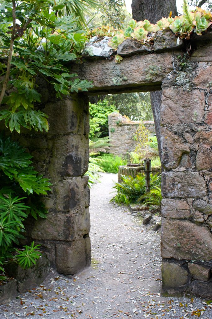
| Description | : | From the 11th until the 15th century the Benedictine monks of the Abbey lived upon Tresco, one of the Isles of Scilly. The Abbey is now in ruins, but there are a few graves here, some of sailors who shipwrecked upon the many rocks nearby. |
frequently asked questions (FAQ):
-
Where is Tresco Benedictine Abbey Priory?
Tresco Benedictine Abbey Priory is located at Tresco, Isles of Scilly Unitary Authority ,Cornwall ,England.
-
Tresco Benedictine Abbey Priory cemetery's updated grave count on graveviews.com?
0 memorials
-
Where are the coordinates of the Tresco Benedictine Abbey Priory?
Latitude: 49.9475090
Longitude: -6.3302140
Nearby Cemetories:
1. St. Nicholas Church
Tresco, Isles of Scilly Unitary Authority, England
Coordinate: 49.9578470, -6.3346550
2. All Saints Church
Isles of Scilly Unitary Authority, England
Coordinate: 49.9526390, -6.3512870
3. St Martin's Church
St Martins, Isles of Scilly Unitary Authority, England
Coordinate: 49.9616570, -6.2847640
4. St. Mary Churchyard
Hugh Town, Isles of Scilly Unitary Authority, England
Coordinate: 49.9152370, -6.3107500
5. St Marys Churchyard
St Marys, Isles of Scilly Unitary Authority, England
Coordinate: 49.9123250, -6.3012600
6. St Mary Old Church Churchyard
St Marys, Isles of Scilly Unitary Authority, England
Coordinate: 49.9106340, -6.3039810
7. St Agnes Churchyard
St Agnes, Isles of Scilly Unitary Authority, England
Coordinate: 49.8928087, -6.3497915
8. Escall's Chapel Burial Ground
Cornwall Unitary Authority, England
Coordinate: 50.0810924, -5.6815943
9. Madron Cemetery
Madron, Cornwall Unitary Authority, England
Coordinate: 50.1327760, -5.5684290
10. Madron Parish Churchyard
Madron, Cornwall Unitary Authority, England
Coordinate: 50.1317547, -5.5647815
11. Wesley Rock Cemetery
Heamoor, Cornwall Unitary Authority, England
Coordinate: 50.1284900, -5.5507200
12. St Ludgvan and St Paul Churchyard
Ludgvan, Cornwall Unitary Authority, England
Coordinate: 50.1447940, -5.4932190
13. Longstone Cemetery
Carbis Bay, Cornwall Unitary Authority, England
Coordinate: 50.1918260, -5.4605190
14. Western Non-Anglican Cemetery
Lelant, Cornwall Unitary Authority, England
Coordinate: 50.1887070, -5.4373470
15. Eastern Anglican Cemetery
Lelant, Cornwall Unitary Authority, England
Coordinate: 50.1885730, -5.4367950
16. Southern Anglican Cemetery
Lelant, Cornwall Unitary Authority, England
Coordinate: 50.1879380, -5.4361620
17. St. Uny Churchyard Old
Lelant, Cornwall Unitary Authority, England
Coordinate: 50.1887240, -5.4362110
18. Rescorla Monument
Hayle, Cornwall Unitary Authority, England
Coordinate: 50.1857330, -5.4215940
19. St Felicitas and St Piala Churchyard
Hayle, Cornwall Unitary Authority, England
Coordinate: 50.1961600, -5.4124860
20. Balwest Chapel Cemetery
Germoe, Cornwall Unitary Authority, England
Coordinate: 50.1213610, -5.3644730
21. St John the Baptist Churchyard
Godolphin Cross, Cornwall Unitary Authority, England
Coordinate: 50.1333830, -5.3470240
22. Gwinear Parish Church Cemetery
Gwinear, Cornwall Unitary Authority, England
Coordinate: 50.1879940, -5.3714960
23. St. Gwinear Churchyard
Gwinear, Cornwall Unitary Authority, England
Coordinate: 50.1874090, -5.3706170
24. St. Breaca Churchyard
Breage, Cornwall Unitary Authority, England
Coordinate: 50.1083210, -5.3321080