
| Memorials | : | 1 |
| Location | : | Scotland |
| Coordinate | : | 55.0398254, -3.6175921 |
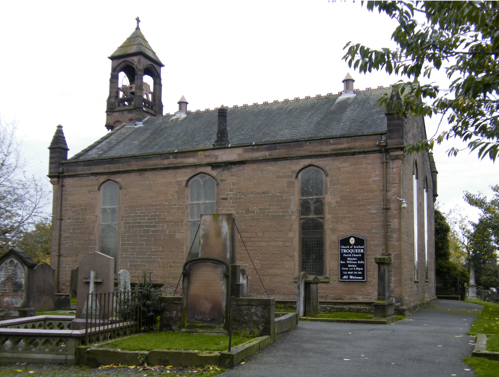
| Description | : | Troqueer is 1 mile South-West of Dumfies railway station. The churchyard adjoins the New Burial Ground and now belongs to the Dumfries Town Council. The 2 burials of the 1914-18 war are at the corner of the third path to the left from the entrance. |
frequently asked questions (FAQ):
-
Where is Troqueer Parish Churchyard?
Troqueer Parish Churchyard is located at Dumfries and Galloway ,Scotland.
-
Troqueer Parish Churchyard cemetery's updated grave count on graveviews.com?
1 memorials
-
Where are the coordinates of the Troqueer Parish Churchyard?
Latitude: 55.0398254
Longitude: -3.6175921


Nearby Cemetories:
1. Troqueer New Burial Ground
Scotland
Coordinate: 55.0399246, -3.6174200
2. Caerlaverock Parish Churchyard
Scotland
Coordinate: 55.0072220, -3.5263890
3. Irongray Churchyard
Scotland
Coordinate: 55.0986790, -3.7017490
4. Irongray Kirkyard - Extention
Scotland
Coordinate: 55.1034857, -3.7632859
5. Southwick Cemetery
Scotland
Coordinate: 54.8953040, -3.7064180
6. Buittle Cemetery
Scotland
Coordinate: 54.9195320, -3.8605370
7. Colvend Parish Churchyard
Scotland
Coordinate: 54.8683920, -3.7742470
8. Keir Churchyard
Scotland
Coordinate: 55.2198710, -3.7941310
9. Balmaghie Parish Churchyard
Scotland
Coordinate: 54.9750000, -3.9969440
10. St Paul's Churchyard
Causewayhead, Allerdale Borough, England
Coordinate: 54.8671390, -3.3552630
11. Silloth Cemetery
Silloth, Allerdale Borough, England
Coordinate: 54.8666200, -3.3551000
12. Quaker Burial Ground
Beckfoot, Copeland Borough, England
Coordinate: 54.8330850, -3.4134130
13. St Michael Churchyard
Bowness-on-Solway, Allerdale Borough, England
Coordinate: 54.9523800, -3.2135380
14. Wesleyan Home Mission Chapel Cemetery
Bowness-on-Solway, Allerdale Borough, England
Coordinate: 54.9535940, -3.2120460
15. St John's Churchyard
Newton Arlosh, Allerdale Borough, England
Coordinate: 54.8853180, -3.2506160
16. Holme St Cuthbert Churchyard
Holme St Cuthbert, Allerdale Borough, England
Coordinate: 54.8108780, -3.3951990
17. Kirkcormack Cemetery
Scotland
Coordinate: 54.8946900, -4.0027600
18. Holme Cultram Abbey Churchyard
Abbeytown, Allerdale Borough, England
Coordinate: 54.8453090, -3.2832650
19. St Bride Churchyard
Kirkbride, Allerdale Borough, England
Coordinate: 54.9047600, -3.2026500
20. Quaker Burial Ground
Allonby, Allerdale Borough, England
Coordinate: 54.7790680, -3.4296924
21. Christ Churchyard
Allonby, Allerdale Borough, England
Coordinate: 54.7671880, -3.4309950
22. St. Mungo Churchyard
Bromfield, Allerdale Borough, England
Coordinate: 54.8109800, -3.2838200
23. St Matthew’s Churchyard
Westnewton, Allerdale Borough, England
Coordinate: 54.7848970, -3.3455930
24. St James Churchyard
Hayton, Allerdale Borough, England
Coordinate: 54.7625930, -3.3880000