
| Memorials | : | 0 |
| Location | : | Sand Brook, Hunterdon County, USA |
| Coordinate | : | 40.4777778, -74.8972222 |
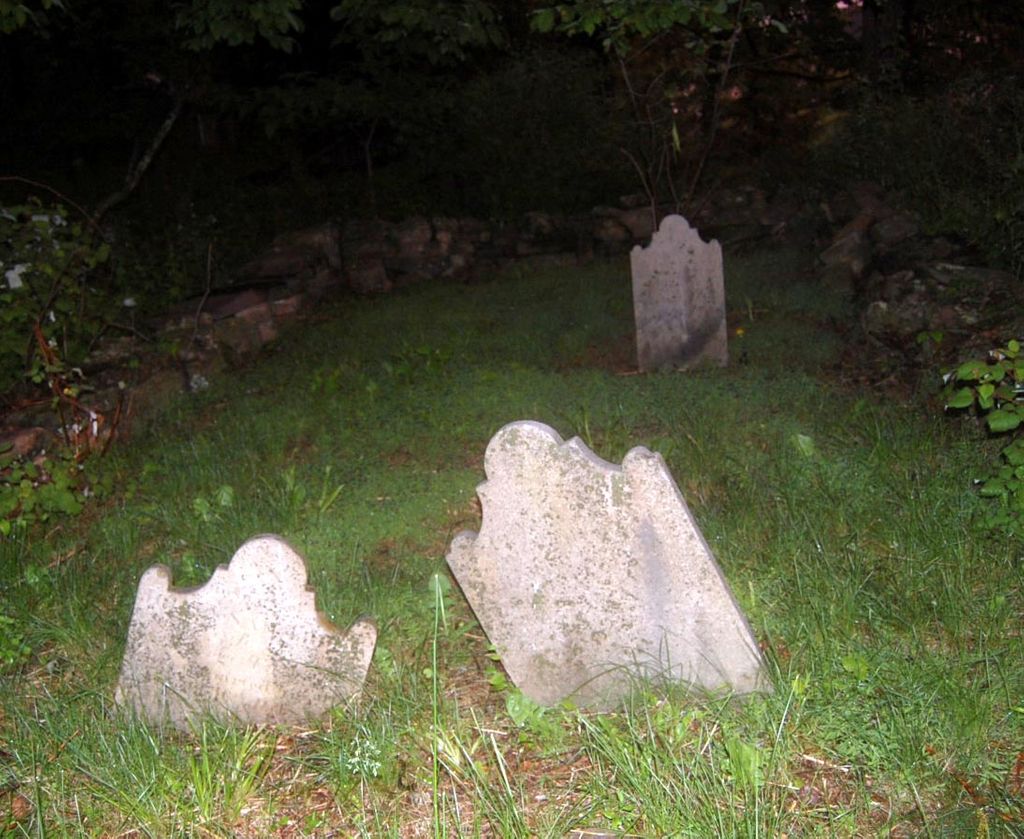
| Description | : | The "Trout Family Burying Ground" is generally located on the former 181-acre George TROUT (1729-1809) farm established in 1775 on the east side of the Easton-Trenton Turnpike (CR 579), not far southwest from the intersection with Stockton-Flemington Road (CR 523). Today, "John Trout Road" leads into a modern subdivision that was built on the old George TROUT farm. The nearest community is Sand Brook approximately 1 mile to the Southwest. The small family burying ground is at the back edge of the lot at 36 Mason Farm Road which is located at the corner with Milestone Road. Walk in from... Read More |
frequently asked questions (FAQ):
-
Where is Trout Family Burying Ground?
Trout Family Burying Ground is located at Sand Brook, Hunterdon County ,New Jersey ,USA.
-
Trout Family Burying Ground cemetery's updated grave count on graveviews.com?
0 memorials
-
Where are the coordinates of the Trout Family Burying Ground?
Latitude: 40.4777778
Longitude: -74.8972222
Nearby Cemetories:
1. Sutton Farm Cemetery
Hunterdon County, USA
Coordinate: 40.4737206, -74.9048309
2. Kitchen Cemetery
Sand Brook, Hunterdon County, USA
Coordinate: 40.4803810, -74.9092480
3. Sand Brook German Baptist Church Cemetery
Sand Brook, Hunterdon County, USA
Coordinate: 40.4687500, -74.9162216
4. Carmelite Monastery Cemetery
Flemington, Hunterdon County, USA
Coordinate: 40.4976610, -74.8980680
5. Rake Family Burying Ground
Sand Brook, Hunterdon County, USA
Coordinate: 40.4598999, -74.9170914
6. Valley School Cemetery
Hunterdon County, USA
Coordinate: 40.4981500, -74.8814430
7. Lower Amwell Cemetery - Old Yard
Sergeantsville, Hunterdon County, USA
Coordinate: 40.4479866, -74.9134750
8. Lower Amwell Cemetery - New Yard
Sergeantsville, Hunterdon County, USA
Coordinate: 40.4475098, -74.9133453
9. Moore Family Burying Ground
Sergeantsville, Hunterdon County, USA
Coordinate: 40.4414400, -74.9008720
10. Old Saint Magdalen Cemetery
Flemington, Hunterdon County, USA
Coordinate: 40.5075700, -74.8688100
11. Geary Gravesite
Amwell, Hunterdon County, USA
Coordinate: 40.4561386, -74.8564301
12. Case Burial Ground
Flemington, Hunterdon County, USA
Coordinate: 40.5077770, -74.8658330
13. Saint Andrews Episcopal Churchyard
Ringoes, Hunterdon County, USA
Coordinate: 40.4406586, -74.8734360
14. Flemington Baptist Churchyard
Flemington, Hunterdon County, USA
Coordinate: 40.5058327, -74.8572235
15. Prospect Hill Cemetery
Flemington, Hunterdon County, USA
Coordinate: 40.5135994, -74.8683014
16. Flemington Jewish Community Cemetery
Flemington, Hunterdon County, USA
Coordinate: 40.5127220, -74.8658829
17. Servis-Quick Family Cemetery
Ringoes, Hunterdon County, USA
Coordinate: 40.4375000, -74.8722220
18. Opdycke Cemetery
Hunterdon County, USA
Coordinate: 40.4375000, -74.9250000
19. Saint Magdalen Cemetery
Flemington, Hunterdon County, USA
Coordinate: 40.5174500, -74.8668250
20. Flemington Presbyterian Church Cemetery
Flemington, Hunterdon County, USA
Coordinate: 40.5141500, -74.8595750
21. Amwell Ridge Cemetery
Ringoes, Hunterdon County, USA
Coordinate: 40.4415970, -74.8554840
22. Pleasant Ridge Cemetery
Ringoes, Hunterdon County, USA
Coordinate: 40.4578018, -74.8336029
23. Griggs Family Burying Ground
Flemington, Hunterdon County, USA
Coordinate: 40.5065002, -74.8385010
24. Pine Hill Cemetery
Sergeantsville, Hunterdon County, USA
Coordinate: 40.4580498, -74.9622192