
| Memorials | : | 112 |
| Location | : | Sergeantsville, Hunterdon County, USA |
| Coordinate | : | 40.4414400, -74.9008720 |
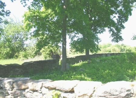
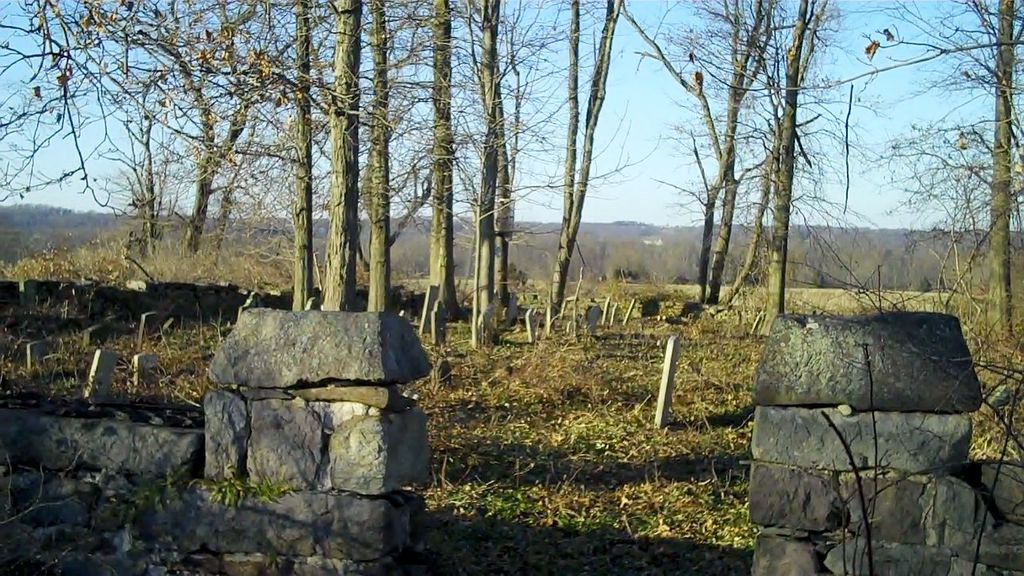
| Description | : | Located on Haines Road near the intersection of Haines and Dunkard Church Roads, near Headquarters, Hunterdon County, New Jersey. The Moore Burying Ground was originally the family plot of Jacob Moore. Church of the Brethren Elder Johannes (John) Naas is buried in the cemetery, as well as Amwell Church of the Brethren members. In May 2008 Moore cemetery was accessible through the owner only and by driving about 200 yards through a field of very tall grass. The cemetery was unkempt and many of the stones had fallen done. There are brown fieldstone markers with no markings on them. ... Read More |
frequently asked questions (FAQ):
-
Where is Moore Family Burying Ground?
Moore Family Burying Ground is located at Sergeantsville, Hunterdon County ,New Jersey ,USA.
-
Moore Family Burying Ground cemetery's updated grave count on graveviews.com?
112 memorials
-
Where are the coordinates of the Moore Family Burying Ground?
Latitude: 40.4414400
Longitude: -74.9008720
Nearby Cemetories:
1. Lower Amwell Cemetery - New Yard
Sergeantsville, Hunterdon County, USA
Coordinate: 40.4475098, -74.9133453
2. Lower Amwell Cemetery - Old Yard
Sergeantsville, Hunterdon County, USA
Coordinate: 40.4479866, -74.9134750
3. Opdycke Cemetery
Hunterdon County, USA
Coordinate: 40.4375000, -74.9250000
4. Saint Andrews Episcopal Churchyard
Ringoes, Hunterdon County, USA
Coordinate: 40.4406586, -74.8734360
5. Servis-Quick Family Cemetery
Ringoes, Hunterdon County, USA
Coordinate: 40.4375000, -74.8722220
6. Rake Family Burying Ground
Sand Brook, Hunterdon County, USA
Coordinate: 40.4598999, -74.9170914
7. Union Cemetery
Ringoes, Hunterdon County, USA
Coordinate: 40.4261017, -74.8732986
8. Sand Brook German Baptist Church Cemetery
Sand Brook, Hunterdon County, USA
Coordinate: 40.4687500, -74.9162216
9. Barber Burying Ground
Sandy Ridge, Hunterdon County, USA
Coordinate: 40.4190292, -74.9282608
10. Sutton Farm Cemetery
Hunterdon County, USA
Coordinate: 40.4737206, -74.9048309
11. Amwell Ridge Cemetery
Ringoes, Hunterdon County, USA
Coordinate: 40.4415970, -74.8554840
12. Trout Family Burying Ground
Sand Brook, Hunterdon County, USA
Coordinate: 40.4777778, -74.8972222
13. Geary Gravesite
Amwell, Hunterdon County, USA
Coordinate: 40.4561386, -74.8564301
14. Kitchen Cemetery
Sand Brook, Hunterdon County, USA
Coordinate: 40.4803810, -74.9092480
15. Sergeantville Methodist Episcopal Church Cemetery
Sergeantsville, Hunterdon County, USA
Coordinate: 40.4458333, -74.9538880
16. Second English Presbyterian Church Cemetery
Amwell, Hunterdon County, USA
Coordinate: 40.3984718, -74.9072189
17. Sandy Ridge Cemetery
Sandy Ridge, Hunterdon County, USA
Coordinate: 40.4232178, -74.9541168
18. Pine Hill Cemetery
Sergeantsville, Hunterdon County, USA
Coordinate: 40.4580498, -74.9622192
19. Rockefeller-Wikoff Burying Ground
Rocktown, Hunterdon County, USA
Coordinate: 40.3978424, -74.8675385
20. Pleasant Ridge Cemetery
Ringoes, Hunterdon County, USA
Coordinate: 40.4578018, -74.8336029
21. Carmelite Monastery Cemetery
Flemington, Hunterdon County, USA
Coordinate: 40.4976610, -74.8980680
22. Winder Phillips Grave Yard
Mount Airy, Hunterdon County, USA
Coordinate: 40.3847222, -74.8833333
23. Rocks Methodist Episcopal Cemetery
Mount Airy, Hunterdon County, USA
Coordinate: 40.3844986, -74.8835983
24. Valley School Cemetery
Hunterdon County, USA
Coordinate: 40.4981500, -74.8814430