
| Memorials | : | 18 |
| Location | : | Turakina, Rangitikei District, New Zealand |
| Coordinate | : | -40.0453000, 175.2239600 |
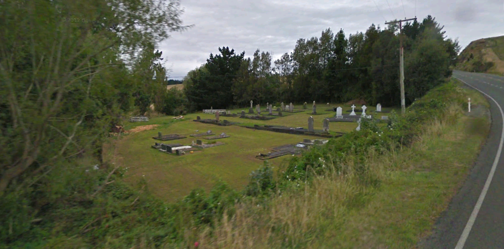
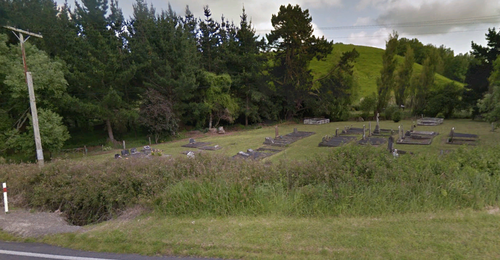
| Description | : | The first gravesites are in the Churchyard of the Chapel of St Joseph which used to be on the State Highway in Turakina. This was the third Catholic Church built in the Wanganui district and was blessed by Father John Stephen Pezant, SM, in September 1868. In 1986 the Historic Chapel was moved to St Matthew's Collegiate School in Masterton. There are 6 headstones in the churchyard as well as a number of unmarked graves. They mark the burials which took place between 1870 and 1879 but as it was in a swamp a new cemetery was then established about... Read More |
frequently asked questions (FAQ):
-
Where is Turakina Catholic Cemetery?
Turakina Catholic Cemetery is located at 1328Wanganui Road Turakina, Rangitikei District ,Manawatū-Whanganui ,New Zealand.
-
Turakina Catholic Cemetery cemetery's updated grave count on graveviews.com?
17 memorials
-
Where are the coordinates of the Turakina Catholic Cemetery?
Latitude: -40.0453000
Longitude: 175.2239600
Nearby Cemetories:
1. Turakina Cemetery
Turakina, Rangitikei District, New Zealand
Coordinate: -40.0461300, 175.2140160
2. Grant Family Makirikiri Cemetery
Turakina, Rangitikei District, New Zealand
Coordinate: -40.0625400, 175.2258200
3. Te Mangungu Churchyard
Turakina, Rangitikei District, New Zealand
Coordinate: -40.0633110, 175.1818200
4. Ratana Cemetery
Ratana, Rangitikei District, New Zealand
Coordinate: -40.0311470, 175.1771200
5. Bonny Glen Cemetery
Marton, Rangitikei District, New Zealand
Coordinate: -40.0496200, 175.3410200
6. Matarawa Cemetery
Fordell, Whanganui District, New Zealand
Coordinate: -39.9468100, 175.1452700
7. Marton Lutheran Cemetery Tutaenui
Marton, Rangitikei District, New Zealand
Coordinate: -40.0772400, 175.3692700
8. Matarawa Presbyterian Cemetery
Whanganui, Whanganui District, New Zealand
Coordinate: -39.9461300, 175.1433100
9. Kauangaroa Pa Cemetery
Kauangaroa, Whanganui District, New Zealand
Coordinate: -39.9231800, 175.2788000
10. Upper Tutaenui Cemetery
Marton, Rangitikei District, New Zealand
Coordinate: -40.0086900, 175.4093900
11. Mount View Cemetery
Marton, Rangitikei District, New Zealand
Coordinate: -40.0631570, 175.4252250
12. St Stephens Anglican Cemetery
Marton, Rangitikei District, New Zealand
Coordinate: -40.0618230, 175.4258020
13. Putiki Urupā
Whanganui District, New Zealand
Coordinate: -39.9466140, 175.0499350
14. Greatford Cemetery
Greatford, Rangitikei District, New Zealand
Coordinate: -40.1260100, 175.4175700
15. Heads Road Cemetery
Whanganui, Whanganui District, New Zealand
Coordinate: -39.9393300, 175.0473400
16. Fraser Family Cemetery
Bulls, Rangitikei District, New Zealand
Coordinate: -40.2000380, 175.3294560
17. Aramoho Cemetery
Whanganui, Whanganui District, New Zealand
Coordinate: -39.8926494, 175.0922441
18. Clifton Cemetery
Bulls, Rangitikei District, New Zealand
Coordinate: -40.1752170, 175.4002900
19. Parewanui Presbyterian Cemetery
Tangimoana, Manawatu District, New Zealand
Coordinate: -40.2229440, 175.3061780
20. St John's Anglican Church Cemetery
Marton, Rangitikei District, New Zealand
Coordinate: -40.0298860, 175.4759430
21. Bulls Māori Cemetery
Bulls, Rangitikei District, New Zealand
Coordinate: -40.1841400, 175.4092600
22. St. Mary's Anglican Church Cemetery
Upokongaro, Whanganui District, New Zealand
Coordinate: -39.8656100, 175.1132820
23. Wheriko Anglican Church Cemetery
Bulls, Rangitikei District, New Zealand
Coordinate: -40.2322588, 175.3195457
24. Tokorangi Urupā
Halcombe, Manawatu District, New Zealand
Coordinate: -40.0856300, 175.4894900