
| Memorials | : | 2 |
| Location | : | Wales |
| Coordinate | : | 51.4563708, -3.2739268 |
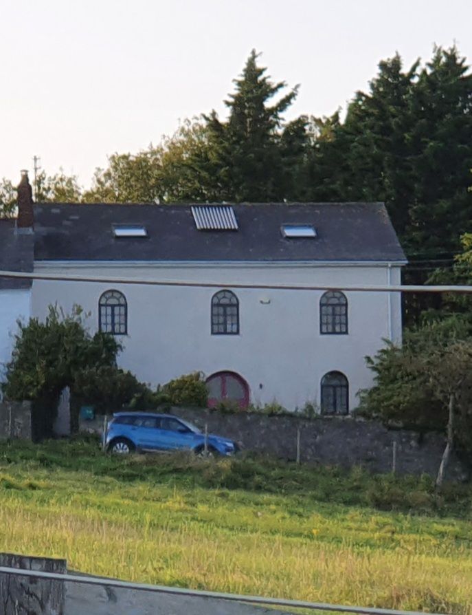
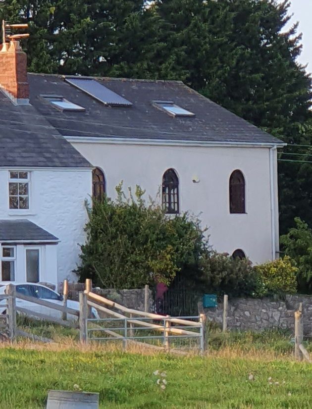
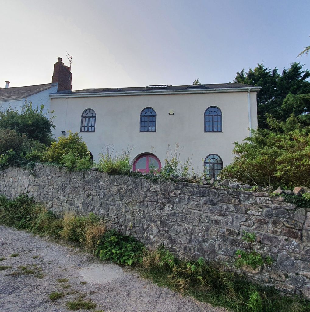
| Description | : | Nearby is the The "mother" chapel at Croes y Parc, Peterston super Ely. The burial ground at Twyn yr Odyn was used until 1946 and a lot of the burial ground was destroyed by nearby quarrying operations. The Chapel closed in 1956 and no registers of the chapel have survived. The Chapel is now a private residence. |
frequently asked questions (FAQ):
-
Where is Twyn yr Odyn Baptist Chapel Burial Ground?
Twyn yr Odyn Baptist Chapel Burial Ground is located at Twyn yr Odyn Vale of Glamorgan , CF5 6BJWales.
-
Twyn yr Odyn Baptist Chapel Burial Ground cemetery's updated grave count on graveviews.com?
2 memorials
-
Where are the coordinates of the Twyn yr Odyn Baptist Chapel Burial Ground?
Latitude: 51.4563708
Longitude: -3.2739268

Nearby Cemetories:
1. St Nicholas Church
Wales
Coordinate: 51.4605000, -3.3098000
2. St George's Churchyard
Wales
Coordinate: 51.4819300, -3.2911700
3. Newcastle St. Illtyd Churchyard
Wales
Coordinate: 51.5080900, -3.5829600
4. St. Peter's Churchyard
Wales
Coordinate: 51.6133800, -3.0590490
5. St. John the Baptist Churchyard
Weston-super-Mare, North Somerset Unitary Authority, England
Coordinate: 51.3523010, -2.9813260
6. Penrhys Cemetery
Wales
Coordinate: 51.6420500, -3.4425800
7. Weston-super-Mare Emmanuel Churchyard
Weston-super-Mare, North Somerset Unitary Authority, England
Coordinate: 51.3458940, -2.9773860
8. Weston-Super-Mare Cemetery
Weston-super-Mare, North Somerset Unitary Authority, England
Coordinate: 51.3541300, -2.9676900
9. Saint Pauls Churchyard
Kewstoke, North Somerset Unitary Authority, England
Coordinate: 51.3655500, -2.9568900
10. St Paul's Churchyard
Kewstoke, North Somerset Unitary Authority, England
Coordinate: 51.3655390, -2.9566120
11. Holy Trinity Churchyard
Ilfracombe, North Devon District, England
Coordinate: 51.5571712, -3.5946496
12. St Nicholas Churchyard (New)
Uphill, North Somerset Unitary Authority, England
Coordinate: 51.3246210, -2.9778420
13. Old St Nicholas Churchyard
Uphill, North Somerset Unitary Authority, England
Coordinate: 51.3203480, -2.9828110
14. Saint Bridget Churchyard
Brean, Sedgemoor District, England
Coordinate: 51.2983000, -3.0100000
15. Ebdon Road Crematorium and Cemetery
Weston-super-Mare, North Somerset Unitary Authority, England
Coordinate: 51.3707090, -2.9254530
16. St. Martin's Churchyard
Worle, North Somerset Unitary Authority, England
Coordinate: 51.3609960, -2.9301250
17. Wick St. Lawrence Churchyard
Wick St Lawrence, North Somerset Unitary Authority, England
Coordinate: 51.3844000, -2.9117000
18. St Mark Churchyard
Weston-super-Mare, North Somerset Unitary Authority, England
Coordinate: 51.3640650, -2.9195540
19. Saint Mary Magdalene Churchyard
Berrow, Sedgemoor District, England
Coordinate: 51.2669160, -3.0136980
20. Clevedon Cemetery
Clevedon, North Somerset Unitary Authority, England
Coordinate: 51.4322600, -2.8747270
21. St Andrew Churchyard
Clevedon, North Somerset Unitary Authority, England
Coordinate: 51.4331670, -2.8735760
22. St Mary the Virgin Churchyard
Hutton, North Somerset Unitary Authority, England
Coordinate: 51.3228030, -2.9306350
23. Saint Peter and St. Paul Churchyard
Bleadon, North Somerset Unitary Authority, England
Coordinate: 51.3074000, -2.9458300
24. St. Augustine's Parish Churchyard
Locking, North Somerset Unitary Authority, England
Coordinate: 51.3322900, -2.9147683