
| Memorials | : | 0 |
| Location | : | Uithuizermeeden, Eemsmond Municipality, Netherlands |
| Coordinate | : | 53.4080100, 6.7117200 |
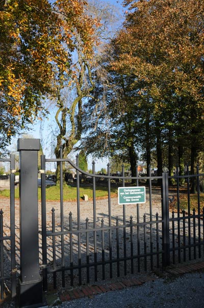
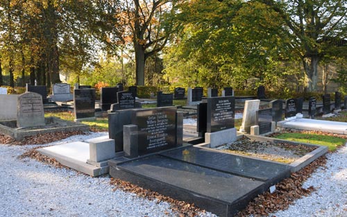
| Description | : | Uithuizermeeden is about 3 kilometres east of Uithuizen, and is 32 kilometres north-north-east of Groningen. The cemetery is on the south-western outskirts of the village, on the road from Loppersum. |
frequently asked questions (FAQ):
-
Where is Uithuizermeeden General Cemetery?
Uithuizermeeden General Cemetery is located at Uithuizermeeden, Eemsmond Municipality ,Groningen ,Netherlands.
-
Uithuizermeeden General Cemetery cemetery's updated grave count on graveviews.com?
0 memorials
-
Where are the coordinates of the Uithuizermeeden General Cemetery?
Latitude: 53.4080100
Longitude: 6.7117200
Nearby Cemetories:
1. Uithuizen Old General Cemetery
Uithuizen, Eemsmond Municipality, Netherlands
Coordinate: 53.4069400, 6.6704800
2. Israëlitische Begraafplaats
Uithuizen, Eemsmond Municipality, Netherlands
Coordinate: 53.4058100, 6.6701800
3. Uithuizen Roman Catholic Cemetery
Uithuizen, Eemsmond Municipality, Netherlands
Coordinate: 53.4068300, 6.6664800
4. Zandeweer Algemene Begraafplaats
Zandeweer, Eemsmond Municipality, Netherlands
Coordinate: 53.3858400, 6.6801400
5. Oosteinde Cemetery
Oosteinde, Eemsmond Municipality, Netherlands
Coordinate: 53.4147200, 6.7939300
6. 't Zandt Algemene Begraafplaats
't Zandt, Loppersum Municipality, Netherlands
Coordinate: 53.3627600, 6.7759900
7. Usquert General Cemetery
Usquert, Eemsmond Municipality, Netherlands
Coordinate: 53.4045800, 6.6109600
8. Kantens Algemene begraafplaats
Kantens, Eemsmond Municipality, Netherlands
Coordinate: 53.3662600, 6.6333800
9. Toornwerd Begraafplaats
Toornwerd, Loppersum Municipality, Netherlands
Coordinate: 53.3538400, 6.6360700
10. Saint Hippolytus Churchyard
Middelstum, Loppersum Municipality, Netherlands
Coordinate: 53.3477817, 6.6412390
11. Godlinze Cemetery
Godlinze, Delfzijl Municipality, Netherlands
Coordinate: 53.3713200, 6.8187300
12. Middelstum Cemetery
Middelstum, Loppersum Municipality, Netherlands
Coordinate: 53.3443200, 6.6451600
13. Spijk Cemetery
Spijk, Delfzijl Municipality, Netherlands
Coordinate: 53.3875600, 6.8366400
14. Loppersum General Cemetery
Loppersum, Loppersum Municipality, Netherlands
Coordinate: 53.3307500, 6.7485600
15. Stedum Cemetery
Stedum, Loppersum Municipality, Netherlands
Coordinate: 53.3251900, 6.6873400
16. Westerwijtwerd Churchyard
Westerwijtwerd, Loppersum Municipality, Netherlands
Coordinate: 53.3339900, 6.6444100
17. Warffum Communal Cemetery
Warffum, Eemsmond Municipality, Netherlands
Coordinate: 53.3935400, 6.5585300
18. Bierum Begraafplaats
Bierum, Delfzijl Municipality, Netherlands
Coordinate: 53.3833351, 6.8666668
19. Algemene Begraafplaats
Holwierde, Delfzijl Municipality, Netherlands
Coordinate: 53.3583678, 6.8745249
20. Sint Annen Begraafplaats
Sint Annen, Ten Boer Municipality, Netherlands
Coordinate: 53.2965300, 6.6592300
21. Linger hill
Oling, Appingedam Municipality, Netherlands
Coordinate: 53.3166656, 6.8333335
22. Appingedam Rusthof Begraafplaats
Appingedam, Appingedam Municipality, Netherlands
Coordinate: 53.3237400, 6.8500800
23. Ten Post Begraafplaats
Ten Post, Ten Boer Municipality, Netherlands
Coordinate: 53.2909200, 6.7434400
24. Joodse Begraafplaats
Appingedam, Appingedam Municipality, Netherlands
Coordinate: 53.3238400, 6.8562700