
| Memorials | : | 5 |
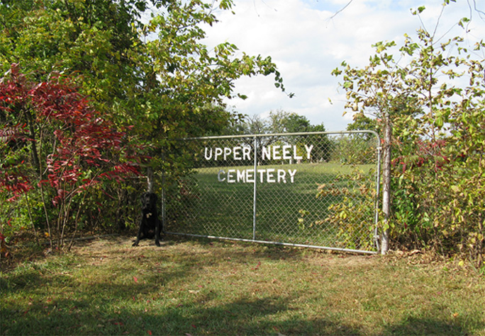
| Location | : | Bolckow, Andrew County, USA |
| Coordinate | : | 40.1083488, -94.7961807 |
frequently asked questions (FAQ):
-
Where is Upper Neely Grove Cemetery?
Upper Neely Grove Cemetery is located at Bolckow, Andrew County ,Missouri ,USA.
-
Upper Neely Grove Cemetery cemetery's updated grave count on graveviews.com?
4 memorials
-
Where are the coordinates of the Upper Neely Grove Cemetery?
Latitude: 40.1083488
Longitude: -94.7961807
Nearby Cemetories:
1. Bolckow Cemetery
Bolckow, Andrew County, USA
Coordinate: 40.1131210, -94.8142929
2. Walnut Grove Methodist Cemetery
Andrew County, USA
Coordinate: 40.0967598, -94.7518311
3. Platte Valley Cemetery
Barnard, Nodaway County, USA
Coordinate: 40.1413994, -94.7692032
4. Lower Neely Grove Cemetery
Andrew County, USA
Coordinate: 40.0627594, -94.8138733
5. Jackson Cemetery
Barnard, Nodaway County, USA
Coordinate: 40.1561012, -94.7842026
6. McBrien Cemetery
Rosendale, Andrew County, USA
Coordinate: 40.0698900, -94.8589600
7. Litts Cemetery
Whitecloud, Nodaway County, USA
Coordinate: 40.1377983, -94.8756027
8. Groves Cemetery
Guilford, Nodaway County, USA
Coordinate: 40.1567001, -94.7221985
9. Whitesville Cemetery
Whitesville, Andrew County, USA
Coordinate: 40.0626183, -94.7162094
10. Barnard American Legion Cemetery
Barnard, Nodaway County, USA
Coordinate: 40.1839600, -94.8173828
11. Baker Cemetery
Barnard, Nodaway County, USA
Coordinate: 40.1660800, -94.8636600
12. Barnard Masonic-IOOF Cemetery
Barnard, Nodaway County, USA
Coordinate: 40.1845818, -94.8176727
13. Clemmens Cemetery
Whitesville, Andrew County, USA
Coordinate: 40.0401430, -94.7413400
14. Weathermon Cemetery
Guilford, Nodaway County, USA
Coordinate: 40.1683998, -94.7240829
15. Alumbaugh Cemetery
Barnard, Nodaway County, USA
Coordinate: 40.1843987, -94.8383026
16. Graves Cemetery
Guilford, Nodaway County, USA
Coordinate: 40.1730995, -94.7276764
17. Fairview Christian Cemetery
Rosendale, Andrew County, USA
Coordinate: 40.0102090, -94.8198890
18. McGlothlin Cemetery
Andrew County, USA
Coordinate: 40.0097700, -94.7740400
19. Gravel Wall Cemetery
Andrew County, USA
Coordinate: 40.0672210, -94.9260280
20. Sharp Cemetery
Barnard, Nodaway County, USA
Coordinate: 40.2176190, -94.7630450
21. Coffman Cemetery
Wyeth, Andrew County, USA
Coordinate: 39.9961014, -94.8099976
22. Salem Cemetery
Pumpkin Center, Nodaway County, USA
Coordinate: 40.2076721, -94.8683167
23. Kellogg Cemetery
Andrew County, USA
Coordinate: 39.9961014, -94.8494034
24. Star Chapel United Methodist Cemetery
Empire Prairie, Andrew County, USA
Coordinate: 40.0828094, -94.6399231