
| Memorials | : | 0 |
| Location | : | Jefferson County, USA |
| Coordinate | : | 38.7976780, -85.2706000 |
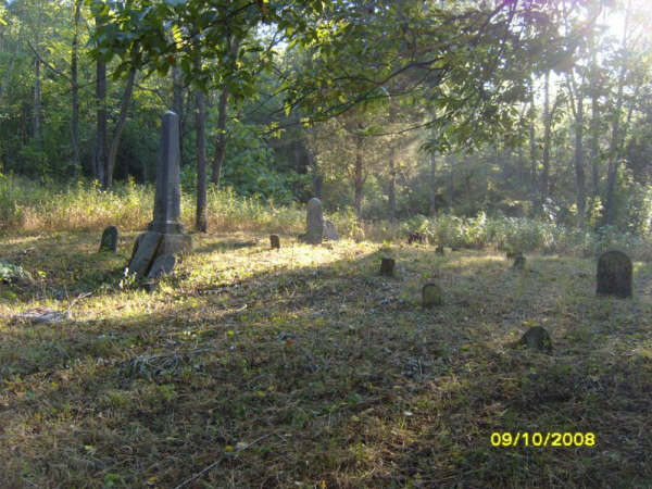
| Description | : | The John Paul DAR transcription describes this as being on Victor Vernon's farm. The Jefferson County Road map shows this as the Hankins Cemetery. It was originally owned by Richard Vernon, Victor' grandfather. It was later owned by Isora Hankins, Victor's cousin, hence the Hankin name. The cemetery is in the SE 1/4 Section and is on the East side of the road running up the East Fork on the Indian-Kentuck Creek (slightly up the hill). The DAR note that is with the transcription is correct in showing that Richard Vernon came from North Carolina in 1828. However,... Read More |
frequently asked questions (FAQ):
-
Where is Vernon Family Cemetery?
Vernon Family Cemetery is located at in Milton Township Jefferson County ,Indiana ,USA.
-
Vernon Family Cemetery cemetery's updated grave count on graveviews.com?
0 memorials
-
Where are the coordinates of the Vernon Family Cemetery?
Latitude: 38.7976780
Longitude: -85.2706000
Nearby Cemetories:
1. Milton Cemetery
Manville, Jefferson County, USA
Coordinate: 38.8097000, -85.2752991
2. Fugit Cemetery
Manville, Jefferson County, USA
Coordinate: 38.7880960, -85.2820240
3. Lawson Cemetery
Jefferson County, USA
Coordinate: 38.7843000, -85.2613000
4. Manville Cemetery
Manville, Jefferson County, USA
Coordinate: 38.7897339, -85.2877731
5. Brumbarger Cemetery
Manville, Jefferson County, USA
Coordinate: 38.8043000, -85.2492000
6. Lanham Cemetery
Manville, Jefferson County, USA
Coordinate: 38.7720850, -85.2640000
7. Joyce Cemetery
Madison, Jefferson County, USA
Coordinate: 38.7710320, -85.2535740
8. Brown Cemetery
Jefferson County, USA
Coordinate: 38.8210800, -85.2943400
9. Macedonia Cemetery
Jefferson County, USA
Coordinate: 38.7956009, -85.2303009
10. Pleasant Ridge Methodist Episcopal Cemetery
Madison, Jefferson County, USA
Coordinate: 38.7650440, -85.2873250
11. Rodgers Graveyard
Canaan, Jefferson County, USA
Coordinate: 38.8325000, -85.2639000
12. Mount Pleasant Cemetery
Canaan, Jefferson County, USA
Coordinate: 38.8329086, -85.2823257
13. Lee Graveyard
Canaan, Jefferson County, USA
Coordinate: 38.8379000, -85.2771900
14. Konkle Cemetery
Brooksburg, Jefferson County, USA
Coordinate: 38.7843830, -85.2209160
15. Reul Cemetery
Jefferson County, USA
Coordinate: 38.7665360, -85.3059890
16. Phillips Cemetery
Milton Township, Jefferson County, USA
Coordinate: 38.7690600, -85.2307270
17. McKendree Cemetery
Manville, Jefferson County, USA
Coordinate: 38.7975000, -85.2149000
18. Bear Farm Cemetery
Manville, Jefferson County, USA
Coordinate: 38.7569420, -85.2433860
19. Demaree Cemetery
China, Jefferson County, USA
Coordinate: 38.8181000, -85.3248000
20. Short Cemetery
Canaan, Jefferson County, USA
Coordinate: 38.8441040, -85.2557830
21. Brooks Cemetery
Madison, Jefferson County, USA
Coordinate: 38.8450500, -85.2558300
22. Rykers Ridge Cemetery New
Central, Jefferson County, USA
Coordinate: 38.7774300, -85.3321500
23. Bee Camp Cemetery
Manville, Jefferson County, USA
Coordinate: 38.7491370, -85.2975440
24. Rykers Ridge Cemetery Old
Central, Jefferson County, USA
Coordinate: 38.7749760, -85.3327420