
| Memorials | : | 3 |
| Location | : | Madison, Jefferson County, USA |
| Coordinate | : | 38.7650440, -85.2873250 |
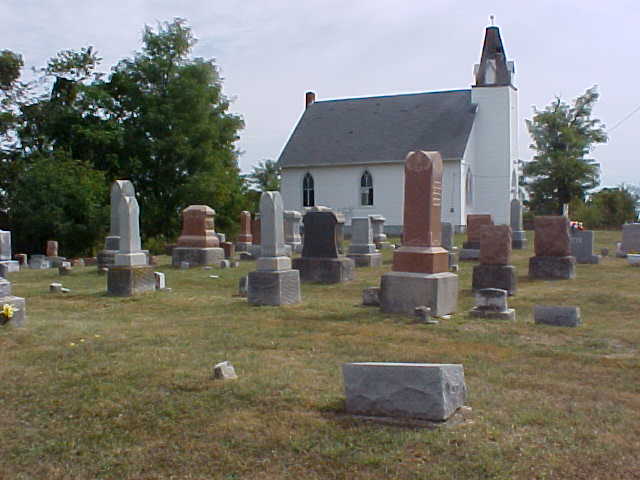
| Description | : | The physical description is Milton Township, Section 27, Township 4 North, Range 11 East, located on E. Pleasant Ridge Road, about 350 feet west of the intersection with E. Bishop Hill Road. The cemetery is on the north side of the road, adjacent to the Pleasant Ridge Methodist Episcopal church, which owns the cemetery. The church was founded in 1839 and has been in this location since 1849. Both cemetery and church are active (2011). |
frequently asked questions (FAQ):
-
Where is Pleasant Ridge Methodist Episcopal Cemetery?
Pleasant Ridge Methodist Episcopal Cemetery is located at Madison, Jefferson County ,Indiana ,USA.
-
Pleasant Ridge Methodist Episcopal Cemetery cemetery's updated grave count on graveviews.com?
3 memorials
-
Where are the coordinates of the Pleasant Ridge Methodist Episcopal Cemetery?
Latitude: 38.7650440
Longitude: -85.2873250
Nearby Cemetories:
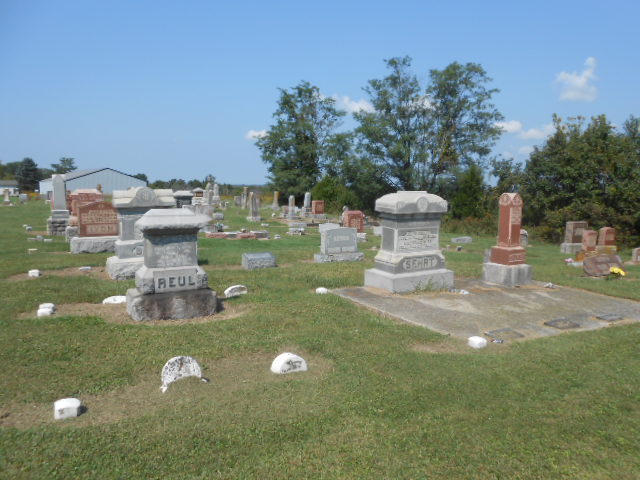
1. Reul Cemetery
Jefferson County, USA
Coordinate: 38.7665360, -85.3059890
2. Bee Camp Cemetery
Manville, Jefferson County, USA
Coordinate: 38.7491370, -85.2975440
3. Lanham Cemetery
Manville, Jefferson County, USA
Coordinate: 38.7720850, -85.2640000
4. Fugit Cemetery
Manville, Jefferson County, USA
Coordinate: 38.7880960, -85.2820240
5. Manville Cemetery
Manville, Jefferson County, USA
Coordinate: 38.7897339, -85.2877731
6. Joyce Cemetery
Madison, Jefferson County, USA
Coordinate: 38.7710320, -85.2535740
7. Lawson Cemetery
Jefferson County, USA
Coordinate: 38.7843000, -85.2613000
8. Saint Peters Lutheran Church Cemetery
Carrollton, Carroll County, USA
Coordinate: 38.7349800, -85.2951300
9. Giltner Cemetery
Carroll County, USA
Coordinate: 38.7349170, -85.2956140
10. Hunters Bottom Cemetery (Defunct)
Carrollton, Carroll County, USA
Coordinate: 38.7332360, -85.2800640
11. Vernon Family Cemetery
Jefferson County, USA
Coordinate: 38.7976780, -85.2706000
12. Bear Farm Cemetery
Manville, Jefferson County, USA
Coordinate: 38.7569420, -85.2433860
13. Rykers Ridge Cemetery Old
Central, Jefferson County, USA
Coordinate: 38.7749760, -85.3327420
14. Rykers Ridge Cemetery New
Central, Jefferson County, USA
Coordinate: 38.7774300, -85.3321500
15. Hunters Bottom Cemetery
Locust, Carroll County, USA
Coordinate: 38.7262700, -85.2802930
16. Giltner Cemetery (Defunct)
Carrollton, Carroll County, USA
Coordinate: 38.7261300, -85.3079500
17. Brooksburg Cemetery
Brooksburg, Jefferson County, USA
Coordinate: 38.7399330, -85.2429428
18. Phillips Cemetery
Milton Township, Jefferson County, USA
Coordinate: 38.7690600, -85.2307270
19. Milton Cemetery
Manville, Jefferson County, USA
Coordinate: 38.8097000, -85.2752991
20. Young Cemetery
Carroll County, USA
Coordinate: 38.7232870, -85.2594270
21. Thomas Graveyard
Jefferson County, USA
Coordinate: 38.7486000, -85.3465000
22. Brumbarger Cemetery
Manville, Jefferson County, USA
Coordinate: 38.8043000, -85.2492000
23. Macedonia Cemetery
Jefferson County, USA
Coordinate: 38.7956009, -85.2303009
24. Brown-Bacon Cemetery
Madison, Jefferson County, USA
Coordinate: 38.7489610, -85.3538550