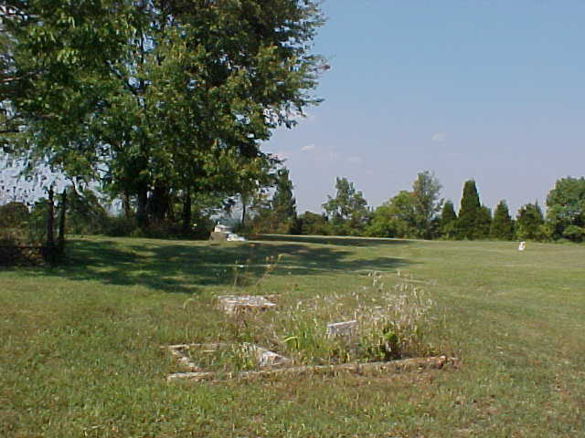
| Memorials | : | 0 |
| Location | : | Jefferson County, USA |
| Coordinate | : | 38.7665360, -85.3059890 |
| Description | : | The physical description is Madison Township, Section 28, Township 4 North, Range 11 East, located on E. Pleasant Ridge Road, about 1/2 mile west of the intersection with N. Manville Hill Road. Known in very early records as Pleasant Ridge cemetery, it may contain several hundred now-unmarked burials. There are now less than three dozen visible grave markers, and the cemetery is no longer active, the last burial having occurred before 1900. |
frequently asked questions (FAQ):
-
Where is Reul Cemetery?
Reul Cemetery is located at Jefferson County ,Indiana ,USA.
-
Reul Cemetery cemetery's updated grave count on graveviews.com?
0 memorials
-
Where are the coordinates of the Reul Cemetery?
Latitude: 38.7665360
Longitude: -85.3059890
Nearby Cemetories:
1. Pleasant Ridge Methodist Episcopal Cemetery
Madison, Jefferson County, USA
Coordinate: 38.7650440, -85.2873250
2. Bee Camp Cemetery
Manville, Jefferson County, USA
Coordinate: 38.7491370, -85.2975440
3. Rykers Ridge Cemetery Old
Central, Jefferson County, USA
Coordinate: 38.7749760, -85.3327420
4. Rykers Ridge Cemetery New
Central, Jefferson County, USA
Coordinate: 38.7774300, -85.3321500
5. Manville Cemetery
Manville, Jefferson County, USA
Coordinate: 38.7897339, -85.2877731
6. Fugit Cemetery
Manville, Jefferson County, USA
Coordinate: 38.7880960, -85.2820240
7. Giltner Cemetery
Carroll County, USA
Coordinate: 38.7349170, -85.2956140
8. Saint Peters Lutheran Church Cemetery
Carrollton, Carroll County, USA
Coordinate: 38.7349800, -85.2951300
9. Lanham Cemetery
Manville, Jefferson County, USA
Coordinate: 38.7720850, -85.2640000
10. Thomas Graveyard
Jefferson County, USA
Coordinate: 38.7486000, -85.3465000
11. Hunters Bottom Cemetery (Defunct)
Carrollton, Carroll County, USA
Coordinate: 38.7332360, -85.2800640
12. Lawson Cemetery
Jefferson County, USA
Coordinate: 38.7843000, -85.2613000
13. Giltner Cemetery (Defunct)
Carrollton, Carroll County, USA
Coordinate: 38.7261300, -85.3079500
14. Joyce Cemetery
Madison, Jefferson County, USA
Coordinate: 38.7710320, -85.2535740
15. Brown-Bacon Cemetery
Madison, Jefferson County, USA
Coordinate: 38.7489610, -85.3538550
16. Vernon Family Cemetery
Jefferson County, USA
Coordinate: 38.7976780, -85.2706000
17. Woodfill Cemetery
Jefferson County, USA
Coordinate: 38.7893800, -85.3509700
18. Hunters Bottom Cemetery
Locust, Carroll County, USA
Coordinate: 38.7262700, -85.2802930
19. Milton Cemetery
Manville, Jefferson County, USA
Coordinate: 38.8097000, -85.2752991
20. Bear Farm Cemetery
Manville, Jefferson County, USA
Coordinate: 38.7569420, -85.2433860
21. Olive Branch Cemetery
Madison, Jefferson County, USA
Coordinate: 38.8044014, -85.3503036
22. Underwood Cemetery
Madison, Jefferson County, USA
Coordinate: 38.7813890, -85.3713890
23. Demaree Cemetery
China, Jefferson County, USA
Coordinate: 38.8181000, -85.3248000
24. Brown Cemetery
Jefferson County, USA
Coordinate: 38.8210800, -85.2943400

