
| Memorials | : | 8 |
| Location | : | RoEllen, Dyer County, USA |
| Coordinate | : | 36.0101620, -89.3177740 |
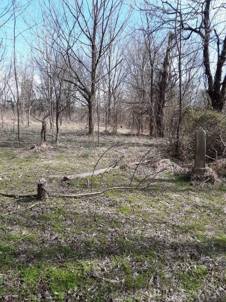
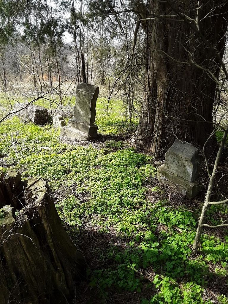
| Description | : | From the intersection of TN-104 E & US-412 S., east of Dyersburg, travel east on TN-104 E for 0.7 mi.; turning south (right) onto Viar Rd., going 1.3 mi. to the north-south fence-line on the south (right) side of the road. The cemetery is about 2000' south along the west side of this fence-line, then west into the cedar trees, where the cemetery is located. From satellite view, it appears that it may have been decades since any cleaning or maintenance of this cemetery has occurred. In fact there is no clear pathway or field road anywhere near it. |
frequently asked questions (FAQ):
-
Where is Viar Cemetery?
Viar Cemetery is located at 1297 Viar Road RoEllen, Dyer County ,Tennessee ,USA.
-
Viar Cemetery cemetery's updated grave count on graveviews.com?
7 memorials
-
Where are the coordinates of the Viar Cemetery?
Latitude: 36.0101620
Longitude: -89.3177740
Nearby Cemetories:
1. Wood Cemetery
RoEllen, Dyer County, USA
Coordinate: 36.0101620, -89.3177740
2. Reynolds Cemetery
RoEllen, Dyer County, USA
Coordinate: 36.0139240, -89.3071170
3. Pierce Cemetery
RoEllen, Dyer County, USA
Coordinate: 36.0305556, -89.3002778
4. Parker Cemetery
RoEllen, Dyer County, USA
Coordinate: 36.0018100, -89.2845300
5. RoEllen Cemetery
RoEllen, Dyer County, USA
Coordinate: 36.0277660, -89.2795420
6. Walker Cemetery
RoEllen, Dyer County, USA
Coordinate: 36.0440510, -89.3011120
7. Fowlkes Cemetery
Dyersburg, Dyer County, USA
Coordinate: 36.0303100, -89.3578170
8. Hodge Cemetery
Dyersburg, Dyer County, USA
Coordinate: 35.9836620, -89.3532490
9. Sorrell Chapel Cemetery
Bonicord, Dyer County, USA
Coordinate: 35.9772470, -89.3458570
10. Clay Cemetery
Fowlkes, Dyer County, USA
Coordinate: 35.9760780, -89.3453920
11. Memorial Park Cemetery
Dyersburg, Dyer County, USA
Coordinate: 36.0358009, -89.3581009
12. Prichard Family Cemetery
RoEllen, Dyer County, USA
Coordinate: 36.0104400, -89.2651020
13. Smith Family Cemetery
RoEllen, Dyer County, USA
Coordinate: 36.0411910, -89.2786710
14. Sawyer Cemetery
Newbern, Dyer County, USA
Coordinate: 36.0549210, -89.3092660
15. Rogers Cemetery
RoEllen, Dyer County, USA
Coordinate: 36.0069000, -89.2618000
16. Wilkins Cemetery
Tatumville, Dyer County, USA
Coordinate: 36.0387700, -89.2653800
17. Shaw Cemetery (Defunct)
Dyersburg, Dyer County, USA
Coordinate: 36.0470570, -89.3618540
18. Dyersburg City Cemetery
Dyersburg, Dyer County, USA
Coordinate: 36.0312996, -89.3786011
19. Clark Cemetery
Dyersburg, Dyer County, USA
Coordinate: 36.0462440, -89.3671680
20. Pate Family Cemetery
Bonicord, Dyer County, USA
Coordinate: 35.9575110, -89.3389720
21. Rehoboth Cemetery
RoEllen, Dyer County, USA
Coordinate: 36.0300700, -89.2530700
22. Fairview Cemetery
Dyersburg, Dyer County, USA
Coordinate: 36.0455580, -89.3715060
23. Bell-Walker Cemetery
Tigrett, Dyer County, USA
Coordinate: 35.9581400, -89.2913360
24. Rehoboth Church Cemetery
RoEllen, Dyer County, USA
Coordinate: 36.0306720, -89.2527870