
| Memorials | : | 0 |
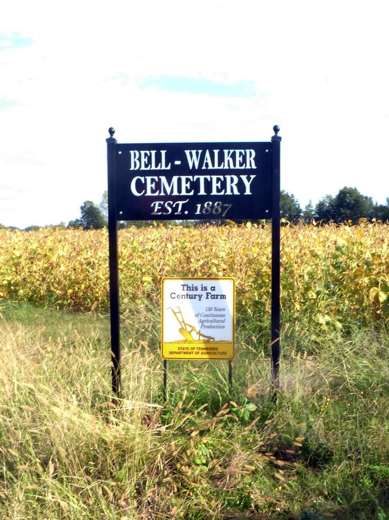
| Location | : | Tigrett, Dyer County, USA |
| Coordinate | : | 35.9581400, -89.2913360 |
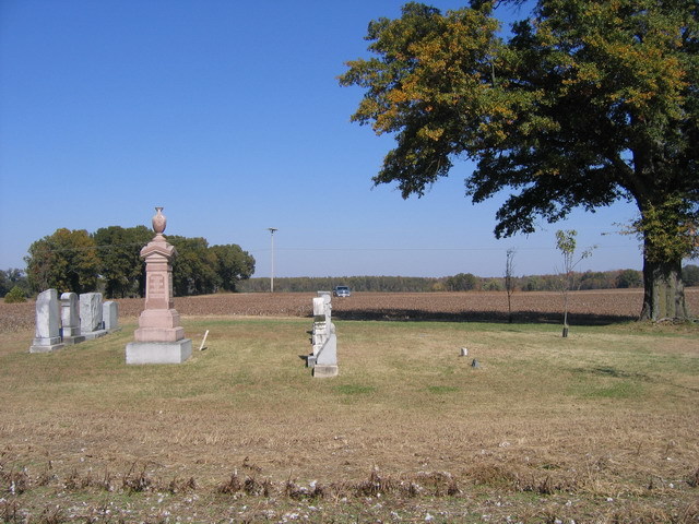
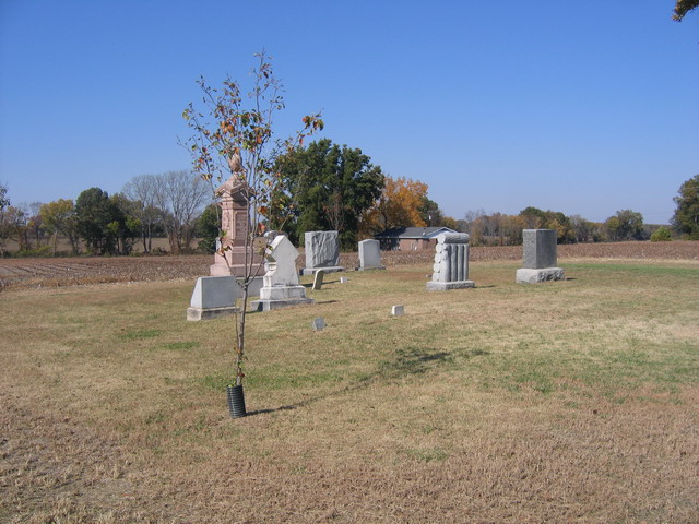
| Description | : | From the intersection of US-412/TN-20 & Old Hwy 20, SE of Dyersburg, travel easterly on Old Hwy 20 for 2.2 mi. to the paved "pull-off", leading south to the cemetery about 100 yd. across a cultivated field. This small family cemetery was first used for the last child of G.W. & M.J. Walker, Mary B. Walker (1865-1866) & deeded as a cemetery by G. W. Walker for his family. |
frequently asked questions (FAQ):
-
Where is Bell-Walker Cemetery?
Bell-Walker Cemetery is located at 5501 Old Hwy 20 Tigrett, Dyer County ,Tennessee ,USA.
-
Bell-Walker Cemetery cemetery's updated grave count on graveviews.com?
0 memorials
-
Where are the coordinates of the Bell-Walker Cemetery?
Latitude: 35.9581400
Longitude: -89.2913360
Nearby Cemetories:
1. Murray Cemetery
Bonicord, Dyer County, USA
Coordinate: 35.9485000, -89.2969000
2. Jones Cemetery
Tigrett, Dyer County, USA
Coordinate: 35.9552230, -89.2747450
3. Staggs Cemetery
Friendship, Dyer County, USA
Coordinate: 35.9397930, -89.2896620
4. Williams Chapel Cemetery
Bonicord, Dyer County, USA
Coordinate: 35.9472008, -89.3221970
5. Millers Chapel Cemetery
Dyersburg, Dyer County, USA
Coordinate: 35.9385986, -89.3163986
6. Saint Peter Cemetery
Tigrett, Dyer County, USA
Coordinate: 35.9616440, -89.2520140
7. Nash Cemetery
Dyersburg, Dyer County, USA
Coordinate: 35.9252500, -89.2822230
8. McGary Family Cemetery
Tigrett, Dyer County, USA
Coordinate: 35.9649530, -89.2501520
9. Shelton Cemetery
Fowlkes, Dyer County, USA
Coordinate: 35.9416530, -89.3281750
10. Mose M. Thompson Cemetery
Friendship, Dyer County, USA
Coordinate: 35.9243680, -89.2765870
11. Hardin Cemetery
Friendship, Dyer County, USA
Coordinate: 35.9243270, -89.2766430
12. Pate Family Cemetery
Bonicord, Dyer County, USA
Coordinate: 35.9575110, -89.3389720
13. Mount Pisgah Cemetery
Friendship, Dyer County, USA
Coordinate: 35.9162470, -89.2901740
14. Parker Cemetery
RoEllen, Dyer County, USA
Coordinate: 36.0018100, -89.2845300
15. Clay Cemetery
Fowlkes, Dyer County, USA
Coordinate: 35.9760780, -89.3453920
16. Sorrell Chapel Cemetery
Bonicord, Dyer County, USA
Coordinate: 35.9772470, -89.3458570
17. Zion Hill Church Cemetery
Friendship, Dyer County, USA
Coordinate: 35.9095110, -89.2900760
18. Cock and Irvin Cemetery
Hawkinsville, Dyer County, USA
Coordinate: 35.9104430, -89.3046210
19. Bowen Chapel Cemetery
Friendship, Dyer County, USA
Coordinate: 35.9311810, -89.2353720
20. Rogers Cemetery
RoEllen, Dyer County, USA
Coordinate: 36.0069000, -89.2618000
21. Bellevernon Cemetery
Friendship, Crockett County, USA
Coordinate: 35.9135830, -89.2495910
22. Hodge Cemetery
Dyersburg, Dyer County, USA
Coordinate: 35.9836620, -89.3532490
23. Viar Cemetery
RoEllen, Dyer County, USA
Coordinate: 36.0101620, -89.3177740
24. Wood Cemetery
RoEllen, Dyer County, USA
Coordinate: 36.0101620, -89.3177740