
| Memorials | : | 2 |
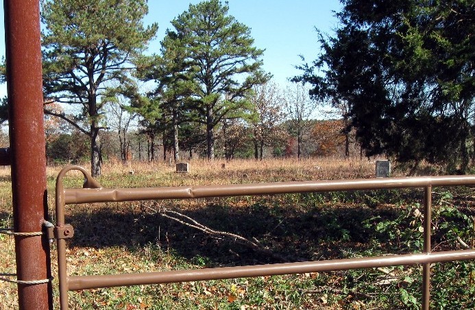
| Location | : | Summersville, Shannon County, USA |
| Coordinate | : | 37.1604670, -91.6267330 |
| Description | : | From Summersville, go south on Hwy. 17 about 3 miles to WW Hwy and turn east. Go to 2nd dirt road on the left about 1.4 miles Co., Rd 431, turn left (north) and go 1 mile and turn right (east) on Co., Rd 428, go to first dirt Rd (unmarked) on the left about 0.5 mile, turn left (north) and go to locked gate at the end of Rd. Cemetery is 0.5 miles north of gate. You can get permission and key to enter Jerry Cooper's property at, Cooper's Farm Supply, 2 miles south of Summersville on Hwy. 17. Ask... Read More |
frequently asked questions (FAQ):
-
Where is Welch Cemetery?
Welch Cemetery is located at Summersville, Shannon County ,Missouri ,USA.
-
Welch Cemetery cemetery's updated grave count on graveviews.com?
2 memorials
-
Where are the coordinates of the Welch Cemetery?
Latitude: 37.1604670
Longitude: -91.6267330
Nearby Cemetories:
1. Barnett Cemetery
Summersville, Shannon County, USA
Coordinate: 37.1954994, -91.6169968
2. Oakside Cemetery
Summersville, Shannon County, USA
Coordinate: 37.1053505, -91.6523285
3. Pickett Cemetery
Summersville, Shannon County, USA
Coordinate: 37.2252998, -91.6374969
4. Flat Rock Cemetery
Eminence, Shannon County, USA
Coordinate: 37.1926003, -91.5232086
5. Black Pond Cemetery
Alley Spring, Shannon County, USA
Coordinate: 37.1478004, -91.5130997
6. Dyer Cemetery
Alley Spring, Shannon County, USA
Coordinate: 37.1217003, -91.5081024
7. Valley Center Cemetery
Shannon County, USA
Coordinate: 37.2860985, -91.6396027
8. Pilgrim Rest Cemetery
Teresita, Shannon County, USA
Coordinate: 37.0189018, -91.6485977
9. Turkey Oak Cemetery
Montier, Shannon County, USA
Coordinate: 37.0203018, -91.5768967
10. Alley Cemetery
Alley Spring, Shannon County, USA
Coordinate: 37.1425018, -91.4417038
11. Dunkard Cemetery
Montier, Shannon County, USA
Coordinate: 37.0208015, -91.5580978
12. Flatwoods Cemetery
Eminence, Shannon County, USA
Coordinate: 37.2212181, -91.4486771
13. Orchard
Round Spring, Shannon County, USA
Coordinate: 37.2569400, -91.4627800
14. Berea Mennonite Cemetery
Birch Tree, Shannon County, USA
Coordinate: 37.0246010, -91.5110016
15. Saint John Vianney Catholic Cemetery
Mountain View, Howell County, USA
Coordinate: 37.0037498, -91.7072525
16. Gill Cemetery
Mountain View, Howell County, USA
Coordinate: 37.0224991, -91.7500000
17. Veterans Memorial Cemetery
Mountain View, Howell County, USA
Coordinate: 36.9975014, -91.6869965
18. Greenlawn Cemetery
Mountain View, Howell County, USA
Coordinate: 36.9975014, -91.6892014
19. Mountain View Cemetery
Mountain View, Howell County, USA
Coordinate: 36.9972992, -91.6904984
20. Culpepper Cemetery
Eminence, Shannon County, USA
Coordinate: 37.1571999, -91.4122009
21. Summers Cemetery
Eminence, Shannon County, USA
Coordinate: 37.2597008, -91.4511032
22. New Salem Cemetery
Mountain View, Howell County, USA
Coordinate: 37.0278015, -91.7727966
23. Montier Cemetery
Montier, Shannon County, USA
Coordinate: 36.9847984, -91.5754013
24. Delaware Cemetery
Eminence, Shannon County, USA
Coordinate: 37.1032982, -91.4092026