
| Memorials | : | 105 |
| Location | : | Fulton County, USA |
| Coordinate | : | 41.5168970, -84.1122450 |
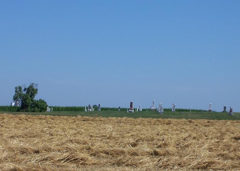
| Description | : | The West Barre Cemetery is southeast of Wauseon, northeast of the junction of County Road C, County Road 13 and Township Road AC. The cemetery is located several yards off the road with access by a grass lane located behind a barn at the northeast corner of the intersection. The burial ground is on land deeded to A.K. Augustus in 1834. The community of West Barre developed at the five corners and had a Baptist Church, United Brethren Church, general store, blacksmith shop, grange, ashery and a post office. A school house was located one-half mile south of the corners.... Read More |
frequently asked questions (FAQ):
-
Where is West Barre Cemetery?
West Barre Cemetery is located at County Road C Fulton County ,Ohio , 43567USA.
-
West Barre Cemetery cemetery's updated grave count on graveviews.com?
105 memorials
-
Where are the coordinates of the West Barre Cemetery?
Latitude: 41.5168970
Longitude: -84.1122450

Nearby Cemetories:
1. Ruppert Cemetery
Fulton County, USA
Coordinate: 41.5344009, -84.0875015
2. Saint Lukes Lutheran Church Cemetery
Fulton County, USA
Coordinate: 41.4963100, -84.1340700
3. Zion Cemetery
Wauseon, Fulton County, USA
Coordinate: 41.5372009, -84.0781021
4. Saint Caspar Catholic Cemetery
Wauseon, Fulton County, USA
Coordinate: 41.5479500, -84.1557600
5. Wauseon Union Cemetery
Wauseon, Fulton County, USA
Coordinate: 41.5480995, -84.1564026
6. Lena Cemetery
Fulton County, USA
Coordinate: 41.5175018, -84.1731033
7. Fowler Cemetery (Defunct)
West Delta, Fulton County, USA
Coordinate: 41.5435110, -84.0568150
8. Mikesell Cemetery
Wauseon, Fulton County, USA
Coordinate: 41.5511017, -84.1631012
9. Berkebile Cemetery
Fulton County, USA
Coordinate: 41.5541992, -84.0569000
10. Fluhart Cemetery
Fulton County, USA
Coordinate: 41.5769005, -84.1130981
11. Bayes Cemetery
Wauseon, Fulton County, USA
Coordinate: 41.5581017, -84.1706009
12. Liberty Chapel Cemetery
Liberty Center, Henry County, USA
Coordinate: 41.4719962, -84.0477244
13. Hubell Cemetery
Wauseon, Fulton County, USA
Coordinate: 41.5591670, -84.0310670
14. Aeschliman Cemetery
Pettisville, Fulton County, USA
Coordinate: 41.5147018, -84.2192001
15. Saint Johns Cemetery
Freedom Township, Henry County, USA
Coordinate: 41.4491997, -84.1727982
16. Freedom Township Cemetery
Freedom Township, Henry County, USA
Coordinate: 41.4752970, -84.2069960
17. Pettisville Lutheran Cemetery
Pettisville, Fulton County, USA
Coordinate: 41.5321900, -84.2237400
18. Ottokee Cemetery
Fulton County, USA
Coordinate: 41.6005610, -84.1386770
19. Pettisville Union Cemetery
Pettisville, Fulton County, USA
Coordinate: 41.5294190, -84.2258910
20. Pettisville Cemetery
Pettisville, Fulton County, USA
Coordinate: 41.5302620, -84.2258690
21. Morrison Cemetery
Liberty Center, Henry County, USA
Coordinate: 41.4426420, -84.0525720
22. Fulton County Home Cemetery
Ottokee, Fulton County, USA
Coordinate: 41.6025540, -84.1307420
23. King Cemetery
Fulton County, USA
Coordinate: 41.5590600, -84.0008800
24. Greenlawn Cemetery
Delta, Fulton County, USA
Coordinate: 41.5752983, -84.0124969