
| Memorials | : | 0 |
| Location | : | Fulton County, USA |
| Coordinate | : | 41.5175018, -84.1731033 |
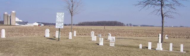
| Description | : | The Lena Cemetery is located southwest of Wauseon, on the east side of Township Road 16, north of County Road C. The Lena burial ground is located on land deeded to Thomas Santee in 1837. The land passed to other owners, including the Miley family, and became known to many as the Miley Cemetery. The Lena "Grave Yard" was transferred to the Clinton township trustees in 1869. The cemetery is located in Clinton Township, Fulton County, Ohio, and is # 3739 (Lena Cemetery / Miley Cemetery) in “Ohio Cemeteries 1803-2003”, compiled by the Ohio Genealogical Society. The U.S. Geological... Read More |
frequently asked questions (FAQ):
-
Where is Lena Cemetery?
Lena Cemetery is located at Township Road 16 Fulton County ,Ohio , 43567USA.
-
Lena Cemetery cemetery's updated grave count on graveviews.com?
0 memorials
-
Where are the coordinates of the Lena Cemetery?
Latitude: 41.5175018
Longitude: -84.1731033

Nearby Cemetories:
1. Wauseon Union Cemetery
Wauseon, Fulton County, USA
Coordinate: 41.5480995, -84.1564026
2. Saint Caspar Catholic Cemetery
Wauseon, Fulton County, USA
Coordinate: 41.5479500, -84.1557600
3. Mikesell Cemetery
Wauseon, Fulton County, USA
Coordinate: 41.5511017, -84.1631012
4. Aeschliman Cemetery
Pettisville, Fulton County, USA
Coordinate: 41.5147018, -84.2192001
5. Saint Lukes Lutheran Church Cemetery
Fulton County, USA
Coordinate: 41.4963100, -84.1340700
6. Bayes Cemetery
Wauseon, Fulton County, USA
Coordinate: 41.5581017, -84.1706009
7. Pettisville Lutheran Cemetery
Pettisville, Fulton County, USA
Coordinate: 41.5321900, -84.2237400
8. Pettisville Union Cemetery
Pettisville, Fulton County, USA
Coordinate: 41.5294190, -84.2258910
9. Pettisville Cemetery
Pettisville, Fulton County, USA
Coordinate: 41.5302620, -84.2258690
10. West Barre Cemetery
Fulton County, USA
Coordinate: 41.5168970, -84.1122450
11. Freedom Township Cemetery
Freedom Township, Henry County, USA
Coordinate: 41.4752970, -84.2069960
12. North Pettisville Cemetery
Wauseon, Fulton County, USA
Coordinate: 41.5728190, -84.2200180
13. Ruppert Cemetery
Fulton County, USA
Coordinate: 41.5344009, -84.0875015
14. Saint Johns Cemetery
Freedom Township, Henry County, USA
Coordinate: 41.4491997, -84.1727982
15. Saint James Lutheran Cemetery
Burlington, Fulton County, USA
Coordinate: 41.5428009, -84.2630997
16. Eckley Cemetery
Eckley, Fulton County, USA
Coordinate: 41.5641600, -84.2491200
17. Zion Cemetery
Wauseon, Fulton County, USA
Coordinate: 41.5372009, -84.0781021
18. Fluhart Cemetery
Fulton County, USA
Coordinate: 41.5769005, -84.1130981
19. Rupp Cemetery
Archbold, Fulton County, USA
Coordinate: 41.5140110, -84.2771370
20. Beck Cemetery
Fulton County, USA
Coordinate: 41.5648620, -84.2682880
21. Wyse Cemetery
Fulton County, USA
Coordinate: 41.5647820, -84.2686700
22. Tedrow Cemetery
Tedrow, Fulton County, USA
Coordinate: 41.6019300, -84.1975100
23. Ottokee Cemetery
Fulton County, USA
Coordinate: 41.6005610, -84.1386770
24. Ayers Cemetery
Fulton County, USA
Coordinate: 41.5960999, -84.2296982