
| Memorials | : | 4 |
| Location | : | Westoe, Metropolitan Borough of South Tyneside, England |
| Coordinate | : | 54.9942190, -1.4221050 |
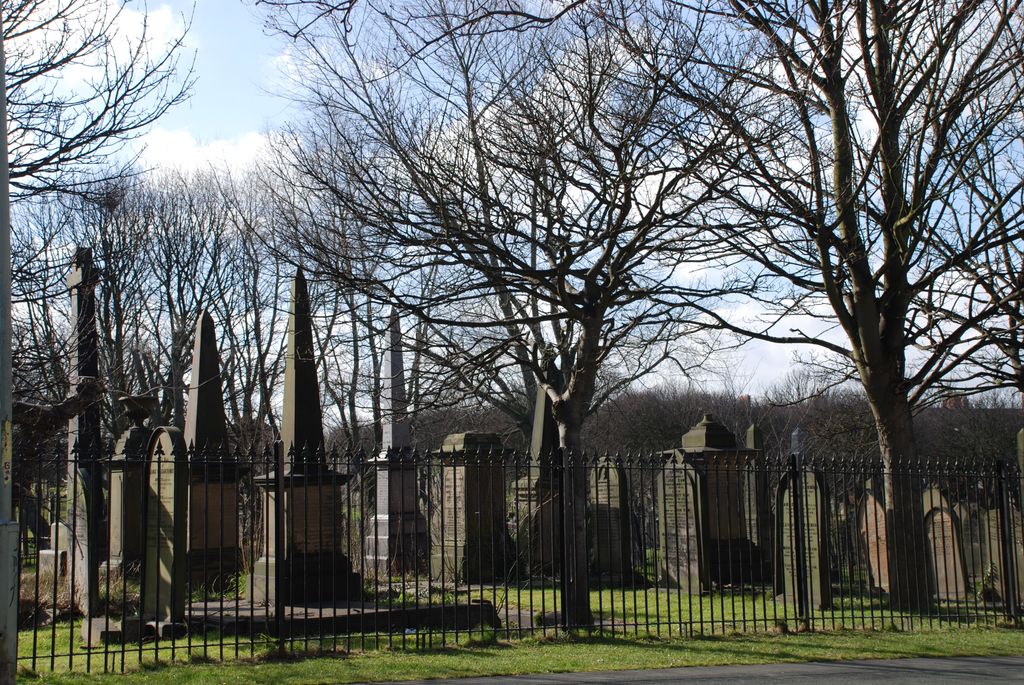
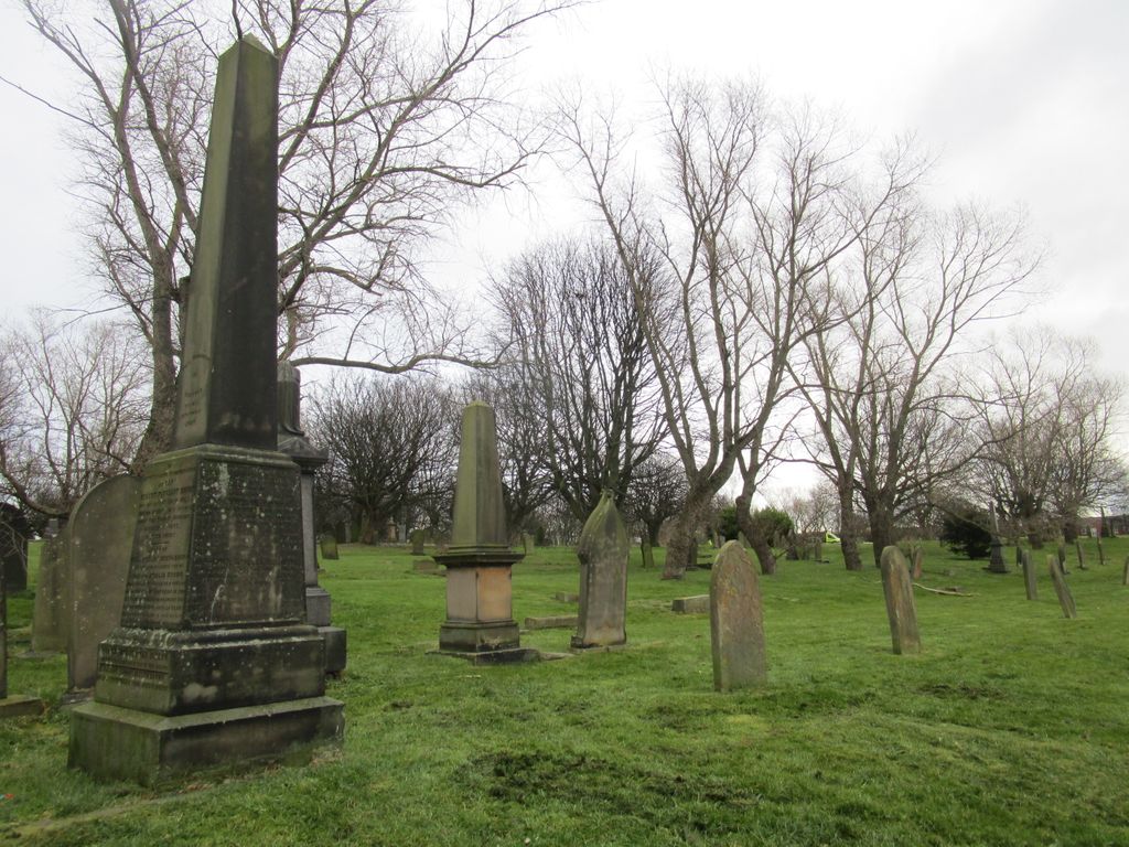
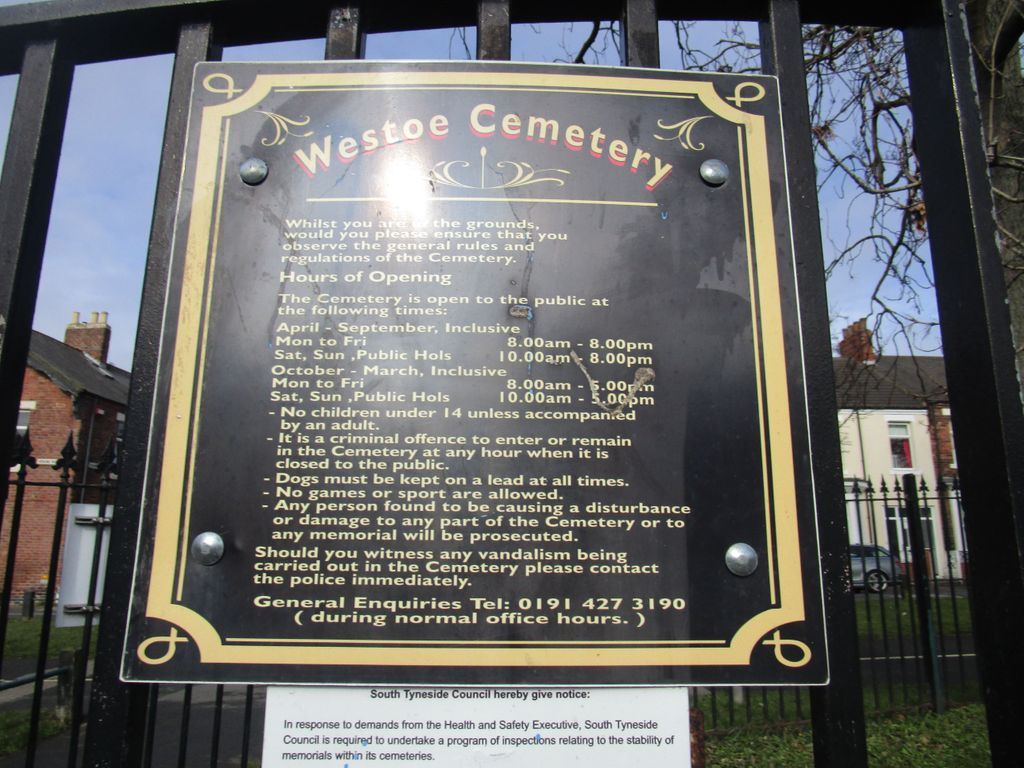
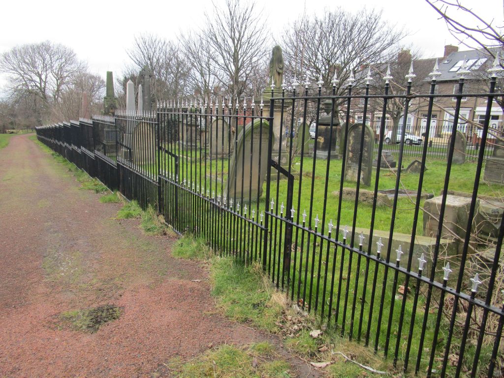
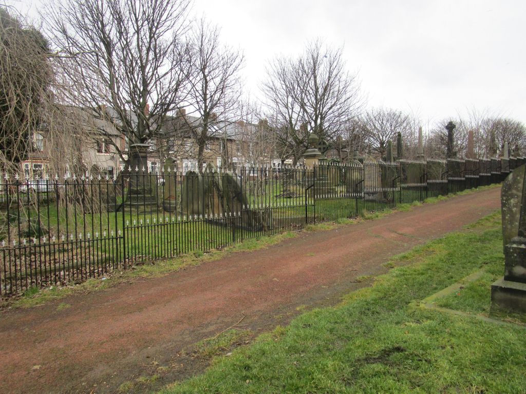
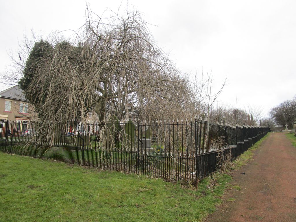
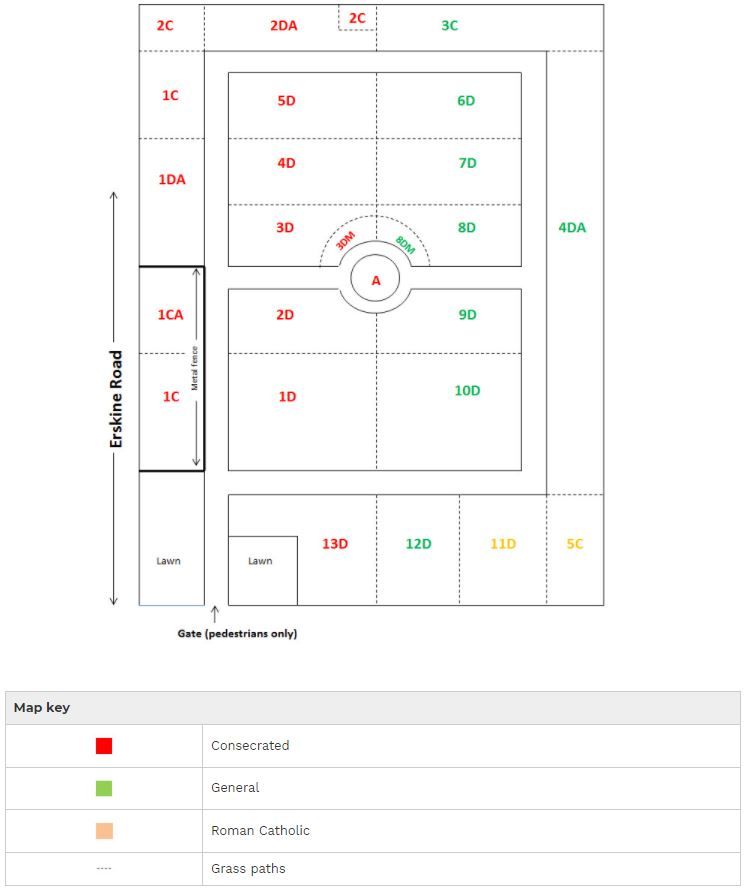
| Description | : | Opened 30 October 1856, the cemetery and burial records are maintained by South Tyneside Metropolitan Borough Council and covers an area of 15 acres. The cemetery is now closed to new graves. The cemetery can be accessed from Erskine Road. It is referred to by the Commonwealth War Graves Commission as South Shields(Westoe) Cemetery, and being in County Durham-they maintain 17 war graves here. |
frequently asked questions (FAQ):
-
Where is Westoe Cemetery?
Westoe Cemetery is located at Westoe, Metropolitan Borough of South Tyneside ,Tyne and Wear ,England.
-
Westoe Cemetery cemetery's updated grave count on graveviews.com?
3 memorials
-
Where are the coordinates of the Westoe Cemetery?
Latitude: 54.9942190
Longitude: -1.4221050
Nearby Cemetories:
1. St. Hilda's Churchyard
South Shields, Metropolitan Borough of South Tyneside, England
Coordinate: 54.9938889, -1.4363889
2. Holy Trinity Churchyard
South Shields, Metropolitan Borough of South Tyneside, England
Coordinate: 54.9908700, -1.4409900
3. South Shields Friends Burial Ground
South Shields, Metropolitan Borough of South Tyneside, England
Coordinate: 54.9910560, -1.4423000
4. St Stephen's Churchyard
South Shields, Metropolitan Borough of South Tyneside, England
Coordinate: 55.0038100, -1.4359200
5. Harton Cemetery
South Shields, Metropolitan Borough of South Tyneside, England
Coordinate: 54.9827360, -1.4124300
6. Tynemouth Priory
Tynemouth, Metropolitan Borough of North Tyneside, England
Coordinate: 55.0175730, -1.4175700
7. St Simon's Churchyard
South Shields, Metropolitan Borough of South Tyneside, England
Coordinate: 54.9721900, -1.4559600
8. Preston Cemetery and Tynemouth Crematorium
North Shields, Metropolitan Borough of North Tyneside, England
Coordinate: 55.0175960, -1.4561910
9. St. Paul's Churchyard
Jarrow, Metropolitan Borough of South Tyneside, England
Coordinate: 54.9804300, -1.4726600
10. South Shields Crematorium
South Shields, Metropolitan Borough of South Tyneside, England
Coordinate: 54.9641900, -1.4541900
11. Jarrow Cemetery
Jarrow, Metropolitan Borough of South Tyneside, England
Coordinate: 54.9727690, -1.4826260
12. St. Paul's Churchyard
Whitley Bay, Metropolitan Borough of North Tyneside, England
Coordinate: 55.0415860, -1.4478140
13. Whitburn Cemetery
Whitburn, Metropolitan Borough of South Tyneside, England
Coordinate: 54.9525060, -1.3644680
14. Church Bank Cemetery
Wallsend, Metropolitan Borough of North Tyneside, England
Coordinate: 54.9951870, -1.5161340
15. Boldon Cemetery
West Boldon, Metropolitan Borough of South Tyneside, England
Coordinate: 54.9422300, -1.4491100
16. Boldon Friends Burial Ground
Boldon, Metropolitan Borough of South Tyneside, England
Coordinate: 54.9424130, -1.4549390
17. St Mary Churchyard
Whitburn, Metropolitan Borough of South Tyneside, England
Coordinate: 54.9480000, -1.3681200
18. Holy Cross Cemetery
Wallsend, Metropolitan Borough of North Tyneside, England
Coordinate: 55.0006080, -1.5185730
19. Hebburn Cemetery
Hebburn, Metropolitan Borough of South Tyneside, England
Coordinate: 54.9684590, -1.5225580
20. St Peters Parish Churchyard
Monkwearmouth, Metropolitan Borough of Sunderland, England
Coordinate: 54.9341667, -1.3813889
21. Mere Knolls Cemetery
Sunderland, Metropolitan Borough of Sunderland, England
Coordinate: 54.9342990, -1.3738590
22. Southwick Cemetery
Southwick, Metropolitan Borough of Sunderland, England
Coordinate: 54.9269940, -1.4165070
23. St. Alban’s Churchyard
Earsdon, Metropolitan Borough of North Tyneside, England
Coordinate: 55.0461000, -1.5004000
24. Earsdon Cemetery
Earsdon, Metropolitan Borough of North Tyneside, England
Coordinate: 55.0474600, -1.5007200