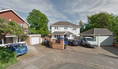
| Memorials | : | 0 |
| Location | : | Weston Favell, Northampton Borough, England |
| Coordinate | : | 52.2492980, -0.8483410 |
| Description | : | Weston Favell Cemetery is located 200 ft west of Saint Peter's Church and was originally part of the Church burial grounds. It is now closed due to lack of space. Saint Peter's Church is a 12th century building displaying Norman architecture. |
frequently asked questions (FAQ):
-
Where is Weston Favel Cemetery?
Weston Favel Cemetery is located at Graspin Lane Weston Favell, Northampton Borough ,Northamptonshire ,England.
-
Weston Favel Cemetery cemetery's updated grave count on graveviews.com?
0 memorials
-
Where are the coordinates of the Weston Favel Cemetery?
Latitude: 52.2492980
Longitude: -0.8483410
Nearby Cemetories:
1. St Peter and St Paul Churchyard
Abington, Northampton Borough, England
Coordinate: 52.2461580, -0.8653790
2. All Saints Churchyard Little Billing
Billing, Northampton Borough, England
Coordinate: 52.2484300, -0.8228800
3. Billing Road Cemetery
Northampton, Northampton Borough, England
Coordinate: 52.2387200, -0.8750900
4. Great Billing Churchyard
Northampton, Northampton Borough, England
Coordinate: 52.2581240, -0.8172800
5. Great Billing Catholic Cemetery
Billing, Northampton Borough, England
Coordinate: 52.2577300, -0.8130700
6. Saint Mary
Little Houghton, South Northamptonshire Borough, England
Coordinate: 52.2290500, -0.8252500
7. Great Houghton Cemetery
Great Houghton, Northampton Borough, England
Coordinate: 52.2242120, -0.8386900
8. Saint Mary
Great Houghton, Northampton Borough, England
Coordinate: 52.2233300, -0.8422800
9. Cemetery of the Sisters of Notre Dame
Northampton Borough, England
Coordinate: 52.2399000, -0.8923333
10. Northampton Gaol Cemetery
Northampton, Northampton Borough, England
Coordinate: 52.2418540, -0.8940440
11. St. Sepulchre Churchyard
Northampton, Northampton Borough, England
Coordinate: 52.2414600, -0.8973600
12. Northampton County Goal Cemetery
Northampton, Northampton Borough, England
Coordinate: 52.2364470, -0.8945440
13. All Saints Church
Northampton, Northampton Borough, England
Coordinate: 52.2371129, -0.8964385
14. St. Peter's Churchyard
Cogenhoe, South Northamptonshire Borough, England
Coordinate: 52.2413000, -0.7856000
15. Old St John the Baptist Churchyard
Boughton, Daventry District, England
Coordinate: 52.2836464, -0.8801961
16. Hardingstone Combined War Memorial
Hardingstone, Northampton Borough, England
Coordinate: 52.2137600, -0.8784700
17. St. Mary Magdalene's Churchyard
Ecton, Wellingborough Borough, England
Coordinate: 52.2640177, -0.7874379
18. Kingsthorpe Cemetery
Kingsthorpe, Northampton Borough, England
Coordinate: 52.2740400, -0.9001200
19. St John the Baptist Churchyard
Boughton, Daventry District, England
Coordinate: 52.2861187, -0.8971496
20. Dallington Cemetery
Northampton, Northampton Borough, England
Coordinate: 52.2505200, -0.9287200
21. Towcester Road Cemetery
Far Cotton, Northampton Borough, England
Coordinate: 52.2178190, -0.9117050
22. St Peter and St Paul
Quinton, South Northamptonshire Borough, England
Coordinate: 52.1934562, -0.8488287
23. Saint Luke Churchyard
Duston, Northampton Borough, England
Coordinate: 52.2428820, -0.9396550
24. Ss Peter and Paul Churchyard
Sywell, Wellingborough Borough, England
Coordinate: 52.2968890, -0.7965030

