
| Memorials | : | 4 |
| Location | : | Duston, Northampton Borough, England |
| Coordinate | : | 52.2428820, -0.9396550 |
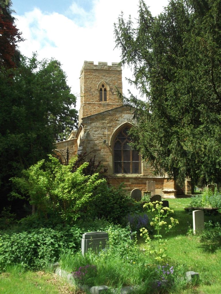
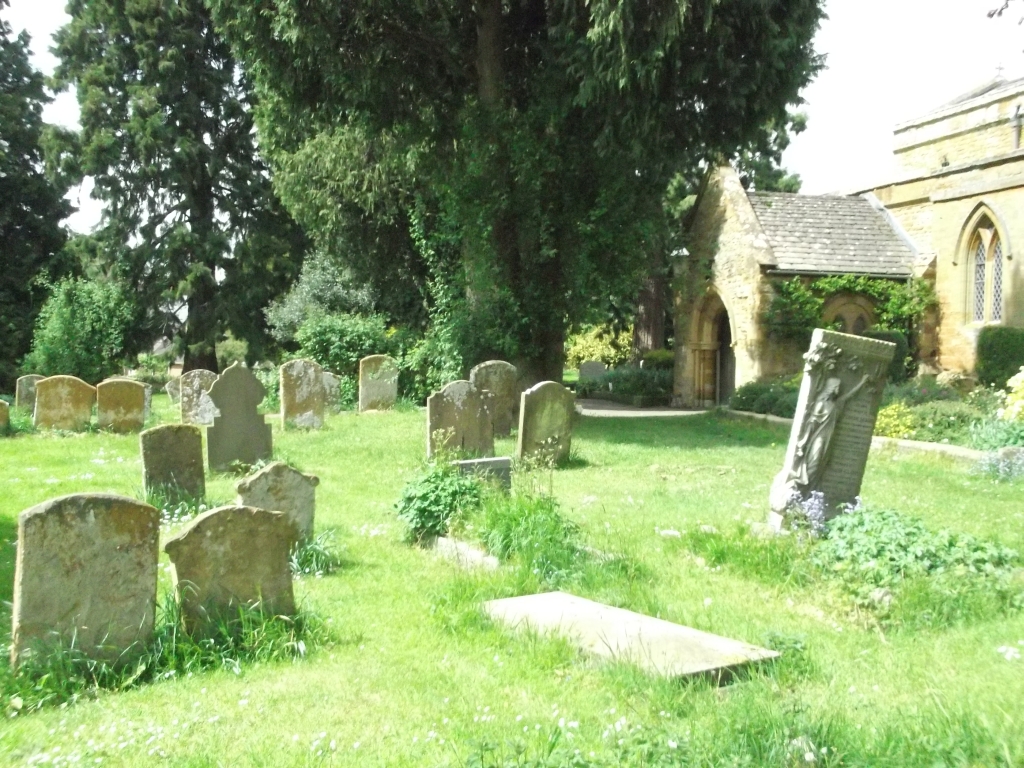
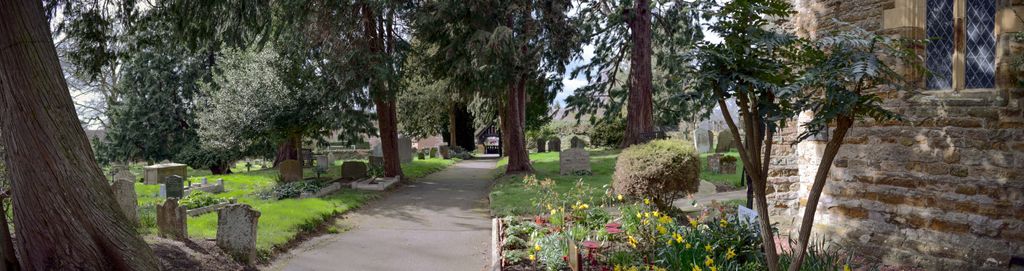
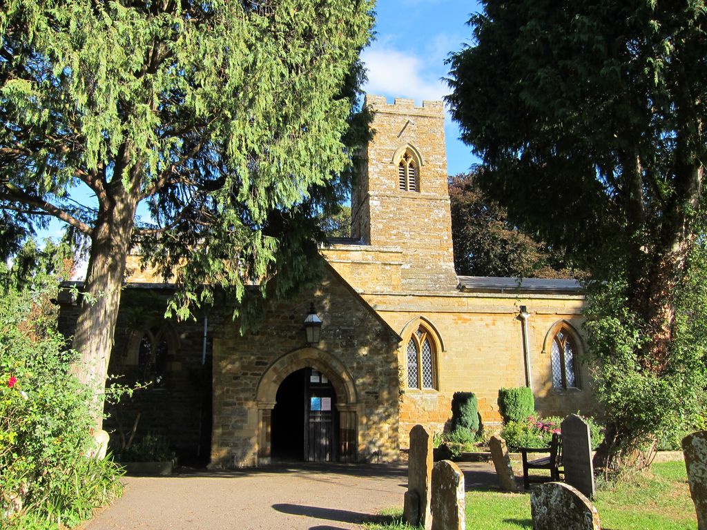
| Description | : | Historical evidence suggests that there have been settlements at Duston and Upton since the Stone Age. There was a large Roman settlement at Duston, and it was probably the main centre of habitation in the area until Anglo-Saxon times (fifth to eighth centuries AD), when Northampton started to emerge as the centre. St. Luke's is an early monastic church, built about 1113 and is a Grade 1 listed building. It was built as a place of worship for Augustinian monks from the nearby St. James Abbey. During the late 13th and early 14th centuries, St. Luke's was extended to its existing... Read More |
frequently asked questions (FAQ):
-
Where is Saint Luke Churchyard?
Saint Luke Churchyard is located at Off Main Road Duston, Northampton Borough ,Northamptonshire , NN5 6JBEngland.
-
Saint Luke Churchyard cemetery's updated grave count on graveviews.com?
3 memorials
-
Where are the coordinates of the Saint Luke Churchyard?
Latitude: 52.2428820
Longitude: -0.9396550
Nearby Cemetories:
1. St Michael's Churchyard
Upton, Northampton Borough, England
Coordinate: 52.2356600, -0.9508160
2. Dallington Cemetery
Northampton, Northampton Borough, England
Coordinate: 52.2505200, -0.9287200
3. St. Sepulchre Churchyard
Northampton, Northampton Borough, England
Coordinate: 52.2414600, -0.8973600
4. All Saints Church
Northampton, Northampton Borough, England
Coordinate: 52.2371129, -0.8964385
5. St. Luke Churchyard
Kislingbury, South Northamptonshire Borough, England
Coordinate: 52.2307300, -0.9806300
6. Northampton Gaol Cemetery
Northampton, Northampton Borough, England
Coordinate: 52.2418540, -0.8940440
7. Northampton County Goal Cemetery
Northampton, Northampton Borough, England
Coordinate: 52.2364470, -0.8945440
8. Cemetery of the Sisters of Notre Dame
Northampton Borough, England
Coordinate: 52.2399000, -0.8923333
9. Towcester Road Cemetery
Far Cotton, Northampton Borough, England
Coordinate: 52.2178190, -0.9117050
10. All Saints Churchyard
Harpole, South Northamptonshire Borough, England
Coordinate: 52.2427100, -0.9899750
11. Counties Crematorium
Northampton, Northampton Borough, England
Coordinate: 52.2058720, -0.9245220
12. Kingsthorpe Cemetery
Kingsthorpe, Northampton Borough, England
Coordinate: 52.2740400, -0.9001200
13. Billing Road Cemetery
Northampton, Northampton Borough, England
Coordinate: 52.2387200, -0.8750900
14. Rothersthorpe Extension
Rothersthorpe, South Northamptonshire Borough, England
Coordinate: 52.2046235, -0.9591382
15. St Peter and St Paul
Rothersthorpe, South Northamptonshire Borough, England
Coordinate: 52.2034651, -0.9566385
16. St Botolph Churchyard
Church Brampton, Daventry District, England
Coordinate: 52.2849866, -0.9486724
17. St Peter and St Paul Churchyard
Abington, Northampton Borough, England
Coordinate: 52.2461580, -0.8653790
18. Hardingstone Combined War Memorial
Hardingstone, Northampton Borough, England
Coordinate: 52.2137600, -0.8784700
19. St John the Baptist Churchyard
Boughton, Daventry District, England
Coordinate: 52.2861187, -0.8971496
20. Spencer Estate Grounds
Althorp, Daventry District, England
Coordinate: 52.2839190, -0.9889520
21. Old St John the Baptist Churchyard
Boughton, Daventry District, England
Coordinate: 52.2836464, -0.8801961
22. Weston Favel Cemetery
Weston Favell, Northampton Borough, England
Coordinate: 52.2492980, -0.8483410
23. St Michael & All Angels Churchyard
Bugbrooke, South Northamptonshire Borough, England
Coordinate: 52.2096900, -1.0149000
24. St. Columba Cemetery
Collingtree, Northampton Borough, England
Coordinate: 52.1908900, -0.8990000