
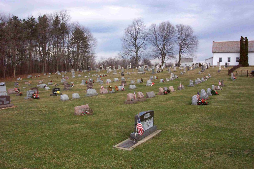
| Memorials | : | 30 |
| Location | : | Carrollton, Carroll County, USA |
| Phone | : | 330-627-2219 |
| Website | : | mtpleasantunitedmethodistchurch.org |
| Coordinate | : | 40.5238991, -81.1003036 |
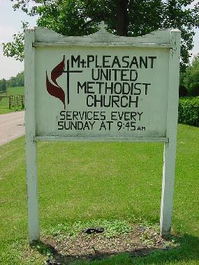
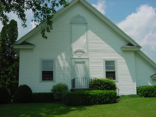
| Description | : | The cemetery is located on the west side of Canyon Road SW (County Road 54) about 1.1 miles northeast of its intersection with Scio Road (Ohio State Route 332). The cemetery is located in Union Township, Carroll County, Ohio, and is # 1468 (Mount Pleasant Cemetery) in “Ohio Cemeteries 1803-2003”, compiled by the Ohio Genealogical Society. The cemetery is registered with the Ohio Division of Real Estate and Professional Licensing (ODRE) as Mt. Pleasant Cemetery with registration license number CRC.2017001493. The U.S. Geological Survey (USGS) Geographic Names Information System (GNIS) feature ID for the cemetery is 1052443 (Mount... Read More |
frequently asked questions (FAQ):
-
Where is Mount Pleasant Cemetery?
Mount Pleasant Cemetery is located at 89 Canyon Road SW (County Road 54) Carrollton, Carroll County ,Ohio , 44615USA.
-
Mount Pleasant Cemetery cemetery's updated grave count on graveviews.com?
30 memorials
-
Where are the coordinates of the Mount Pleasant Cemetery?
Latitude: 40.5238991
Longitude: -81.1003036

Nearby Cemetories:
1. Seceders Cemetery
Carroll County, USA
Coordinate: 40.5332985, -81.1446991
2. Westview Cemetery
Carrollton, Carroll County, USA
Coordinate: 40.5663986, -81.0852966
3. Scotts Cemetery
Carroll County, USA
Coordinate: 40.5386009, -81.1556015
4. Champers Cemetery
Carrollton, Carroll County, USA
Coordinate: 40.5667610, -81.1178540
5. Piecynski Farm Cemetery
Carrollton, Carroll County, USA
Coordinate: 40.5658690, -81.1224020
6. Farnsworth Cemetery
Carroll County, USA
Coordinate: 40.5385017, -81.1567001
7. Grandview Cemetery
Carrollton, Carroll County, USA
Coordinate: 40.5694008, -81.0828018
8. Old Scott Cemetery
Carroll County, USA
Coordinate: 40.5483017, -81.1541977
9. Arabia Cemetery
Perrysville, Carroll County, USA
Coordinate: 40.4803009, -81.0678024
10. McGuire Cemetery
Tabor, Carroll County, USA
Coordinate: 40.5518990, -81.1564026
11. Immaculate Heart of Mary Cemetery
Carrollton, Carroll County, USA
Coordinate: 40.5758010, -81.0955510
12. Palermo Cemetery
Carroll County, USA
Coordinate: 40.4894444, -81.1522220
13. Lee Cemetery
Carroll County, USA
Coordinate: 40.5391998, -81.0314026
14. Mount Tabor Cemetery
Carroll County, USA
Coordinate: 40.4817009, -81.1483002
15. Green Hill Cemetery
Carroll County, USA
Coordinate: 40.5303001, -81.0246964
16. Perrysville Methodist Episcopal Church Cemetery
Perrysville, Carroll County, USA
Coordinate: 40.4655991, -81.0982971
17. Perrysville United Methodist Cemetery
Perrysville, Carroll County, USA
Coordinate: 40.4625510, -81.0973610
18. Saint Luke Cemetery
Carroll County, USA
Coordinate: 40.5303001, -81.1810989
19. Denver George Haddock Family Cemetery
Carrollton, Carroll County, USA
Coordinate: 40.5443880, -81.0227370
20. Pleasant Valley Cemetery
Carroll County, USA
Coordinate: 40.5764008, -81.1493988
21. Aller Family Cemetery
Carrollton, Carroll County, USA
Coordinate: 40.5879760, -81.0771540
22. New Perrysville Cemetery
Perrysville, Carroll County, USA
Coordinate: 40.4569016, -81.1016998
23. Bethel Cemetery
Leavittsville, Carroll County, USA
Coordinate: 40.4921989, -81.1841965
24. Hagey Family Cemetery
Perrysville, Carroll County, USA
Coordinate: 40.4525980, -81.0996160