
| Memorials | : | 220 |
| Location | : | Whangateau, Auckland Council, New Zealand |
| Coordinate | : | -36.3141600, 174.7710200 |
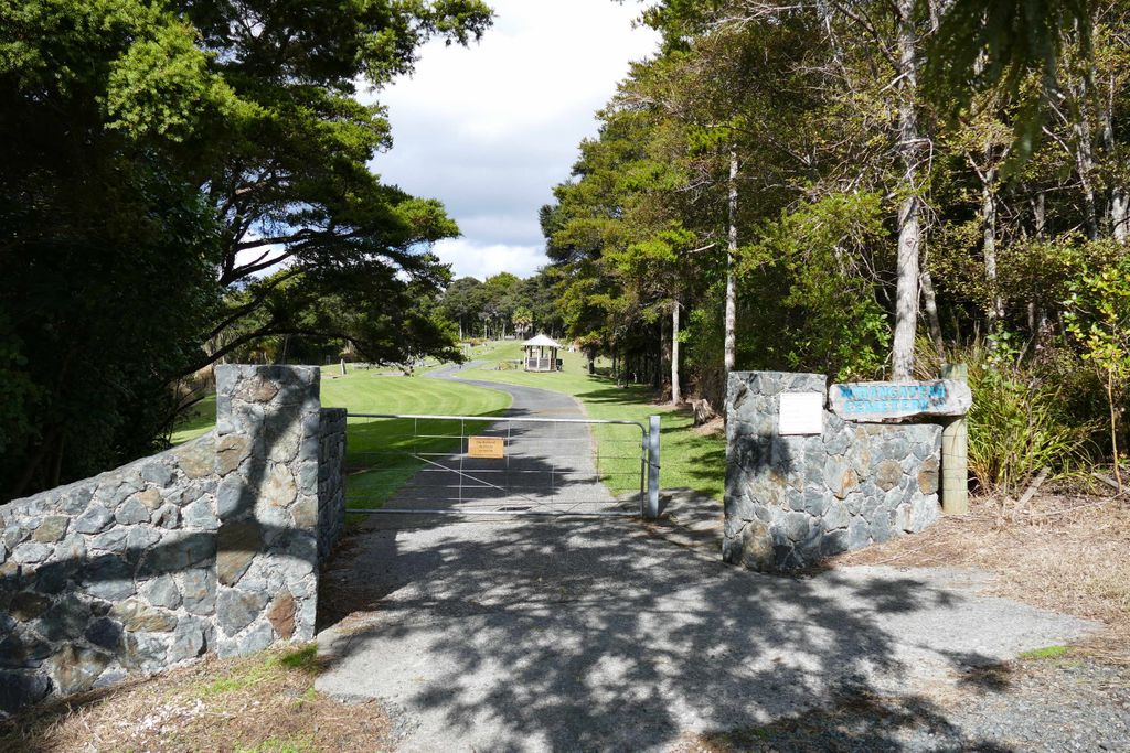
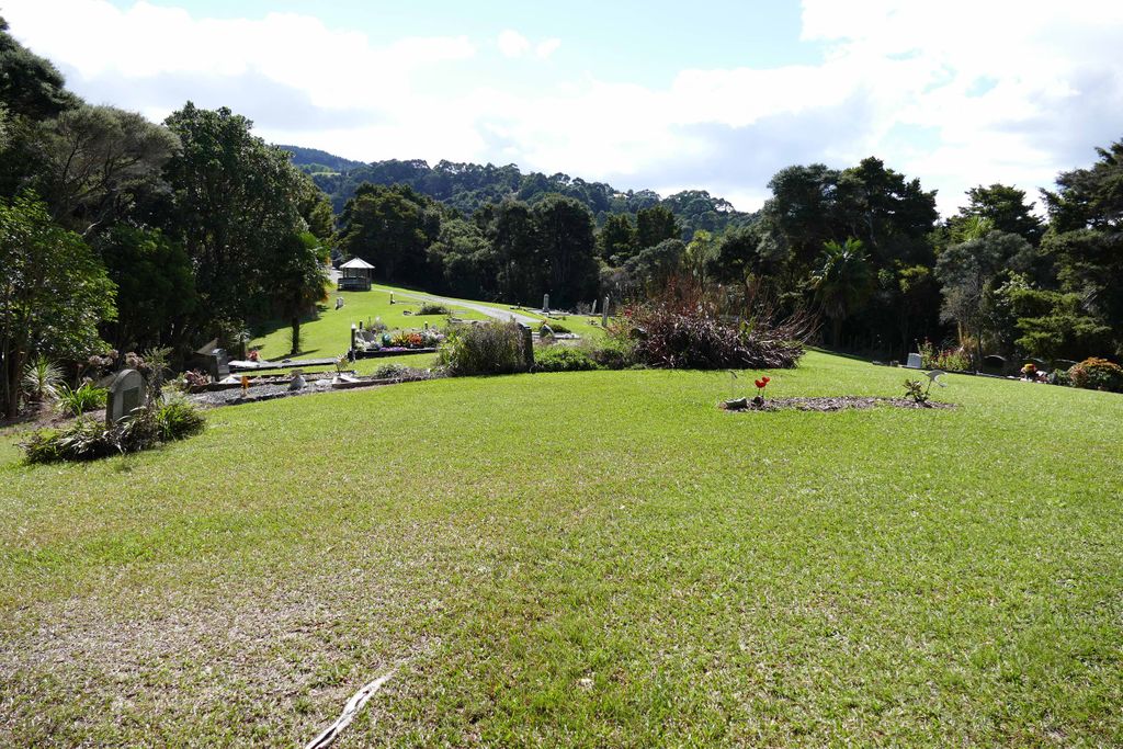
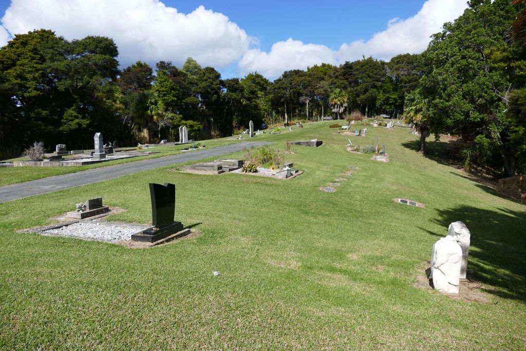
| Description | : | The Whangateau Cemetery is located 80km north of the Auckland CBD. It has been in existence since it was gazetted on 15thOctober 1892. It is administered by the Whangateau Cemetery Trust who work within the local government requirements for burials. It is well cared for. The cemetery is located at the top of the hill on the eastern side of the Whangateau Public Domain. Access is approximately 400m from the Domain on the right side when heading towards Leigh. The driveway passes through a private farm and farm gates may require opening and closing. The... Read More |
frequently asked questions (FAQ):
-
Where is Whangateau Cemetery?
Whangateau Cemetery is located at 533 Leigh Road Whangateau, Auckland Council ,Auckland ,New Zealand.
-
Whangateau Cemetery cemetery's updated grave count on graveviews.com?
19 memorials
-
Where are the coordinates of the Whangateau Cemetery?
Latitude: -36.3141600
Longitude: 174.7710200


Nearby Cemetories:
1. Leigh Cemetery
Leigh, Auckland Council, New Zealand
Coordinate: -36.2902800, 174.8094100
2. Matakana Public Cemetery
Matakana, Auckland Council, New Zealand
Coordinate: -36.3488910, 174.7232640
3. Pakiri Cemetery
Pakiri, Auckland Council, New Zealand
Coordinate: -36.2594400, 174.7265300
4. Warkworth Anglican Church Cemetery
Warkworth, Auckland Council, New Zealand
Coordinate: -36.4022100, 174.6628800
5. Warkworth Roman Catholic Cemetery
Warkworth, Auckland Council, New Zealand
Coordinate: -36.3895340, 174.6457850
6. Boyds Hill Cemetery
Kawau Island, Auckland Council, New Zealand
Coordinate: -36.4312880, 174.8294080
7. Warkworth Cemetery
Warkworth, Auckland Council, New Zealand
Coordinate: -36.4128510, 174.6674360
8. Te Kapa Cemetery
Mahurangi, Auckland Council, New Zealand
Coordinate: -36.4511910, 174.7502920
9. National Erebus Memorial
Parnell, Auckland Council, New Zealand
Coordinate: -36.4546695, 174.7720847
10. Mahurangi Heads Presbyterian Church Cemetery
Mahurangi, Auckland Council, New Zealand
Coordinate: -36.4589100, 174.7317400
11. Te Arai Cemetery
Te Arai, Auckland Council, New Zealand
Coordinate: -36.1910790, 174.6010190
12. Pukapuka Cemetery
Pohuehue, Auckland Council, New Zealand
Coordinate: -36.4858910, 174.6783405
13. Te Muri
Puhoi, Auckland Council, New Zealand
Coordinate: -36.5182030, 174.7204840
14. Wellsford Cemetery
Wellsford, Auckland Council, New Zealand
Coordinate: -36.2826700, 174.5106800
15. Puhoi Cemetery
Puhoi, Auckland Council, New Zealand
Coordinate: -36.5052400, 174.6476300
16. Hoteo North Cemetery
Hoteo North, Auckland Council, New Zealand
Coordinate: -36.3255803, 174.4957872
17. Port Albert Cemetery
Port Albert, Auckland Council, New Zealand
Coordinate: -36.2813200, 174.4483850
18. Hakaru Cemetery
Hakaru, Kaipara District, New Zealand
Coordinate: -36.1491780, 174.5103440
19. Tauhoa Cemetery
Tauhoa, Auckland Council, New Zealand
Coordinate: -36.3671330, 174.4449600
20. Mangawhai Cemetery
Mangawhai, Kaipara District, New Zealand
Coordinate: -36.1138090, 174.5436890
21. Komokoriki Cemetery
Manukau, Auckland Council, New Zealand
Coordinate: -36.5026370, 174.5033710
22. Kaiwaka Cemetery
Kaiwaka, Kaipara District, New Zealand
Coordinate: -36.1585390, 174.4597370
23. Minniesdale Chapel Cemetery
Wharehine, Auckland Council, New Zealand
Coordinate: -36.3139990, 174.3996600
24. Glorit Cemetery
Glorit, Auckland Council, New Zealand
Coordinate: -36.4599760, 174.4448830