
| Memorials | : | 0 |
| Location | : | Lower Whitley, Cheshire West and Chester Unitary Authority, England |
| Website | : | heritage.quaker.org.uk/files/Frandley%20LM.pdf |
| Coordinate | : | 53.3128000, -2.5774000 |
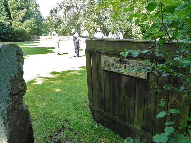
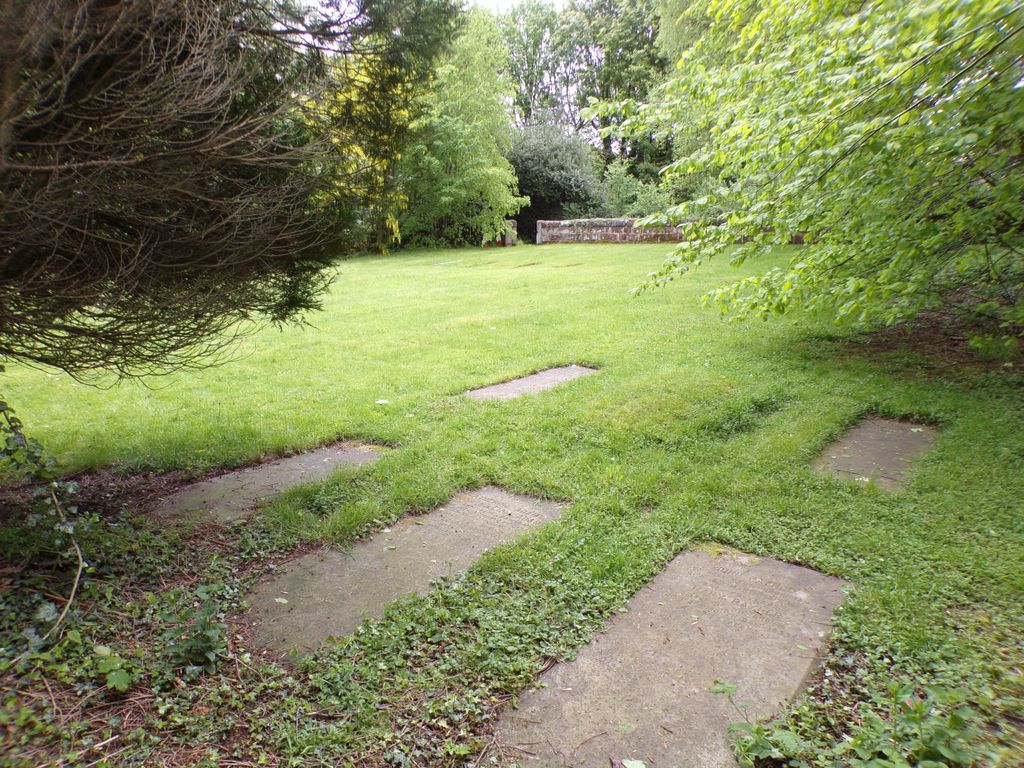
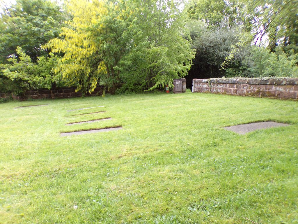
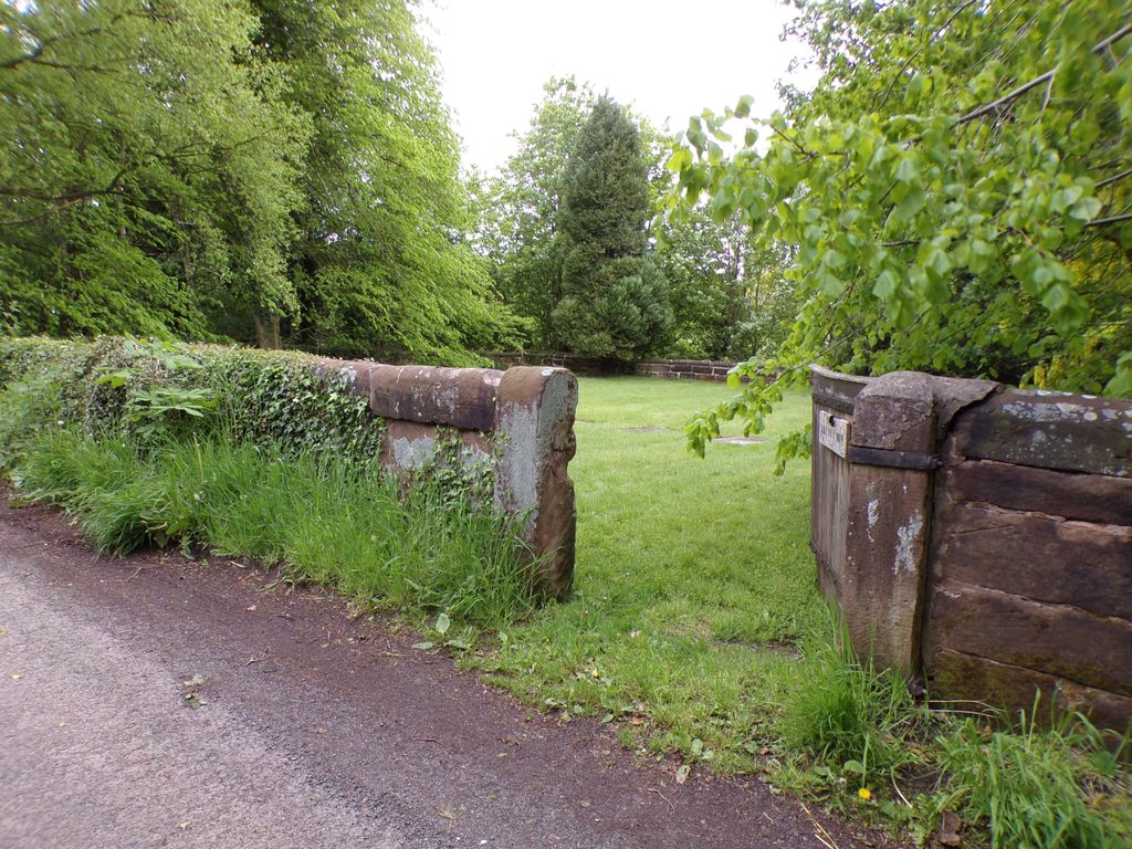
| Description | : | This is the detached burial ground of Frandley Quaker Meeting, Sandiway Lane, Northwich (please see Frandley Society of Friends Burial Ground). The web site of the Frandley Society of Friends says, "Whitley Burial Ground (Fig.5.) is located on the road between Lower Whitley on the south and Higher Whitley on the North. The National Grid Reference is SJ 61642 79691. The 618 square yard site has red sandstone walling listed at Grade II. The date of the earliest gravestone is 1686 for John Starkey; unusually for Quakers this gravestone is decorated with a shield engraved with scrolls to both side... Read More |
frequently asked questions (FAQ):
-
Where is Whitley Quaker Burial Ground?
Whitley Quaker Burial Ground is located at Village Lane Lower Whitley, Cheshire West and Chester Unitary Authority ,Cheshire ,England.
-
Whitley Quaker Burial Ground cemetery's updated grave count on graveviews.com?
0 memorials
-
Where are the coordinates of the Whitley Quaker Burial Ground?
Latitude: 53.3128000
Longitude: -2.5774000
Nearby Cemetories:
1. Saint Luke's
Lower Whitley, Cheshire West and Chester Unitary Authority, England
Coordinate: 53.3054000, -2.5802000
2. Frandley Quaker Burial Ground
Antrobus, Cheshire West and Chester Unitary Authority, England
Coordinate: 53.3081893, -2.5484550
3. Little Leigh Baptist Churchyard
Little Leigh, Cheshire West and Chester Unitary Authority, England
Coordinate: 53.2911690, -2.5759770
4. St. Mark's Churchyard
Antrobus, Cheshire West and Chester Unitary Authority, England
Coordinate: 53.3122200, -2.5350400
5. Saint Matthew's Churchyard
Stretton, Warrington Unitary Authority, England
Coordinate: 53.3403000, -2.5717310
6. Appleton Thorn St. Cross Churchyard
Appleton, Warrington Unitary Authority, England
Coordinate: 53.3501000, -2.5455000
7. All Saints Churchyard
Daresbury, Halton Unitary Authority, England
Coordinate: 53.3405457, -2.6313031
8. Barnton Cemetery
Barnton, Cheshire West and Chester Unitary Authority, England
Coordinate: 53.2735320, -2.5407780
9. St. Mary and All Saints Churchyard
Great Budworth, Cheshire West and Chester Unitary Authority, England
Coordinate: 53.2936000, -2.5043000
10. Fox Covert Cemetery
Warrington, Warrington Unitary Authority, England
Coordinate: 53.3607300, -2.5856900
11. Hill Cliffe Cemetery
Warrington, Warrington Unitary Authority, England
Coordinate: 53.3611905, -2.5842857
12. St. Mary's Churchyard
Weaverham, Cheshire West and Chester Unitary Authority, England
Coordinate: 53.2637800, -2.5757800
13. Walton Lea Crematorium
Warrington, Warrington Unitary Authority, England
Coordinate: 53.3624630, -2.6016730
14. St. John The Evangelist Churchyard
Walton, Warrington Unitary Authority, England
Coordinate: 53.3626750, -2.6052020
15. St. Peter's Churchyard
Aston, Cheshire West and Chester Unitary Authority, England
Coordinate: 53.3012900, -2.6681500
16. Christ Church Churchyard
Crowton, Cheshire West and Chester Unitary Authority, England
Coordinate: 53.2663956, -2.6311641
17. St Thomas Churchyard
Stockton Heath, Warrington Unitary Authority, England
Coordinate: 53.3723200, -2.5823800
18. St. Paul's Churchyard
Marston, Cheshire West and Chester Unitary Authority, England
Coordinate: 53.2819250, -2.4899741
19. St Wilfrid's Churchyard
Grappenhall, Warrington Unitary Authority, England
Coordinate: 53.3723000, -2.5434000
20. St Wilfrid Roman Catholic Churchyard
Northwich, Cheshire West and Chester Unitary Authority, England
Coordinate: 53.2621080, -2.5068050
21. Norton Priory
Norton, Halton Unitary Authority, England
Coordinate: 53.3424120, -2.6796450
22. St. Helen Witton Churchyard
Northwich, Cheshire West and Chester Unitary Authority, England
Coordinate: 53.2602000, -2.5046000
23. Witton Cemetery
Northwich, Cheshire West and Chester Unitary Authority, England
Coordinate: 53.2584600, -2.5052600
24. Halton Cemetery
Runcorn, Halton Unitary Authority, England
Coordinate: 53.3283800, -2.6943340