
| Memorials | : | 2 |
| Location | : | Grappenhall, Warrington Unitary Authority, England |
| Coordinate | : | 53.3723000, -2.5434000 |
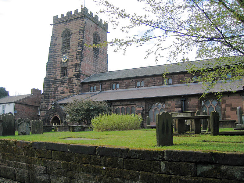
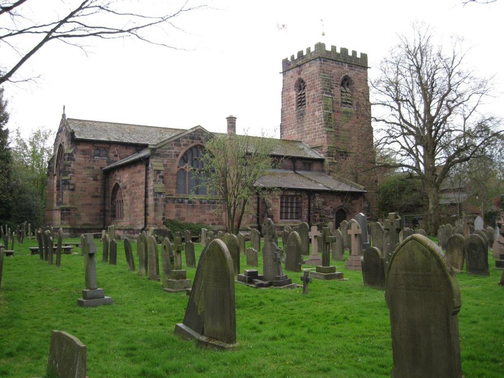
| Description | : | The church is Norman in origin, built probably in the earlier part of the 12th century and completed about 1120. This would was a small and simple church, consisting of a nave, chancel and, possibly, an apse.The foundations of this church were discovered during the 1873–74 restoration. A chantry chapel was added by the Boydell family in 1334 in a position where the south aisle now stands. From 1529 the church was largely rebuilt in local sandstone. The old church was demolished and a new nave, chancel, north aisle and a west tower were built. In 1539 the south aisle was... Read More |
frequently asked questions (FAQ):
-
Where is St Wilfrid's Churchyard?
St Wilfrid's Churchyard is located at Grappenhall, Warrington Unitary Authority ,Cheshire ,England.
-
St Wilfrid's Churchyard cemetery's updated grave count on graveviews.com?
1 memorials
-
Where are the coordinates of the St Wilfrid's Churchyard?
Latitude: 53.3723000
Longitude: -2.5434000

Nearby Cemetories:
1. All Saints Churchyard
Thelwall, Warrington Unitary Authority, England
Coordinate: 53.3822300, -2.5282700
2. Appleton Thorn St. Cross Churchyard
Appleton, Warrington Unitary Authority, England
Coordinate: 53.3501000, -2.5455000
3. St Thomas Churchyard
Stockton Heath, Warrington Unitary Authority, England
Coordinate: 53.3723200, -2.5823800
4. Hill Cliffe Cemetery
Warrington, Warrington Unitary Authority, England
Coordinate: 53.3611905, -2.5842857
5. Fox Covert Cemetery
Warrington, Warrington Unitary Authority, England
Coordinate: 53.3607300, -2.5856900
6. St. Elphin's Churchyard
Warrington, Warrington Unitary Authority, England
Coordinate: 53.3909750, -2.5800370
7. Warrington Cemetery
Warrington, Warrington Unitary Authority, England
Coordinate: 53.3964660, -2.5730780
8. Christ Church Graveyard
Padgate, Warrington Unitary Authority, England
Coordinate: 53.4072619, -2.5565873
9. Walton Lea Crematorium
Warrington, Warrington Unitary Authority, England
Coordinate: 53.3624630, -2.6016730
10. Saint Matthew's Churchyard
Stretton, Warrington Unitary Authority, England
Coordinate: 53.3403000, -2.5717310
11. St. John The Evangelist Churchyard
Walton, Warrington Unitary Authority, England
Coordinate: 53.3626750, -2.6052020
12. Saint Mary's Churchyard
Lymm, Warrington Unitary Authority, England
Coordinate: 53.3771000, -2.4784000
13. Lymm Baptist Churchyard
Lymm, Warrington Unitary Authority, England
Coordinate: 53.3765240, -2.4724300
14. St. Barnabas Churchyard
Warrington Unitary Authority, England
Coordinate: 53.3920038, -2.6121106
15. St. Peter's Parish Churchyard
Lymm, Warrington Unitary Authority, England
Coordinate: 53.3802800, -2.4610000
16. Saint Werburgh's Churchyard
Warburton, Metropolitan Borough of Trafford, England
Coordinate: 53.4021610, -2.4572830
17. St. Mark's Churchyard
Antrobus, Cheshire West and Chester Unitary Authority, England
Coordinate: 53.3122200, -2.5350400
18. Risley Presbyterian Church Churchyard
Warrington Unitary Authority, England
Coordinate: 53.4322500, -2.5283880
19. All Saints Churchyard
Daresbury, Halton Unitary Authority, England
Coordinate: 53.3405457, -2.6313031
20. Unitarian Chapel
Croft, Warrington Unitary Authority, England
Coordinate: 53.4345995, -2.5440079
21. Whitley Quaker Burial Ground
Lower Whitley, Cheshire West and Chester Unitary Authority, England
Coordinate: 53.3128000, -2.5774000
22. Frandley Quaker Burial Ground
Antrobus, Cheshire West and Chester Unitary Authority, England
Coordinate: 53.3081893, -2.5484550
23. Christ Church Churchyard
Warrington, Warrington Unitary Authority, England
Coordinate: 53.4376659, -2.5428132
24. Winwick Hospital Churchyard
Warrington Unitary Authority, England
Coordinate: 53.4265000, -2.6050000