
| Memorials | : | 0 |
| Location | : | Walton, Warrington Unitary Authority, England |
| Website | : | www.stjohnshigherwalton.org.uk/ |
| Coordinate | : | 53.3626750, -2.6052020 |
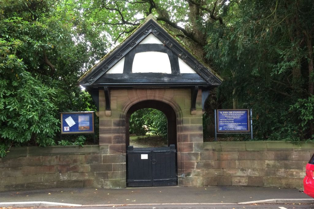
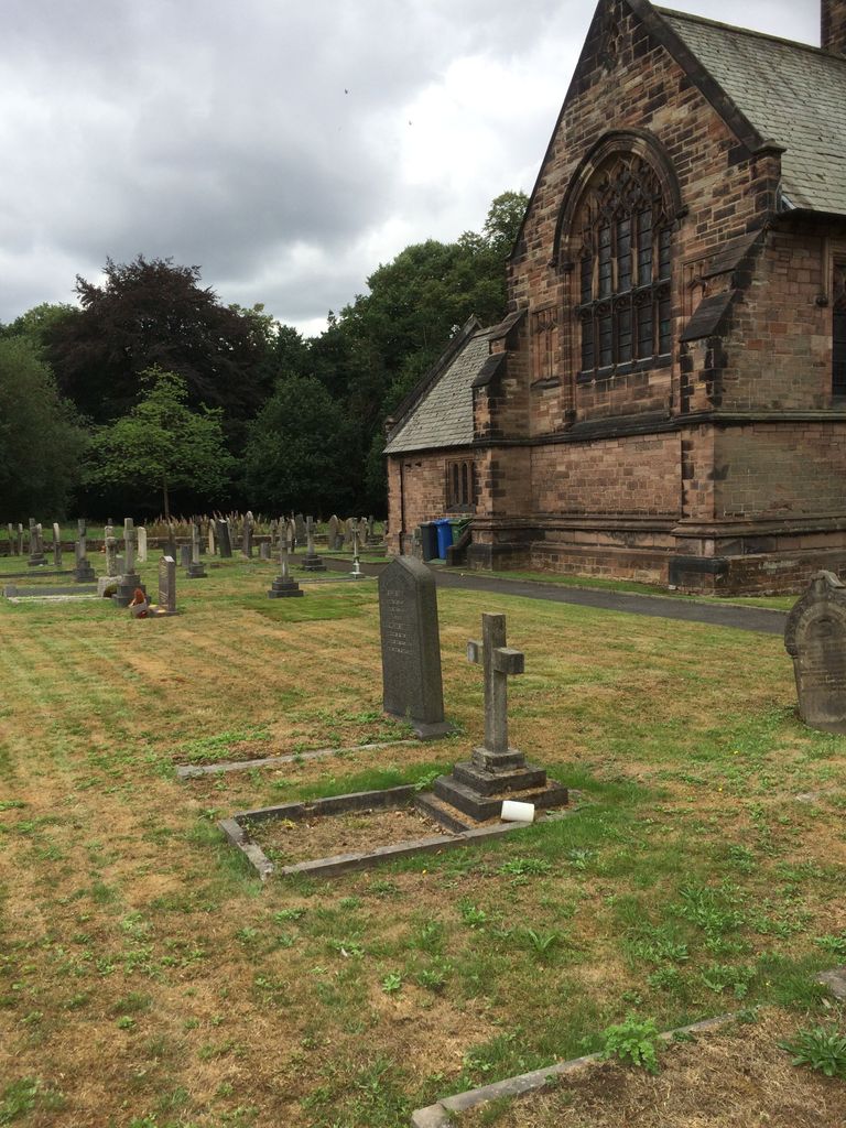
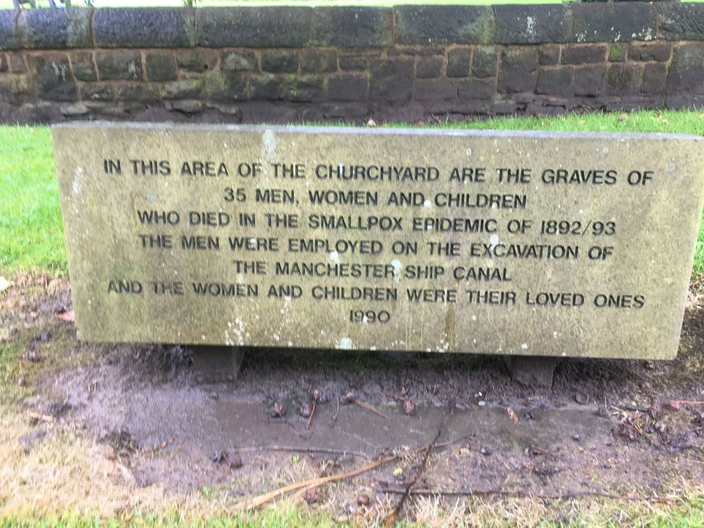
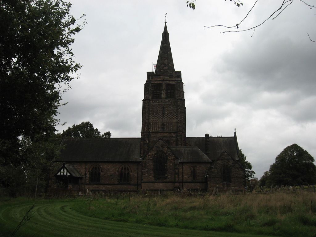
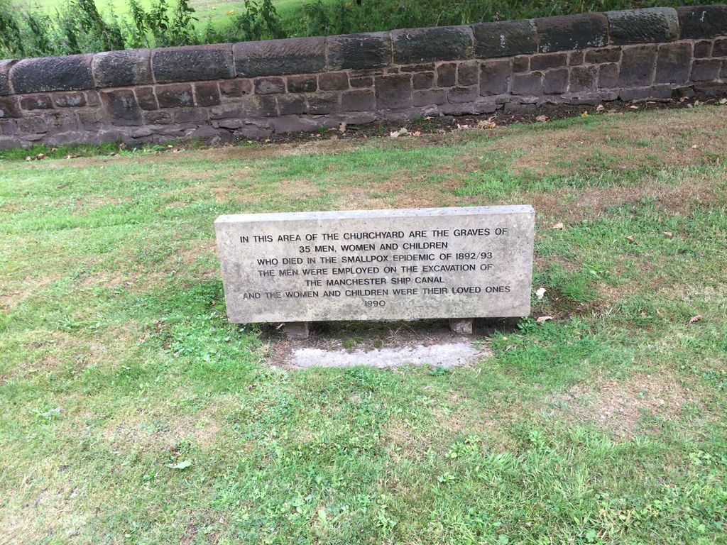
| Description | : | Originally built as a private chapel for the Walton Hall Estate in 1882–83 it is now an Anglican parish church, part of the diocese of Chester. The church, and its Lych gate, are both grade II listed. At the rear of the church is a memorial to 35 people who died of smallpox during the construction of the nearby Manchester Ship Canal and who are buried in that part of the churchyard in unmarked graves. |
frequently asked questions (FAQ):
-
Where is St. John The Evangelist Churchyard?
St. John The Evangelist Churchyard is located at Old Chester Road Walton, Warrington Unitary Authority ,Cheshire , WA4 6TFEngland.
-
St. John The Evangelist Churchyard cemetery's updated grave count on graveviews.com?
0 memorials
-
Where are the coordinates of the St. John The Evangelist Churchyard?
Latitude: 53.3626750
Longitude: -2.6052020
Nearby Cemetories:
1. Walton Lea Crematorium
Warrington, Warrington Unitary Authority, England
Coordinate: 53.3624630, -2.6016730
2. Fox Covert Cemetery
Warrington, Warrington Unitary Authority, England
Coordinate: 53.3607300, -2.5856900
3. Hill Cliffe Cemetery
Warrington, Warrington Unitary Authority, England
Coordinate: 53.3611905, -2.5842857
4. St Thomas Churchyard
Stockton Heath, Warrington Unitary Authority, England
Coordinate: 53.3723200, -2.5823800
5. All Saints Churchyard
Daresbury, Halton Unitary Authority, England
Coordinate: 53.3405457, -2.6313031
6. St. Barnabas Churchyard
Warrington Unitary Authority, England
Coordinate: 53.3920038, -2.6121106
7. Saint Matthew's Churchyard
Stretton, Warrington Unitary Authority, England
Coordinate: 53.3403000, -2.5717310
8. St. Elphin's Churchyard
Warrington, Warrington Unitary Authority, England
Coordinate: 53.3909750, -2.5800370
9. St. Mary's Cemetery
Great Sankey, Warrington Unitary Authority, England
Coordinate: 53.3885690, -2.6507810
10. Appleton Thorn St. Cross Churchyard
Appleton, Warrington Unitary Authority, England
Coordinate: 53.3501000, -2.5455000
11. St Wilfrid's Churchyard
Grappenhall, Warrington Unitary Authority, England
Coordinate: 53.3723000, -2.5434000
12. Warrington Cemetery
Warrington, Warrington Unitary Authority, England
Coordinate: 53.3964660, -2.5730780
13. Penketh Quaker Meeting House
Penketh, Warrington Unitary Authority, England
Coordinate: 53.3873500, -2.6555300
14. St. Mary's Churchyard
Great Sankey, Warrington Unitary Authority, England
Coordinate: 53.3912000, -2.6497000
15. Norton Priory
Norton, Halton Unitary Authority, England
Coordinate: 53.3424120, -2.6796450
16. All Saints Churchyard
Thelwall, Warrington Unitary Authority, England
Coordinate: 53.3822300, -2.5282700
17. Whitley Quaker Burial Ground
Lower Whitley, Cheshire West and Chester Unitary Authority, England
Coordinate: 53.3128000, -2.5774000
18. Christ Church Graveyard
Padgate, Warrington Unitary Authority, England
Coordinate: 53.4072619, -2.5565873
19. Saint Luke's
Lower Whitley, Cheshire West and Chester Unitary Authority, England
Coordinate: 53.3054000, -2.5802000
20. Halton Cemetery
Runcorn, Halton Unitary Authority, England
Coordinate: 53.3283800, -2.6943340
21. Winwick Hospital Churchyard
Warrington Unitary Authority, England
Coordinate: 53.4265000, -2.6050000
22. Frandley Quaker Burial Ground
Antrobus, Cheshire West and Chester Unitary Authority, England
Coordinate: 53.3081893, -2.5484550
23. St. Mark's Churchyard
Antrobus, Cheshire West and Chester Unitary Authority, England
Coordinate: 53.3122200, -2.5350400
24. St. Oswald Churchyard
Winwick, Warrington Unitary Authority, England
Coordinate: 53.4309200, -2.5972200