
| Memorials | : | 0 |
| Location | : | Wissenkerke, Noord-Beveland Municipality, Netherlands |
| Coordinate | : | 51.5855300, 3.7439600 |
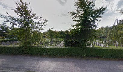
| Description | : | Wissenkerke is a village in the western half of the island of Noord Beveland It is part of the Noord-Beveland municipality located in the province of Zeeland, in the south-western Netherlands. It is approx 21kms north east of Middelburg. Despite a Commonwealth War Graves Commission document which states an unknown soldier is buried here from the War of 1914-1918, in October of 2021 the CWGC determined the documentation was in error, and in fact there is no World War One of grave at this cemetery. |
frequently asked questions (FAQ):
-
Where is Wissenkerke General Cemetery?
Wissenkerke General Cemetery is located at Nieuweweg Wissenkerke, Noord-Beveland Municipality ,Zeeland ,Netherlands.
-
Wissenkerke General Cemetery cemetery's updated grave count on graveviews.com?
0 memorials
-
Where are the coordinates of the Wissenkerke General Cemetery?
Latitude: 51.5855300
Longitude: 3.7439600
Nearby Cemetories:
1. Kamperland General Cemetery
Kamperland, Noord-Beveland Municipality, Netherlands
Coordinate: 51.5720500, 3.7028400
2. Colijnsplaat General Cemetery
Colijnsplaat, Noord-Beveland Municipality, Netherlands
Coordinate: 51.5993700, 3.8421900
3. Begraafplaats Kerkhofring
Zanddijk, Veere Municipality, Netherlands
Coordinate: 51.5400512, 3.6583653
4. Vrouwenpolder Cemetery
Vrouwenpolder, Veere Municipality, Netherlands
Coordinate: 51.5762700, 3.6247700
5. Wolphaartsdijk Algemene Begraafplaats
Wolphaartsdijk, Goes Municipality, Netherlands
Coordinate: 51.5271200, 3.8191400
6. Kats General Cemetery
Kats, Noord-Beveland Municipality, Netherlands
Coordinate: 51.5704500, 3.8825800
7. Lewedorp Kerkhof
Lewedorp, Borsele Municipality, Netherlands
Coordinate: 51.4940600, 3.7502800
8. Algemene Begraafplaats
Serooskerke, Veere Municipality, Netherlands
Coordinate: 51.5531700, 3.5993600
9. Algemene Begraafplaats Burgh
Burgh-Haamstede, Schouwen-Duiveland Municipality, Netherlands
Coordinate: 51.6906989, 3.7354186
10. 's-Heer-Hendrikskinderen Algemene Begraafplaats
's-Heer Hendrikskinderen, Goes Municipality, Netherlands
Coordinate: 51.5012100, 3.8463800
11. Hervormd Kerk
Burgh, Schouwen-Duiveland Municipality, Netherlands
Coordinate: 51.6910269, 3.7330038
12. Wilhelminadorp General Cemetery
Wilhelminadorp, Goes Municipality, Netherlands
Coordinate: 51.5323600, 3.8916900
13. Nieuwdorp Algemene Begraafplaats
Nieuwdorp, Borsele Municipality, Netherlands
Coordinate: 51.4775300, 3.7466800
14. Nieuwdorp Dutch Reformed Cemetery
Nieuwdorp, Borsele Municipality, Netherlands
Coordinate: 51.4768900, 3.7438300
15. Hervormd Haamstede
Haamstede, Schouwen-Duiveland Municipality, Netherlands
Coordinate: 51.6976691, 3.7434654
16. Middelburg Algemene Begraafplaats
Middelburg, Middelburg Municipality, Netherlands
Coordinate: 51.4973900, 3.6271800
17. Goes Algemene Begraafplaats
Goes, Goes Municipality, Netherlands
Coordinate: 51.5120600, 3.8866100
18. Algemene Begraafplaats Vredehof
Burgh-Haamstede, Schouwen-Duiveland Municipality, Netherlands
Coordinate: 51.7012200, 3.7451700
19. Middelburg Abbey
Middelburg, Middelburg Municipality, Netherlands
Coordinate: 51.5000000, 3.6166670
20. Oostkapelle General Cemetery
Oostkapelle, Veere Municipality, Netherlands
Coordinate: 51.5671500, 3.5547700
21. Joodse Begraafplaats Walensingel
Middelburg Municipality, Netherlands
Coordinate: 51.5001460, 3.6058240
22. Portugees-Joodse begraafplaats Jodengang
Middelburg Municipality, Netherlands
Coordinate: 51.5006540, 3.6037420
23. Heinkenszand Kerklaan Cemetery
Heinkenszand, Borsele Municipality, Netherlands
Coordinate: 51.4717900, 3.8139200
24. 's-Heerenhoek Old Cemetery
's-Heerenhoek, Borsele Municipality, Netherlands
Coordinate: 51.4634500, 3.7642900