
| Memorials | : | 0 |
| Location | : | Wilhelminadorp, Goes Municipality, Netherlands |
| Coordinate | : | 51.5323600, 3.8916900 |
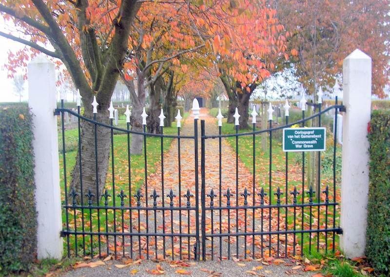
| Description | : | Wilhelminadorp is a small village on the Oosterschelde. It is part of the Goes Municipality, located in the province of Zeeland in the south-western Netherlands. It lies approx 5km north of Goes. The cemetery is outside the village boundary and is approached by a long chemin d'access through an orchard. |
frequently asked questions (FAQ):
-
Where is Wilhelminadorp General Cemetery?
Wilhelminadorp General Cemetery is located at Langeweg / Brugstraat Wilhelminadorp, Goes Municipality ,Zeeland ,Netherlands.
-
Wilhelminadorp General Cemetery cemetery's updated grave count on graveviews.com?
0 memorials
-
Where are the coordinates of the Wilhelminadorp General Cemetery?
Latitude: 51.5323600
Longitude: 3.8916900
Nearby Cemetories:
1. Goes Algemene Begraafplaats
Goes, Goes Municipality, Netherlands
Coordinate: 51.5120600, 3.8866100
2. Hervormde Gemeente te Kattendijke
Kattendijke, Goes Municipality, Netherlands
Coordinate: 51.5236607, 3.9446858
3. Kattendijke General Cemetery
Kattendijke, Goes Municipality, Netherlands
Coordinate: 51.5230400, 3.9476100
4. Kats General Cemetery
Kats, Noord-Beveland Municipality, Netherlands
Coordinate: 51.5704500, 3.8825800
5. Kloetinge General Cemetery
Kloetinge, Goes Municipality, Netherlands
Coordinate: 51.4971500, 3.9232100
6. 's-Heer-Hendrikskinderen Algemene Begraafplaats
's-Heer Hendrikskinderen, Goes Municipality, Netherlands
Coordinate: 51.5012100, 3.8463800
7. Wolphaartsdijk Algemene Begraafplaats
Wolphaartsdijk, Goes Municipality, Netherlands
Coordinate: 51.5271200, 3.8191400
8. Crematorium en uitvaartcentrum Het Zeeuwse Land
Goes Municipality, Netherlands
Coordinate: 51.4810570, 3.8994665
9. Kapelle French Military Cemetery
Kapelle, Kapelle Municipality, Netherlands
Coordinate: 51.4877370, 3.9482423
10. Wemeldinge Algemene Begraafplaats
Wemeldinge, Kapelle Municipality, Netherlands
Coordinate: 51.5126200, 3.9883100
11. Biezelinge Algemene Begraafplaats
Biezelinge, Kapelle Municipality, Netherlands
Coordinate: 51.4777300, 3.9575600
12. Colijnsplaat General Cemetery
Colijnsplaat, Noord-Beveland Municipality, Netherlands
Coordinate: 51.5993700, 3.8421900
13. 's-Gravenpolder Algemene Begraafplaats
's-Gravenpolder, Borsele Municipality, Netherlands
Coordinate: 51.4556100, 3.9003500
14. Lenshoekdijk Old
's-Gravenpolder, Borsele Municipality, Netherlands
Coordinate: 51.4554900, 3.9012800
15. Heinkenszand Kerklaan Cemetery
Heinkenszand, Borsele Municipality, Netherlands
Coordinate: 51.4717900, 3.8139200
16. Algemene Begraafplaats
Nisse, Borsele Municipality, Netherlands
Coordinate: 51.4584900, 3.8467600
17. Algemene Begraafplaats Stavenisse
Stavenisse, Tholen Municipality, Netherlands
Coordinate: 51.5880304, 4.0098963
18. Schore Algemene Begraafplaats
Schore, Kapelle Municipality, Netherlands
Coordinate: 51.4658500, 3.9969800
19. Lewedorp Kerkhof
Lewedorp, Borsele Municipality, Netherlands
Coordinate: 51.4940600, 3.7502800
20. Yerseke General Cemetery
Yerseke, Reimerswaal Municipality, Netherlands
Coordinate: 51.4949200, 4.0455800
21. Begraafplaats De Boschburg
Yerseke, Reimerswaal Municipality, Netherlands
Coordinate: 51.4970586, 4.0475950
22. 's-Heerenhoek Old Cemetery
's-Heerenhoek, Borsele Municipality, Netherlands
Coordinate: 51.4634500, 3.7642900
23. Nieuwdorp Algemene Begraafplaats
Nieuwdorp, Borsele Municipality, Netherlands
Coordinate: 51.4775300, 3.7466800
24. Wissenkerke General Cemetery
Wissenkerke, Noord-Beveland Municipality, Netherlands
Coordinate: 51.5855300, 3.7439600