
| Memorials | : | 0 |
| Location | : | Colijnsplaat, Noord-Beveland Municipality, Netherlands |
| Coordinate | : | 51.5993700, 3.8421900 |
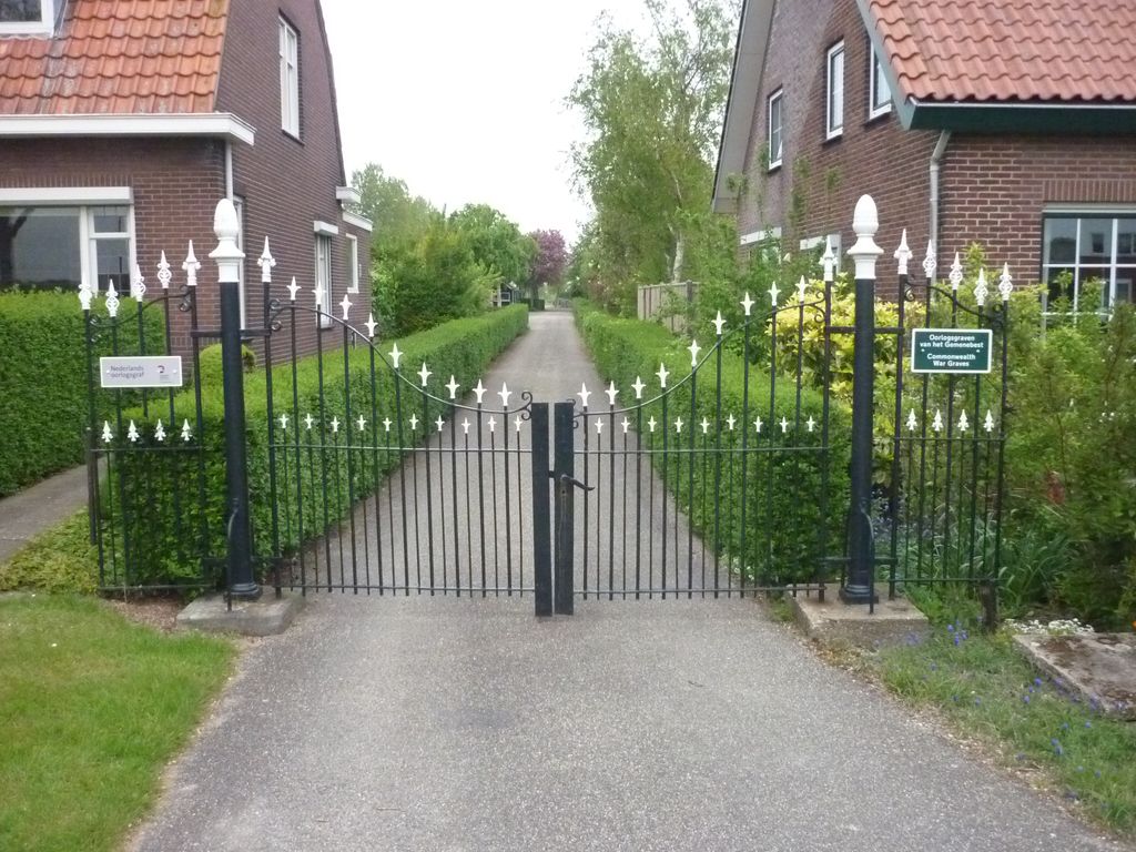
| Description | : | Colijnsplaat is a small town in the north eastern part of the island of Noord-Beveland. It is part of the Noord-Beveland municipality located in the province of Zeeland, in the south-western Netherlands. It is approx 13kms north of Goes. |
frequently asked questions (FAQ):
-
Where is Colijnsplaat General Cemetery?
Colijnsplaat General Cemetery is located at Colijnsplaatseweg Colijnsplaat, Noord-Beveland Municipality ,Zeeland ,Netherlands.
-
Colijnsplaat General Cemetery cemetery's updated grave count on graveviews.com?
0 memorials
-
Where are the coordinates of the Colijnsplaat General Cemetery?
Latitude: 51.5993700
Longitude: 3.8421900
Nearby Cemetories:
1. Kats General Cemetery
Kats, Noord-Beveland Municipality, Netherlands
Coordinate: 51.5704500, 3.8825800
2. Wissenkerke General Cemetery
Wissenkerke, Noord-Beveland Municipality, Netherlands
Coordinate: 51.5855300, 3.7439600
3. Joodse Begraafplaats
Zierikzee, Schouwen-Duiveland Municipality, Netherlands
Coordinate: 51.6492220, 3.9276670
4. Wolphaartsdijk Algemene Begraafplaats
Wolphaartsdijk, Goes Municipality, Netherlands
Coordinate: 51.5271200, 3.8191400
5. Wilhelminadorp General Cemetery
Wilhelminadorp, Goes Municipality, Netherlands
Coordinate: 51.5323600, 3.8916900
6. RK Begraafplaats St. Barbara
Zierikzee, Schouwen-Duiveland Municipality, Netherlands
Coordinate: 51.6534575, 3.9243835
7. Zierikzee Algemene Begraafplaats
Zierikzee, Schouwen-Duiveland Municipality, Netherlands
Coordinate: 51.6504300, 3.9351100
8. Begraafplaats Ouwerkerk
Ouwerkerk, Schouwen-Duiveland Municipality, Netherlands
Coordinate: 51.6243089, 3.9826324
9. Kamperland General Cemetery
Kamperland, Noord-Beveland Municipality, Netherlands
Coordinate: 51.5720500, 3.7028400
10. Begraafplaats Capelle
Nieuwerkerk, Schouwen-Duiveland Municipality, Netherlands
Coordinate: 51.6455209, 3.9684963
11. Goes Algemene Begraafplaats
Goes, Goes Municipality, Netherlands
Coordinate: 51.5120600, 3.8866100
12. Begraafplaats Kerkwerve
Kerkwerve, Schouwen-Duiveland Municipality, Netherlands
Coordinate: 51.6860290, 3.9019918
13. 's-Heer-Hendrikskinderen Algemene Begraafplaats
's-Heer Hendrikskinderen, Goes Municipality, Netherlands
Coordinate: 51.5012100, 3.8463800
14. Hervormde Gemeente te Kattendijke
Kattendijke, Goes Municipality, Netherlands
Coordinate: 51.5236607, 3.9446858
15. Kattendijke General Cemetery
Kattendijke, Goes Municipality, Netherlands
Coordinate: 51.5230400, 3.9476100
16. Begraafplaats Serooskerke
Serooskerke, Schouwen-Duiveland Municipality, Netherlands
Coordinate: 51.7004759, 3.8157287
17. Algemene Begraafplaats Stavenisse
Stavenisse, Tholen Municipality, Netherlands
Coordinate: 51.5880304, 4.0098963
18. Begraafplaats Nieuwerkerk
Nieuwerkerk, Schouwen-Duiveland Municipality, Netherlands
Coordinate: 51.6476363, 4.0005802
19. Begraafplaats Noordgouwe
Noordgouwe, Schouwen-Duiveland Municipality, Netherlands
Coordinate: 51.6930516, 3.9357464
20. Driekoningenkerk
Noordgouwe, Schouwen-Duiveland Municipality, Netherlands
Coordinate: 51.6937781, 3.9387569
21. Algemene Begraafplaats Burgh
Burgh-Haamstede, Schouwen-Duiveland Municipality, Netherlands
Coordinate: 51.6906989, 3.7354186
22. Kloetinge General Cemetery
Kloetinge, Goes Municipality, Netherlands
Coordinate: 51.4971500, 3.9232100
23. Hervormd Kerk
Burgh, Schouwen-Duiveland Municipality, Netherlands
Coordinate: 51.6910269, 3.7330038
24. Oude Begraafplaats Ellemeet
Ellemeet, Schouwen-Duiveland Municipality, Netherlands
Coordinate: 51.7137581, 3.8294904