
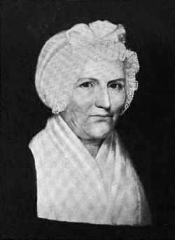
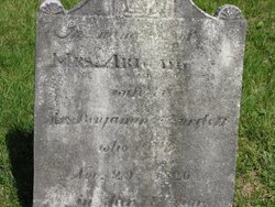
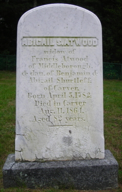
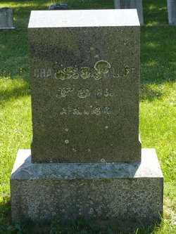
Abigail Atwood Shurtleff
| Birth | : | 7 Oct 1755 Plympton, Plymouth County, Massachusetts, USA |
| Death | : | 29 Nov 1826 Carver, Plymouth County, Massachusetts, USA |
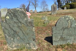
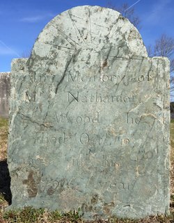
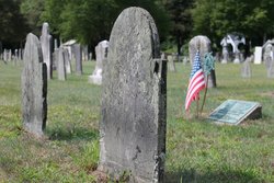
| Burial | : | Spring Valley Cemetery, Spring Valley, Greene County, USA |
| Coordinate | : | 39.6127010, -84.0005030 |
| Plot | : | Row 7 Section N |
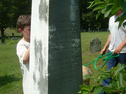
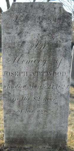
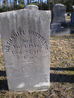
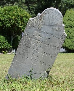
| Description | : | Daughter of Lt Nathaniel Atwood and Abigail Shaw, wife of Benjamin Shurtleff married June 7, 1773 in Plympton. She died at 8 pm. She weighed 275 pounds, as did most her sons. "Mrs Shurtleff was said to be an exceptionally large woman and a majority of her children resembled her in that respect. It was said she and her eight sons weighed a ton. They actually totaled 2014 pounds. She was broad in her views and much in advance of the times in which she lived. While Mrs Shurtleff was waiting her turn in line, a man jostled her aside and stepped... Read More |
frequently asked questions (FAQ):
-
Where is Abigail Atwood Shurtleff's memorial?
Abigail Atwood Shurtleff's memorial is located at: Spring Valley Cemetery, Spring Valley, Greene County, USA.
-
When did Abigail Atwood Shurtleff death?
Abigail Atwood Shurtleff death on 29 Nov 1826 in Carver, Plymouth County, Massachusetts, USA
-
Where are the coordinates of the Abigail Atwood Shurtleff's memorial?
Latitude: 39.6127010
Longitude: -84.0005030
Family Members:
Parent
Spouse
Siblings


Children
Flowers:


Nearby Cemetories:
1. Spring Valley Cemetery
Spring Valley, Greene County, USA
Coordinate: 39.6127010, -84.0005030
2. Cain Cemetery
Spring Valley, Greene County, USA
Coordinate: 39.6187250, -83.9947030
3. Elam Cemetery
Spring Valley, Greene County, USA
Coordinate: 39.6060867, -83.9771729
4. Roxanna Cemetery (Defunct)
Spring Valley, Greene County, USA
Coordinate: 39.5867004, -84.0089035
5. McKnight Cemetery
Spring Valley Township, Greene County, USA
Coordinate: 39.5906860, -83.9725670
6. Mercer Cemetery
Spring Valley Township, Greene County, USA
Coordinate: 39.6097830, -83.9543750
7. Compton Farm Cemetery
Waynesville, Warren County, USA
Coordinate: 39.5716110, -84.0043610
8. Hedges Road Stone
Xenia, Greene County, USA
Coordinate: 39.6499460, -83.9706150
9. Rich Cemetery
Xenia, Greene County, USA
Coordinate: 39.6316390, -83.9339140
10. New Burlington Cemetery
New Burlington, Clinton County, USA
Coordinate: 39.5675201, -83.9591064
11. Mount Holly Cemetery
Mount Holly, Warren County, USA
Coordinate: 39.5630989, -84.0342026
12. Bellbrook Cemetery
Bellbrook, Greene County, USA
Coordinate: 39.6441480, -84.0697750
13. Pioneer Cemetery
Bellbrook, Greene County, USA
Coordinate: 39.6464005, -84.0691986
14. Fairview Primitive Baptist Church Cemetery
Bellbrook, Greene County, USA
Coordinate: 39.6258888, -84.0815048
15. Bonner Family Cemetery
Xenia, Greene County, USA
Coordinate: 39.6561500, -83.9393500
16. Middle Run Cemetery
Bellbrook, Greene County, USA
Coordinate: 39.5816800, -84.0745480
17. Maxey Cemetery
Xenia, Greene County, USA
Coordinate: 39.6333110, -83.9201500
18. Caesar Creek Cemetery
Waynesville, Warren County, USA
Coordinate: 39.5477420, -83.9835450
19. Marshall Cemetery
Bellbrook, Greene County, USA
Coordinate: 39.6780200, -84.0392500
20. Davis Cemetery (Defunct)
Xenia, Greene County, USA
Coordinate: 39.6518830, -83.9216730
21. Maple Corner Cemetery
Maple Corner, Greene County, USA
Coordinate: 39.6106161, -83.9065960
22. Huston Cemetery
Bellbrook, Greene County, USA
Coordinate: 39.6576080, -84.0756870
23. Saint Brigid Cemetery
Xenia, Greene County, USA
Coordinate: 39.6828003, -83.9630966
24. Babb Cemetery
Middleton Corner, Greene County, USA
Coordinate: 39.5809700, -83.9081700