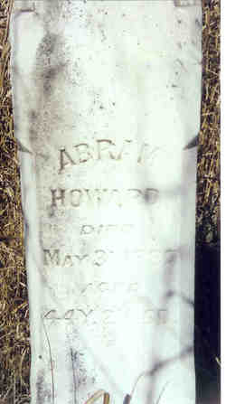
Abram T Howard
| Birth | : | 26 Mar 1843 Andrew County, Missouri, USA |
| Death | : | 31 May 1887 Nodaway County, Missouri, USA |
| Burial | : | All Saints Churchyard, Hempstead, North Norfolk District, England |
| Coordinate | : | 52.8895200, 1.1274620 |
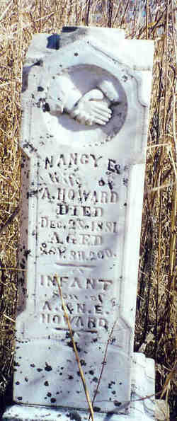
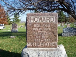
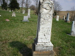
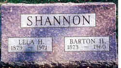
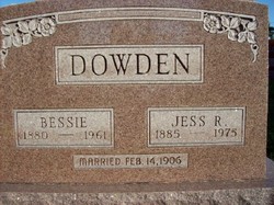
| Description | : | Son of John and Margaret Ramsour Howard. He married Nancy Ellen Jenkins February 26, 1874 in Andrew County, Missouri. Their Children: Son who died in infancy, Joseph, Lela, Bessie, Earl and Elmer. Earl and Elmer were twins. Their mother died shortly after the twins were born. Matilda and Jane (sisters of Abram) raised the twins. Lela and Bessie were raised by Benjamin (Abram's brother) and his wife Frances Howard. |
frequently asked questions (FAQ):
-
Where is Abram T Howard's memorial?
Abram T Howard's memorial is located at: All Saints Churchyard, Hempstead, North Norfolk District, England.
-
When did Abram T Howard death?
Abram T Howard death on 31 May 1887 in Nodaway County, Missouri, USA
-
Where are the coordinates of the Abram T Howard's memorial?
Latitude: 52.8895200
Longitude: 1.1274620
Family Members:
Parent
Spouse
Siblings
Children
Flowers:
Nearby Cemetories:
1. All Saints Churchyard
Hempstead, North Norfolk District, England
Coordinate: 52.8895200, 1.1274620
2. St Andrew Churchyard
Hempstead, North Norfolk District, England
Coordinate: 52.8895750, 1.1270070
3. Saint Mary's Churchyard
Baconsthorpe, North Norfolk District, England
Coordinate: 52.8872500, 1.1606900
4. All Saints Churchyard
Bodham, North Norfolk District, England
Coordinate: 52.9057700, 1.1596200
5. Edgefield Old Churchyard
Edgefield, North Norfolk District, England
Coordinate: 52.8687300, 1.1001800
6. Saint Andrew the Apostle
Holt, North Norfolk District, England
Coordinate: 52.9063400, 1.0933500
7. St. Peter and St. Paul's Churchyard
Edgefield, North Norfolk District, England
Coordinate: 52.8645320, 1.1089840
8. Methodist Memorial Gardens
Holt, North Norfolk District, England
Coordinate: 52.9067730, 1.0878360
9. St. Michael's Churchyard
Plumstead, North Norfolk District, England
Coordinate: 52.8691700, 1.1669320
10. Holt Town Cemetery
Holt, North Norfolk District, England
Coordinate: 52.9117900, 1.0850400
11. St Lawrence Churchyard
Hunworth, North Norfolk District, England
Coordinate: 52.8772530, 1.0673080
12. St. Mary's Churchyard
Barningham, North Norfolk District, England
Coordinate: 52.8757410, 1.1882470
13. St. Peter's Churchyard
North Barningham, North Norfolk District, England
Coordinate: 52.8888040, 1.1954330
14. St. Andrews Churchyard
Letheringsett, North Norfolk District, England
Coordinate: 52.9081600, 1.0623490
15. St. Mary the Virgin Churchyard
Kelling, North Norfolk District, England
Coordinate: 52.9322300, 1.1053700
16. St. Peter's Churchyard
Matlaske, North Norfolk District, England
Coordinate: 52.8683511, 1.1946365
17. St. Andrew’s Churchyard
Little Barningham, North Norfolk District, England
Coordinate: 52.8547270, 1.1795150
18. All Saints Churchyard
Briston, North Norfolk District, England
Coordinate: 52.8511120, 1.0617870
19. St. Mary's Churchyard
Bessingham, North Norfolk District, England
Coordinate: 52.8871980, 1.2193150
20. St Mary's Church
Mannington, North Norfolk District, England
Coordinate: 52.8418580, 1.1786460
21. All Saints Churchyard
Gresham, North Norfolk District, England
Coordinate: 52.9005410, 1.2210720
22. St. Andrew's Churchyard
Saxthorpe, North Norfolk District, England
Coordinate: 52.8299250, 1.1398600
23. St. Andrew's Churchyard
Brinton, North Norfolk District, England
Coordinate: 52.8803690, 1.0274610
24. St Mary Churchyard Burgh Parva
Melton Constable, North Norfolk District, England
Coordinate: 52.8605700, 1.0337300

