
| Birth | : | 8 Jul 1914 Franklin, Macon County, North Carolina, USA |
| Death | : | 31 Aug 2005 Franklin, Macon County, North Carolina, USA |
| Burial | : | Hillcrest Memorial Park, Hurffville, Gloucester County, USA |
| Coordinate | : | 39.7491989, -75.1110992 |
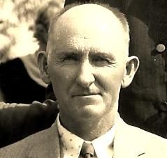
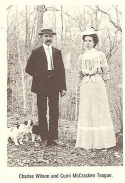
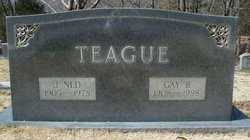
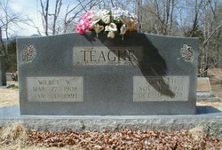
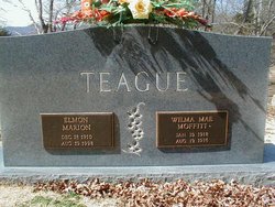
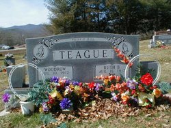
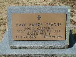
| Description | : | Franklin - Adeline Elizabeth Teague Henderson, 91, of Franklin, died Wednesday, Aug. 31, 2005, at Mountain Trace Nursing Center. She was a native of Macon County, a daughter of the late Charles W. and Cumi McCracken Teague. She was married to Lester C. Henderson, who passed away April 30, 1996. She was also preceded in death by sister, Mary Cunningham and five brothers, Ned, Wilbur, Elmon, Woodrow and Rafe. She is survived by two daughters, JoAnn Henderson and Linda Morrow and her husband, Gene, of Franklin; three sons, Charles Henderson and his wife, Janice, of Franklin, Max Henderson and his wife,... Read More |
frequently asked questions (FAQ):
-
Where is Adaline Elizabeth Teague Henderson's memorial?
Adaline Elizabeth Teague Henderson's memorial is located at: Hillcrest Memorial Park, Hurffville, Gloucester County, USA.
-
When did Adaline Elizabeth Teague Henderson death?
Adaline Elizabeth Teague Henderson death on 31 Aug 2005 in Franklin, Macon County, North Carolina, USA
-
Where are the coordinates of the Adaline Elizabeth Teague Henderson's memorial?
Latitude: 39.7491989
Longitude: -75.1110992
Family Members:
Parent
Spouse

Siblings
Children
Flowers:


Nearby Cemetories:
1. Hillcrest Memorial Park
Hurffville, Gloucester County, USA
Coordinate: 39.7491989, -75.1110992
2. Bethel Methodist Church Cemetery
Hurffville, Gloucester County, USA
Coordinate: 39.7571983, -75.1110992
3. Bunker Hill Presbyterian Church Cemetery
Gloucester County, USA
Coordinate: 39.7451600, -75.0849200
4. Cost Family Cemetery
Pitman, Gloucester County, USA
Coordinate: 39.7307100, -75.1332310
5. Bunker Hill Presbyterian Church Cemetery
Sewell, Gloucester County, USA
Coordinate: 39.7767514, -75.0931293
6. Manahath Cemetery
Glassboro, Gloucester County, USA
Coordinate: 39.7154236, -75.1141129
7. Driver Cemetery
Barnsboro, Gloucester County, USA
Coordinate: 39.7631000, -75.1554900
8. Jesse Chew Cemetery
Gloucester County, USA
Coordinate: 39.7736800, -75.1498250
9. Mount Zion Methodist Church Cemetery
Barnsboro, Gloucester County, USA
Coordinate: 39.7547540, -75.1629530
10. Saint Thomas Episcopal Church Cemetery
Glassboro, Gloucester County, USA
Coordinate: 39.7079200, -75.1101500
11. First United Methodist Church Cemetery
Glassboro, Gloucester County, USA
Coordinate: 39.7068900, -75.1081300
12. Alms House Cemetery
Lakeland, Camden County, USA
Coordinate: 39.7878700, -75.0823500
13. Saint Bridgets Cemetery
Glassboro, Gloucester County, USA
Coordinate: 39.7023300, -75.1159000
14. Trinity Bible Cemetery
Glassboro, Gloucester County, USA
Coordinate: 39.7003610, -75.1133800
15. Saint Johns United Methodist Cemetery
Turnersville, Gloucester County, USA
Coordinate: 39.7598300, -75.0487100
16. Grenloch First Presbyterian Church Memorial Garden
Grenloch Terrace, Gloucester County, USA
Coordinate: 39.7806000, -75.0587000
17. Grenloch First Presbyterian Church Memory Garden
Camden County, USA
Coordinate: 39.7806000, -75.0587000
18. Richwood United Methodist Church Cemetery
Richwood, Gloucester County, USA
Coordinate: 39.7211100, -75.1667700
19. Holy Trinity Memorial Garden
Wenonah, Gloucester County, USA
Coordinate: 39.7922200, -75.1514700
20. Buffalo Soldiers Cemetery
Franklinville, Gloucester County, USA
Coordinate: 39.8010180, -75.0899580
21. Wenonah Cemetery
Wenonah, Gloucester County, USA
Coordinate: 39.7893982, -75.1622009
22. Mantua Methodist Cemetery
Mantua, Gloucester County, USA
Coordinate: 39.7883160, -75.1663420
23. Blackwood Baptist Cemetery
Blackwood, Camden County, USA
Coordinate: 39.8010521, -75.0709305
24. Mantua Union Graveyard
Mantua, Gloucester County, USA
Coordinate: 39.7902460, -75.1707610