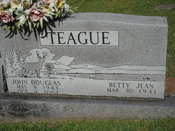
John Woodrow Teague
| Birth | : | 10 Aug 1912 Waynesville, Haywood County, North Carolina, USA |
| Death | : | 12 Nov 2004 Franklin, Macon County, North Carolina, USA |
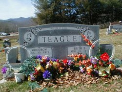
| Burial | : | Choteau Cemetery, Choteau, Teton County, USA |
| Coordinate | : | 47.8121986, -112.1631012 |
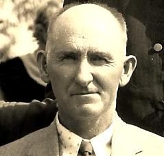
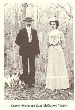
| Description | : | Franklin - John Woodrow Teague, 92, of Prentiss Bridge Road, passed away Friday, Nov. 12, 2004, in a local hospital after a period of declining health. Mr. Teague was born in Macon County and was the son of the late Charles Wilson and Cumi McCracken Teague. He was first a farmer, his parents being the founders of Teague's Cannery and Prentiss Food Company. He owned and operated Teague's Dairy, one of the first in county, and was always open to new ideas in agriculture. Following this, he was employed in the Macon County School System's maintenance department. In his later years,... Read More |
frequently asked questions (FAQ):
-
Where is John Woodrow Teague's memorial?
John Woodrow Teague's memorial is located at: Choteau Cemetery, Choteau, Teton County, USA.
-
When did John Woodrow Teague death?
John Woodrow Teague death on 12 Nov 2004 in Franklin, Macon County, North Carolina, USA
-
Where are the coordinates of the John Woodrow Teague's memorial?
Latitude: 47.8121986
Longitude: -112.1631012
Family Members:
Parent
Spouse
Siblings
Children
Nearby Cemetories:
1. Choteau Cemetery
Choteau, Teton County, USA
Coordinate: 47.8121986, -112.1631012
2. Trinity Lutheran Cemetery
Farmington, Teton County, USA
Coordinate: 47.8843994, -112.0764008
3. New Rockport Colony Cemetery
New Rockport Colony, Teton County, USA
Coordinate: 47.8648000, -112.0199000
4. Miller Colony Cemetery
Miller Colony, Teton County, USA
Coordinate: 47.9258000, -112.2943000
5. Bynum Cemetery
Bynum, Teton County, USA
Coordinate: 47.9710007, -112.3059998
6. Saint Paul Cemetery
Fairfield, Teton County, USA
Coordinate: 47.6758000, -111.9014000
7. United Church of Christ Columbarium
Fairfield, Teton County, USA
Coordinate: 47.6158400, -111.9784300
8. Fairfield Mennonite Cemetery
Fairfield, Teton County, USA
Coordinate: 47.6149840, -111.9804050
9. Beck Cemetery
Teton County, USA
Coordinate: 47.7844009, -111.8163986
10. Sunset Hills Cemetery
Fairfield, Teton County, USA
Coordinate: 47.5946400, -111.9870900
11. Midway Hutterite Colony Cemetery
Conrad, Pondera County, USA
Coordinate: 48.0669000, -111.9959000
12. Pondera Valley Lutheran Cemetery
Conrad, Pondera County, USA
Coordinate: 48.1085000, -112.1126000
13. Dutton Cemetery
Dutton, Teton County, USA
Coordinate: 47.8504000, -111.7100000
14. Power Community Cemetery
Teton County, USA
Coordinate: 47.7421989, -111.6913986
15. Rockport Colony Cemetery
Rockport Colony, Teton County, USA
Coordinate: 48.0677000, -112.4783000
16. Teton Canyon Metis Cemetery
Choteau, Teton County, USA
Coordinate: 47.8695750, -112.6675680
17. Augusta Cemetery
Augusta, Lewis and Clark County, USA
Coordinate: 47.4961014, -112.4039001
18. Indian Burial Ground
Teton County, USA
Coordinate: 47.9719009, -112.6539001
19. Elk Creek Colony Cemetery
Augusta, Lewis and Clark County, USA
Coordinate: 47.4620000, -112.3218000
20. Fort Shaw Military Cemetery
Fort Shaw, Cascade County, USA
Coordinate: 47.5065700, -111.8358500
21. Hillside Cemetery
Conrad, Pondera County, USA
Coordinate: 48.1768990, -111.9835968
22. New Miami Colony Cemetery
New Miami Colony, Pondera County, USA
Coordinate: 48.1911000, -112.2832000
23. Sun River Cemetery
Sun River, Cascade County, USA
Coordinate: 47.5242004, -111.7166977
24. Dupuyer Cemetery
Pondera County, USA
Coordinate: 48.1857986, -112.5083008

