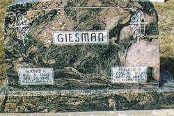
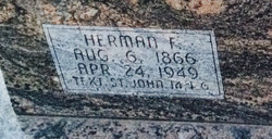
Adelheid B Schmidt Giesman
| Birth | : | 16 Nov 1874 Lower Saxony (Niedersachsen), Germany |
| Death | : | 26 Oct 1949 De Witt, Saline County, Nebraska, USA |
| Burial | : | Saint Paul's Lutheran Cemetery, Gage County, USA |
| Coordinate | : | 40.4186330, -96.8187780 |
| Description | : | Adelheid Schmidt, daughter of Brunke Schmidt and his wife, Christiina Marie(nee Kuper) was born in Ostfriensland, Germany on November 16 1874.There she was baptized in the name of the Triune God. When she was two years old she came to America with her parents. The family settled near Sterling, Nebraska. After she was received the necessary instruction in religion, she was confirmed in St. John's Lutheran Church near Sterling Nebraska on April 14, 1889 by Pastor Julius Wolff. On November 16, 1894, she was united in marriage to Herman Giesman near Sterling. The ceremony was performed by Pastor William Beckman of Burr,... Read More |
frequently asked questions (FAQ):
-
Where is Adelheid B Schmidt Giesman's memorial?
Adelheid B Schmidt Giesman's memorial is located at: Saint Paul's Lutheran Cemetery, Gage County, USA.
-
When did Adelheid B Schmidt Giesman death?
Adelheid B Schmidt Giesman death on 26 Oct 1949 in De Witt, Saline County, Nebraska, USA
-
Where are the coordinates of the Adelheid B Schmidt Giesman's memorial?
Latitude: 40.4186330
Longitude: -96.8187780
Family Members:
Spouse
Children
Flowers:
Nearby Cemetories:
1. Saint Paul's Lutheran Cemetery
Gage County, USA
Coordinate: 40.4186330, -96.8187780
2. Rose Hill Cemetery
Gage County, USA
Coordinate: 40.3936005, -96.8553009
3. Clatonia Cemetery
Clatonia, Gage County, USA
Coordinate: 40.4614500, -96.8556600
4. Zion Evangelical Lutheran Cemetery
Clatonia, Gage County, USA
Coordinate: 40.4666910, -96.8749310
5. Highland Center Cemetery
Cortland, Gage County, USA
Coordinate: 40.4660988, -96.7611008
6. Trinity Cemetery
Clatonia, Gage County, USA
Coordinate: 40.4508018, -96.8936005
7. Marsh Cemetery
Clatonia, Gage County, USA
Coordinate: 40.4867230, -96.8185310
8. Sykes Family Cemetery
Clatonia, Gage County, USA
Coordinate: 40.4868330, -96.8186260
9. Dolen Cemetery
Gage County, USA
Coordinate: 40.3494950, -96.8225930
10. Immanuel Cemetery
Gage County, USA
Coordinate: 40.5088005, -96.8133011
11. Oak Grove Cemetery
De Witt, Saline County, USA
Coordinate: 40.4049988, -96.9483032
12. Christ Lutheran Church Cemetery
Pickrell, Gage County, USA
Coordinate: 40.4079410, -96.6848370
13. Pleasant View Cemetery
Pickrell, Gage County, USA
Coordinate: 40.3493240, -96.7101000
14. Cortland Cemetery
Cortland, Gage County, USA
Coordinate: 40.4879200, -96.7041250
15. Saint James Cemetery
Cortland, Gage County, USA
Coordinate: 40.4886050, -96.7036050
16. Austin Creek Cemetery
Beatrice, Gage County, USA
Coordinate: 40.3282280, -96.7233020
17. First Trinity Lutheran Cemetery
Beatrice, Gage County, USA
Coordinate: 40.3053600, -96.8794400
18. Freeman Cemetery
Beatrice, Gage County, USA
Coordinate: 40.2966933, -96.8435666
19. Hallam Community Cemetery
Hallam, Lancaster County, USA
Coordinate: 40.5419006, -96.7885971
20. Saint Joseph Cemetery
Beatrice, Gage County, USA
Coordinate: 40.3054700, -96.7460700
21. Homestead National Historical Park
Beatrice, Gage County, USA
Coordinate: 40.2864800, -96.8271100
22. First Mennonite Church Cemetery
Beatrice, Gage County, USA
Coordinate: 40.2856800, -96.8120500
23. Sunny Side Cemetery
Wilber, Saline County, USA
Coordinate: 40.4942017, -96.9685974
24. Sunnyside Cemetery
Cortland, Gage County, USA
Coordinate: 40.4799200, -96.6511800

