
| Birth | : | 30 Apr 1906 Montague, Siskiyou County, California, USA |
| Death | : | 31 May 1986 Yreka, Siskiyou County, California, USA |
| Burial | : | Soledad Cemetery, Soledad, Monterey County, USA |
| Coordinate | : | 36.4275131, -121.3124542 |
| Plot | : | Eagles 27-2-6 |
| Inscription | : | Adeline L. Borba Lowderbaugh Apr. 30, 1906-May 31, 1986 |
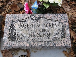
| Description | : | Adeline was born in Hawkinsville on April 30, 1906. She was born to the parents of Joseph and Emily Lemos Borba. Adeline had a passion for spending time and managing many cafes. She even opened and managed her very own café in Montague which she named Ad's café. Her daughters followed in her foot steps as all four of the girls pitched in to help their mother and became waitresses in the café. She had spent most of her fulfilled life in Montague doing what she loved up until her health had slowly started failing, she passed away on May... Read More |
frequently asked questions (FAQ):
-
Where is Adeline Lucille Borba Lowderbaugh's memorial?
Adeline Lucille Borba Lowderbaugh's memorial is located at: Soledad Cemetery, Soledad, Monterey County, USA.
-
When did Adeline Lucille Borba Lowderbaugh death?
Adeline Lucille Borba Lowderbaugh death on 31 May 1986 in Yreka, Siskiyou County, California, USA
-
Where are the coordinates of the Adeline Lucille Borba Lowderbaugh's memorial?
Latitude: 36.4275131
Longitude: -121.3124542
Family Members:
Parent

Spouse
Siblings
Children
Flowers:


Nearby Cemetories:
1. Soledad Cemetery
Soledad, Monterey County, USA
Coordinate: 36.4275131, -121.3124542
2. Soledad Mission Cemetery
Soledad, Monterey County, USA
Coordinate: 36.4047460, -121.3561260
3. San Benito County Cemetery
Hollister, San Benito County, USA
Coordinate: 36.4859009, -121.2306976
4. Gonzales Cemetery
Gonzales, Monterey County, USA
Coordinate: 36.4947014, -121.4300003
5. Greenfield Cemetery
Greenfield, Monterey County, USA
Coordinate: 36.3347130, -121.2128372
6. Greenfield Holy Trinity Cemetery
Greenfield, Monterey County, USA
Coordinate: 36.3164139, -121.2428131
7. Willow Creek Cemetery
San Benito County, USA
Coordinate: 36.5957985, -121.1903000
8. Bitterwater Cemetery
Rock Spring Peak, San Benito County, USA
Coordinate: 36.4006004, -120.9916992
9. King City Cemetery
King City, Monterey County, USA
Coordinate: 36.2066078, -121.1374207
10. Paicines Cemetery
Paicines, San Benito County, USA
Coordinate: 36.7088580, -121.2456330
11. Cherry Hill Cemetery
Panoche, San Benito County, USA
Coordinate: 36.6150017, -120.9586029
12. Yamato Cemetery
Salinas, Monterey County, USA
Coordinate: 36.6552811, -121.6307297
13. Garden of Memories
Salinas, Monterey County, USA
Coordinate: 36.6565247, -121.6384125
14. Mansfield Cemetery
King City, Monterey County, USA
Coordinate: 36.1030320, -121.1478060
15. Church of the Good Shepherd Cemetery
Salinas, Monterey County, USA
Coordinate: 36.5413990, -121.7260410
16. Saint Pauls Episcopal Church Columbarium
Salinas, Monterey County, USA
Coordinate: 36.6588430, -121.6558850
17. Chinese Cemetery
Salinas, Monterey County, USA
Coordinate: 36.6952057, -121.6390381
18. Monterey County Potters Field Cemetery
Salinas, Monterey County, USA
Coordinate: 36.6960900, -121.6381950
19. Barbree Ranch Cemetery
San Lucas, Monterey County, USA
Coordinate: 36.0914030, -121.0822670
20. Saint Georges Episcopal Church Columbarium
Salinas, Monterey County, USA
Coordinate: 36.7062580, -121.6440980
21. San Lucas Cemetery
San Lucas, Monterey County, USA
Coordinate: 36.1258354, -121.0134735
22. Calvary Catholic Cemetery
Salinas, Monterey County, USA
Coordinate: 36.6880341, -121.6818085
23. Long Valley Cemetery
San Lucas, Monterey County, USA
Coordinate: 36.1467700, -120.9545100
24. Whitcher Cemetery
East Garrison, Monterey County, USA
Coordinate: 36.6501730, -121.7305270