
| Birth | : | 9 Mar 1915 Wessington Springs, Jerauld County, South Dakota, USA |
| Death | : | 22 Oct 2008 Pierre, Hughes County, South Dakota, USA |
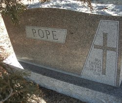
| Burial | : | Mount Calvary Cemetery, Pierre, Hughes County, USA |
| Coordinate | : | 44.4197006, -100.3557968 |
| Description | : | Ales Brady, 93 of Pierre Died on Tuesday October 22 at Golden Living Center in Pierre Visitation will be Friday, October 24 from 10:00am-Noon at Isburg Funeral Chapel Services at Noon Friday, October 24 at Isburg Funeral Chapel with Burial at Calvary Cemetery in Pierre Ales was born on May 9, 1915 in Wessington Springs, SD to Milton and Anna (Anderson) Mitchell. She grew up in Wessington Springs and Van Metre. She attended country schools through the 8th grade. She moved to Stanley and Hughes County area in the mid 1940's. Ales was united in marriage to Bernard Brady on December 31,... Read More |
frequently asked questions (FAQ):
-
Where is Ales Kristine Mitchell Brady's memorial?
Ales Kristine Mitchell Brady's memorial is located at: Mount Calvary Cemetery, Pierre, Hughes County, USA.
-
When did Ales Kristine Mitchell Brady death?
Ales Kristine Mitchell Brady death on 22 Oct 2008 in Pierre, Hughes County, South Dakota, USA
-
Where are the coordinates of the Ales Kristine Mitchell Brady's memorial?
Latitude: 44.4197006
Longitude: -100.3557968
Family Members:
Parent
Spouse

Siblings
Children
Flowers:


Nearby Cemetories:
1. Mount Calvary Cemetery
Pierre, Hughes County, USA
Coordinate: 44.4197006, -100.3557968
2. Fort Pierre Chouteau Cemetery
Fort Pierre, Stanley County, USA
Coordinate: 44.3908700, -100.3878300
3. Scotty Philip Cemetery
Fort Pierre, Stanley County, USA
Coordinate: 44.4019012, -100.4036026
4. South Dakota State Capitol Grounds
Pierre, Hughes County, USA
Coordinate: 44.3660100, -100.3448000
5. Riverside Cemetery
Pierre, Hughes County, USA
Coordinate: 44.3608017, -100.3071976
6. Cedar Hill Cemetery
Fort Pierre, Stanley County, USA
Coordinate: 44.3356018, -100.3964005
7. Byron Township Cemetery
Blunt, Hughes County, USA
Coordinate: 44.4979200, -100.1904700
8. Canning Cemetery
Hughes County, USA
Coordinate: 44.3986890, -100.0278460
9. Okobojo Cemetery
Sully County, USA
Coordinate: 44.6568985, -100.3647003
10. Fort Sully Post Cemetery
Sully County, USA
Coordinate: 44.5866480, -100.6087530
11. Pleasant Hill Cemetery
Blunt, Hughes County, USA
Coordinate: 44.5135994, -100.0156021
12. Meers Cemetery
Stanley County, USA
Coordinate: 44.4116970, -100.7360760
13. Holy Name Episcopal Cemetery
Fort Pierre, Stanley County, USA
Coordinate: 44.2694960, -100.0357300
14. Holy Name Chapel Cemetery
Fort Pierre, Stanley County, USA
Coordinate: 44.2694292, -100.0356989
15. Mathews Family Cemetery
Stanley County, USA
Coordinate: 44.1816040, -100.5581080
16. Fort Bennett Post Cemetery
Stanley County, USA
Coordinate: 44.6716500, -100.6404200
17. Onida Cemetery
Onida, Sully County, USA
Coordinate: 44.7147000, -100.0650000
18. Chapelle Cemetery
Hughes County, USA
Coordinate: 44.3025017, -99.8653030
19. Blair Cemetery
Sully County, USA
Coordinate: 44.8027992, -100.4199982
20. Holy Faith Cemetery
Lyman County, USA
Coordinate: 44.1356010, -99.9878006
21. Mission Ridge Cemetery
Mission Ridge, Stanley County, USA
Coordinate: 44.6960983, -100.7716980
22. Immanuel Lutheran Cemetery
Van Metre, Jones County, USA
Coordinate: 44.0958800, -100.7263300
23. Medicine Hill Cemetery
Harrold, Hughes County, USA
Coordinate: 44.5116997, -99.7453003
24. Saint John Catholic Cemetery
Harrold, Hughes County, USA
Coordinate: 44.5127983, -99.7335968