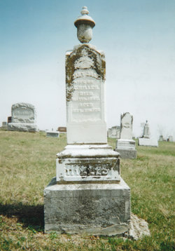
| Birth | : | 11 Aug 1808 Virginia, USA |
| Death | : | 21 Feb 1895 |
| Burial | : | Pitcock Cemetery, Clay County, USA |
| Coordinate | : | 36.5992012, -85.6911011 |
| Description | : | Alexander H. Woods was born in Virginia, near Wheeling, August 11, 1808, and moved with his family to Wayne county, Ohio, when he was eight years of age, and from there to Constantine, Mich., in 1829. (He) was married to Miss Elizabeth Meek in Michigan, January 13, 1831. (Th)ey came to Iowa on January 11, (183)7 and settled on a claim one and (a) (h)alf miles north-east of Bentonsport where they made their home for about 58 ears, and where he died. Eleven children were born to them, two sons and nine daughters. Both of the sons, five of the... Read More |
frequently asked questions (FAQ):
-
Where is Alexander H. Woods's memorial?
Alexander H. Woods's memorial is located at: Pitcock Cemetery, Clay County, USA.
-
When did Alexander H. Woods death?
Alexander H. Woods death on 21 Feb 1895 in
-
Where are the coordinates of the Alexander H. Woods's memorial?
Latitude: 36.5992012
Longitude: -85.6911011
Family Members:
Spouse
Children
Flowers:
Nearby Cemetories:
1. Pitcock Cemetery
Clay County, USA
Coordinate: 36.5992012, -85.6911011
2. Cherry Cemetery #3
Oak Grove, Clay County, USA
Coordinate: 36.6015000, -85.7100300
3. Clementsville Cemetery
Clementsville, Clay County, USA
Coordinate: 36.6132300, -85.7146410
4. Hinson Cemetery
Moss, Clay County, USA
Coordinate: 36.5756750, -85.7020010
5. Moore Cemetery #1
Moss, Clay County, USA
Coordinate: 36.6164920, -85.6636620
6. Liberty Church Cemetery
Boles, Clay County, USA
Coordinate: 36.6010850, -85.6496830
7. Beech Grove Cemetery
Harlan Crossroads, Monroe County, USA
Coordinate: 36.6319000, -85.6809000
8. Jonestown Cemetery
Clay County, USA
Coordinate: 36.5619011, -85.6921997
9. Old Bowman Cemetery
Gamaliel, Monroe County, USA
Coordinate: 36.6289830, -85.7204190
10. Smith Cemetery
Pine Hill, Clay County, USA
Coordinate: 36.5714930, -85.6568170
11. Willhoite-Curtis Cemetery
Tompkinsville, Monroe County, USA
Coordinate: 36.6182208, -85.6442948
12. Moore Cemetery
Moss, Clay County, USA
Coordinate: 36.6113400, -85.6374980
13. Old Bob Wood Place Cemetery
Boles, Monroe County, USA
Coordinate: 36.6325120, -85.6515600
14. Eads-Denton Cemetery
Pine Hill, Clay County, USA
Coordinate: 36.5644207, -85.6503187
15. Cherry Denton Cemetery
Clay County, USA
Coordinate: 36.5512200, -85.6971200
16. Harlan's Crossroads Cemetery
Harlan Crossroads, Monroe County, USA
Coordinate: 36.6518500, -85.7064700
17. Kendall Cemetery
Moss, Clay County, USA
Coordinate: 36.5672540, -85.6362650
18. Beautiful Home Cemetery
Tompkinsville, Monroe County, USA
Coordinate: 36.6392000, -85.7371000
19. Moss Cemetery
Moss, Clay County, USA
Coordinate: 36.5911210, -85.6214460
20. Freedom Cemetery #2
Tompkinsville, Monroe County, USA
Coordinate: 36.6284060, -85.6289940
21. Pricetown Cemetery
Clay County, USA
Coordinate: 36.5422500, -85.6750670
22. James H. Cherry Family Cemetery
Clay County, USA
Coordinate: 36.5453700, -85.7266000
23. Carnahan Cemetery
Harlan Crossroads, Monroe County, USA
Coordinate: 36.6592700, -85.7224900
24. Odle Cemetery
Clay County, USA
Coordinate: 36.5966988, -85.6085968


