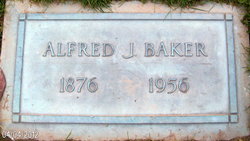
| Birth | : | 6 Aug 1845 Missouri, USA |
| Death | : | 30 Jul 1929 Long Beach, Pacific County, Washington, USA |
| Burial | : | Lone Fir Cemetery, Long Beach, Pacific County, USA |
| Coordinate | : | 46.3622017, -124.0175018 |
| Plot | : | Pioneer Section, Row 3, Site 13. |
| Description | : | Chinook Observer Thursday, November 29, 1979 From the obituary of their daughter, Lottie: Lottie's parents [Alfred and Mary Baker] donated property to develop the Long Fir Cemetery northeast of Long Beach. She grew up on the farm and in her early years helped her mother cook her popular chicken cream dinners for travelers, guests and visitors. Mary and Alfred Baker donated property for the Long Beach Community Church on Washington Street. History of the Columbia River Valley From The Dalles to the Sea, Volume III, by The S.J. Clarke Publishing Company, 1928. Alfred Baker, who has experienced many... Read More |
frequently asked questions (FAQ):
-
Where is Alfred Baker's memorial?
Alfred Baker's memorial is located at: Lone Fir Cemetery, Long Beach, Pacific County, USA.
-
When did Alfred Baker death?
Alfred Baker death on 30 Jul 1929 in Long Beach, Pacific County, Washington, USA
-
Where are the coordinates of the Alfred Baker's memorial?
Latitude: 46.3622017
Longitude: -124.0175018
Family Members:
Parent
Spouse
Siblings
Children
Flowers:
Nearby Cemetories:
1. Lone Fir Cemetery
Long Beach, Pacific County, USA
Coordinate: 46.3622017, -124.0175018
2. Briscoe Family Cemetery
Pacific County, USA
Coordinate: 46.3867690, -124.0541310
3. Ilwaco Cemetery
Ilwaco, Pacific County, USA
Coordinate: 46.3180008, -124.0227966
4. Ocean Park Cemetery
Ocean Park, Pacific County, USA
Coordinate: 46.4903970, -124.0427580
5. Peaceful Hill Cemetery
Naselle, Pacific County, USA
Coordinate: 46.3678017, -123.7994003
6. Fort Stevens National Cemetery
Warrenton, Clatsop County, USA
Coordinate: 46.1949997, -123.9597015
7. Oysterville Cemetery
Oysterville, Pacific County, USA
Coordinate: 46.5478670, -124.0337350
8. Salmon Creek Cemetery Old
Wahkiakum County, USA
Coordinate: 46.3578630, -123.7178340
9. Salmon Creek Cemetery
Deep River, Wahkiakum County, USA
Coordinate: 46.3634000, -123.7164000
10. Warrenton Pauper Cemetery
Warrenton, Clatsop County, USA
Coordinate: 46.1572266, -123.9399033
11. Ocean View Cemetery
Warrenton, Clatsop County, USA
Coordinate: 46.1519800, -123.9372400
12. Astoria Pioneer Cemetery
Astoria, Clatsop County, USA
Coordinate: 46.1819000, -123.8264008
13. Deep River Cemetery
Deep River, Wahkiakum County, USA
Coordinate: 46.3587910, -123.6849890
14. Bay Center Cemetery
Bay Center, Pacific County, USA
Coordinate: 46.5986490, -123.9355650
15. Clatsop Plains Pioneer Cemetery
Warrenton, Clatsop County, USA
Coordinate: 46.1222000, -123.9263992
16. Seal River Cemetery
Rosburg, Wahkiakum County, USA
Coordinate: 46.3329210, -123.6600870
17. Grays River Old Cemetery
Rosburg, Wahkiakum County, USA
Coordinate: 46.3210130, -123.6440080
18. Rosburg Cemetery
Wahkiakum County, USA
Coordinate: 46.3348000, -123.6400000
19. Greenwood Cemetery
Astoria, Clatsop County, USA
Coordinate: 46.1371994, -123.8028030
20. Bay Center Pioneer Cemetery
Bay Center, Pacific County, USA
Coordinate: 46.6298850, -123.9538870
21. Lewis and Clark Cemetery
Miles Crossing, Clatsop County, USA
Coordinate: 46.1133800, -123.8541000
22. Eden Valley Cemetery
Eden, Wahkiakum County, USA
Coordinate: 46.3018270, -123.6254030
23. Grays River Grange Cemetery
Grays River, Wahkiakum County, USA
Coordinate: 46.3548000, -123.6144000
24. Wilsonville Cemetery
Pacific County, USA
Coordinate: 46.6379710, -123.9387740


