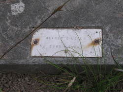
Alfred E. “Fred” Leger
| Birth | : | 31 Oct 1857 Montreal, Montreal Region, Quebec, Canada |
| Death | : | 4 Sep 1909 Navarro, Mendocino County, California, USA |
| Burial | : | St. Mary and St. Margaret Churchyard, Sprowston, Broadland District, England |
| Coordinate | : | 52.6635430, 1.3248800 |
frequently asked questions (FAQ):
-
Where is Alfred E. “Fred” Leger's memorial?
Alfred E. “Fred” Leger's memorial is located at: St. Mary and St. Margaret Churchyard, Sprowston, Broadland District, England.
-
When did Alfred E. “Fred” Leger death?
Alfred E. “Fred” Leger death on 4 Sep 1909 in Navarro, Mendocino County, California, USA
-
Where are the coordinates of the Alfred E. “Fred” Leger's memorial?
Latitude: 52.6635430
Longitude: 1.3248800
Family Members:
Spouse
Children
Flowers:
Nearby Cemetories:
1. St. Mary and St. Margaret Churchyard
Sprowston, Broadland District, England
Coordinate: 52.6635430, 1.3248800
2. Sprowston Cemetery
Sprowston, Broadland District, England
Coordinate: 52.6644440, 1.3249400
3. St. Margaret's Churchyard
Catton, Broadland District, England
Coordinate: 52.6626280, 1.2970190
4. Old Catton Churchyard
Norwich, City of Norwich, England
Coordinate: 52.6627000, 1.2969770
5. Christ Churchyard, New Catton
Norwich, City of Norwich, England
Coordinate: 52.6438540, 1.2977320
6. Norwich Prison
Norwich, City of Norwich, England
Coordinate: 52.6377840, 1.3174000
7. All Saints Churchyard
Rackheath, Broadland District, England
Coordinate: 52.6846160, 1.3573490
8. Saint Peter's Churchyard
Spixworth, Broadland District, England
Coordinate: 52.6933240, 1.3145170
9. St. Peter Crostwick Church Cemetery
Crostwick, Broadland District, England
Coordinate: 52.6934480, 1.3395750
10. St James with Pockthorpe Churchyard
Norwich, City of Norwich, England
Coordinate: 52.6359070, 1.3001060
11. Whitefriars
Norwich, City of Norwich, England
Coordinate: 52.6351750, 1.3006400
12. St. Augustine's Churchyard
Norwich, City of Norwich, England
Coordinate: 52.6371000, 1.2925960
13. St. Saviour Churchyard
Norwich, City of Norwich, England
Coordinate: 52.6351710, 1.2968890
14. St. Helen's Churchyard
Norwich, City of Norwich, England
Coordinate: 52.6328420, 1.3044730
15. St. Martin at Palace Church
Norwich, City of Norwich, England
Coordinate: 52.6335450, 1.3017730
16. St. Julian Churchyard
Norwich, City of Norwich, England
Coordinate: 52.6336490, 1.3010100
17. St. Edmund's Churchyard
Norwich, City of Norwich, England
Coordinate: 52.6342780, 1.2989640
18. Quaker Burial Ground
Norwich, City of Norwich, England
Coordinate: 52.6361120, 1.2914810
19. Old Meeting House
Norwich, City of Norwich, England
Coordinate: 52.6338830, 1.2956790
20. Norwich Cathedral
Norwich, City of Norwich, England
Coordinate: 52.6319420, 1.3016020
21. St. Clement the Martyr Churchyard
Norwich, City of Norwich, England
Coordinate: 52.6332670, 1.2966570
22. Saint Mary In The Marsh Churchyard
Norwich, City of Norwich, England
Coordinate: 52.6307240, 1.3025470
23. St Simon & St Jude Church Cemetery
Norwich, City of Norwich, England
Coordinate: 52.6320630, 1.2976390
24. St. Martin at Oak Church
Norwich, City of Norwich, England
Coordinate: 52.6348420, 1.2901930


