
| Birth | : | 14 Feb 1833 Lewis County, West Virginia, USA |
| Death | : | 19 Feb 1905 Grantsville, Calhoun County, West Virginia, USA |
| Burial | : | Bethlehem Cemetery, Grantsville, Calhoun County, USA |
| Coordinate | : | 38.9124985, -81.0841980 |
| Description | : | Alfred Stump was the 13th of the 14 children of Michael and Elizabeth Bush Stump of Gilmer County VA, now WV. He married Lucetta (aka Lousetta) Robinson, daughter of William and Catherine Weaver Robinson, in 1853, in Gilmer County VA, now WV. Alfred and Lucetta Stump had children together, including Batelle, Marcellus, Elias Howard, Chantilla Malvern, Amie Silcott, and French Stump. Their home was on the Sycamore Fork of Steer Creek. Alfred Stump was also a grandson of Michael and Magdaline Richards Stump of Lewis County VA, now WV, and Jacob and Margaret Swan Bush of Lewis County VA, now... Read More |
frequently asked questions (FAQ):
-
Where is Alfred Stump's memorial?
Alfred Stump's memorial is located at: Bethlehem Cemetery, Grantsville, Calhoun County, USA.
-
When did Alfred Stump death?
Alfred Stump death on 19 Feb 1905 in Grantsville, Calhoun County, West Virginia, USA
-
Where are the coordinates of the Alfred Stump's memorial?
Latitude: 38.9124985
Longitude: -81.0841980
Family Members:
Parent

Spouse
Siblings
Children
Flowers:


Nearby Cemetories:
1. Bethlehem Cemetery
Grantsville, Calhoun County, USA
Coordinate: 38.9124985, -81.0841980
2. Betts Cemetery
Calhoun County, USA
Coordinate: 38.9303017, -81.1153030
3. Pleasant Hill Cemetery
Grantsville, Calhoun County, USA
Coordinate: 38.9508018, -81.0627975
4. Saint Paul Cemetery
Grantsville, Calhoun County, USA
Coordinate: 38.8770000, -81.1275000
5. Saint Paul Cemetery
Mount Zion, Calhoun County, USA
Coordinate: 38.8768997, -81.1278000
6. Hunt Cemetery
Bigbend, Calhoun County, USA
Coordinate: 38.9573700, -81.1239100
7. Bethel-Bennett-Burns Cemetery
Grantsville, Calhoun County, USA
Coordinate: 38.9022000, -81.0153000
8. Broomstick Cemetery
Calhoun County, USA
Coordinate: 38.9668999, -81.0911026
9. Mount Zion Cemetery
Grantsville, Calhoun County, USA
Coordinate: 38.8605995, -81.1256027
10. Roling Cemetery
Calhoun County, USA
Coordinate: 38.8521996, -81.0702972
11. Norman Ridge United Methodist Church Cemetery
Calhoun County, USA
Coordinate: 38.9687900, -81.1175100
12. Yoak Cemetery
Five Forks, Calhoun County, USA
Coordinate: 38.9703865, -81.1154938
13. Bennett Cemetery
Calhoun County, USA
Coordinate: 38.8636017, -81.0314026
14. Bryners Chapel Cemetery
Joker, Calhoun County, USA
Coordinate: 38.9033012, -81.1703033
15. Ayers Cemetery
Latonia, Gilmer County, USA
Coordinate: 38.9422222, -81.0058333
16. Taylor Cemetery
Bigbend, Calhoun County, USA
Coordinate: 38.9801760, -81.1199320
17. Big Springs Cemetery
Big Springs, Calhoun County, USA
Coordinate: 38.9850006, -81.0708008
18. Hur Cemetery
Calhoun County, USA
Coordinate: 38.8741989, -81.1686020
19. Knight Cemetery
Big Springs, Calhoun County, USA
Coordinate: 38.9894000, -81.0800000
20. Chestnut Grove Baptist Church Cemetery
Gilmer County, USA
Coordinate: 38.9340420, -80.9885860
21. Nobe Cemetery
Nobe, Calhoun County, USA
Coordinate: 38.9813000, -81.0380300
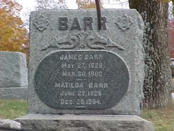
22. Barr Cemetery
Calhoun County, USA
Coordinate: 38.8274994, -81.0924988
23. Stump Cemetery
Stumptown, Gilmer County, USA
Coordinate: 38.8495000, -81.0030000
24. Trace Fork United Methodist Church Cemetery
Gilmer County, USA
Coordinate: 38.9743580, -81.0005560