
| Memorials | : | 45 |
| Location | : | Stumptown, Gilmer County, USA |
| Coordinate | : | 38.8495000, -81.0030000 |
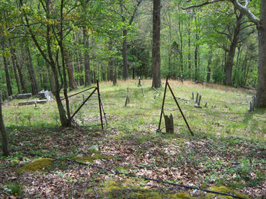
| Description | : | This cemetery is different than the one where Michael Stump III and Magdalene Richards Stump were buried, though it too overlooks Steer Creek and is near Stumptown. It is also up the hill from the cemetery at Doc and Aunt Katy Stump's Farm. This cemetery is west of Stumptown, and north of the intersection of C.R. 7 and U.S. 33 & 119. |
frequently asked questions (FAQ):
-
Where is Stump Cemetery?
Stump Cemetery is located at Stumptown, Gilmer County ,West Virginia ,USA.
-
Stump Cemetery cemetery's updated grave count on graveviews.com?
45 memorials
-
Where are the coordinates of the Stump Cemetery?
Latitude: 38.8495000
Longitude: -81.0030000
Nearby Cemetories:
1. Mount Pisgah Church Cemetery
Stumptown, Gilmer County, USA
Coordinate: 38.8469900, -80.9932700
2. Collins Community Cemetery
Stumptown, Gilmer County, USA
Coordinate: 38.8459700, -80.9903630
3. Snakeroot Cemetery
Gilmer County, USA
Coordinate: 38.8586006, -80.9910965
4. Elihu-Stump Cemetery
Gilmer County, USA
Coordinate: 38.8403015, -80.9878006
5. Bennett Cemetery
Calhoun County, USA
Coordinate: 38.8636017, -81.0314026
6. Michael Stump Cemetery-Steer Creek
Stumptown, Gilmer County, USA
Coordinate: 38.8273200, -80.9736800
7. Meadows Cemetery
Gilmer County, USA
Coordinate: 38.8506012, -80.9492035
8. Turner Cemetery
Lockney, Gilmer County, USA
Coordinate: 38.8764000, -80.9555969
9. Johnny Godfrey Cemetery
Lockney, Gilmer County, USA
Coordinate: 38.8755150, -80.9503720
10. Normantown Cemetery
Normantown, Gilmer County, USA
Coordinate: 38.8511040, -80.9403910
11. Riddle Cemetery
Lockney, Gilmer County, USA
Coordinate: 38.8854710, -80.9561810
12. Roling Cemetery
Calhoun County, USA
Coordinate: 38.8521996, -81.0702972
13. Susan Stump Cemetery
Shock, Gilmer County, USA
Coordinate: 38.8012660, -80.9749330
14. Bethel-Bennett-Burns Cemetery
Grantsville, Calhoun County, USA
Coordinate: 38.9022000, -81.0153000
15. Chestnut Lick Community Church Cemetery
Gilmer County, USA
Coordinate: 38.8223950, -80.9426220
16. Mollohan Cemetery
Normantown, Gilmer County, USA
Coordinate: 38.8429600, -80.9262500
17. Upper Steer Run Baptist Church Cemetery
Gilmer County, USA
Coordinate: 38.8429370, -80.9227830
18. Brown Cemetery
Gilmer County, USA
Coordinate: 38.8869070, -80.9272360
19. Riddle Cemetery
Hardman, Gilmer County, USA
Coordinate: 38.8961111, -80.9333333
20. Barr Cemetery
Calhoun County, USA
Coordinate: 38.8274994, -81.0924988
21. Oak Grove Cemetery
Normantown, Gilmer County, USA
Coordinate: 38.8061420, -80.9267360
22. Boggs Cemetery
Normantown, Gilmer County, USA
Coordinate: 38.8238160, -80.9127130
23. Allen Cemetery
Millstone, Calhoun County, USA
Coordinate: 38.8129770, -81.0908790
24. Cox Cemetery
Normantown, Gilmer County, USA
Coordinate: 38.8953300, -80.9170500