| Birth | : | 16 Mar 1877 Illinois, USA |
| Death | : | 28 Sep 1951 Columbus, Platte County, Nebraska, USA |
| Burial | : | Monticello Union Cemetery, Shawnee, Johnson County, USA |
| Coordinate | : | 38.9920311, -94.8617020 |
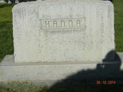
| Description | : | Mrs. Allena May McClure, widow of the late Sam McClure of east of Palmer, passed away Friday morning last week at the Lutheran hospital in Columbus where she had been taken a week previous for treatment. She was 75 years old. Funeral services conducted by Rev. Dawson Parks of the Central City Methodist church, were held in the Solt Funeral home in Central City, Monday, and burial was made in the Fairview cemetery northeast of Archer. Mrs. McClure's parents, Mr. and Mrs. David Hanna, homesteaded on the farm two miles north and 9 miles east of Palmer in 1879, when Allena... Read More |
frequently asked questions (FAQ):
-
Where is Allena May Hanna McClure's memorial?
Allena May Hanna McClure's memorial is located at: Monticello Union Cemetery, Shawnee, Johnson County, USA.
-
When did Allena May Hanna McClure death?
Allena May Hanna McClure death on 28 Sep 1951 in Columbus, Platte County, Nebraska, USA
-
Where are the coordinates of the Allena May Hanna McClure's memorial?
Latitude: 38.9920311
Longitude: -94.8617020
Family Members:
Parent
Spouse
Siblings
Children
Flowers:
Nearby Cemetories:
1. Monticello Union Cemetery
Shawnee, Johnson County, USA
Coordinate: 38.9920311, -94.8617020
2. Shawnee Mission Memory Gardens
Shawnee, Johnson County, USA
Coordinate: 38.9923210, -94.8573914
3. Old Monticello Cemetery
Shawnee, Johnson County, USA
Coordinate: 38.9951973, -94.8359833
4. Murphy Cemetery
Lenexa, Johnson County, USA
Coordinate: 38.9709282, -94.8816986
5. Boles Cemetery
Wilder, Johnson County, USA
Coordinate: 39.0292168, -94.8723450
6. Cedar Junction Cemetery
Cedar, Johnson County, USA
Coordinate: 38.9776800, -94.9339500
7. Smith Burial Site
Lenexa, Johnson County, USA
Coordinate: 38.9319730, -94.8530820
8. Lenape Cemetery
Lenape, Leavenworth County, USA
Coordinate: 39.0074997, -94.9602966
9. Elm Grove Cemetery
Mahon, Leavenworth County, USA
Coordinate: 39.0582085, -94.9450150
10. Lenexa Cemetery
Lenexa, Johnson County, USA
Coordinate: 38.9681015, -94.7416992
11. Saint Johns Catholic Cemetery
Lenexa, Johnson County, USA
Coordinate: 38.9666748, -94.7418594
12. DeSoto Cemetery
De Soto, Johnson County, USA
Coordinate: 38.9710999, -94.9882965
13. Olathe Memorial Cemetery
Olathe, Johnson County, USA
Coordinate: 38.8961983, -94.8170013
14. Resurrection Catholic Cemetery
Lenexa, Johnson County, USA
Coordinate: 38.9763985, -94.7277985
15. Pleasant View Cemetery
Shawnee, Johnson County, USA
Coordinate: 39.0192490, -94.7236862
16. Saint Joseph Catholic Cemetery
Shawnee, Johnson County, USA
Coordinate: 39.0167700, -94.7228800
17. Shawnee Cemetery
Shawnee, Johnson County, USA
Coordinate: 39.0181007, -94.7228012
18. Shawnee Indian Cemetery
Shawnee, Johnson County, USA
Coordinate: 39.0210800, -94.7123400
19. Chance Cemetery
Linwood, Leavenworth County, USA
Coordinate: 39.0018997, -95.0156021
20. Campbell Cemetery
Shawnee, Johnson County, USA
Coordinate: 39.0294952, -94.7087479
21. Mount Sidney Cemetery
Linwood, Leavenworth County, USA
Coordinate: 39.0017014, -95.0243988
22. Sarcoxie Cemetery
Linwood, Leavenworth County, USA
Coordinate: 39.0410995, -95.0186005
23. Glenwood Cemetery
Fairmount Township, Leavenworth County, USA
Coordinate: 39.1080017, -94.9449005
24. Antioch Pioneer Cemetery
Merriam, Johnson County, USA
Coordinate: 38.9934807, -94.6868896


