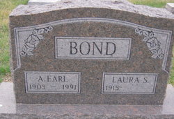
Alonzo Earl Bond
| Birth | : | 10 Mar 1903 Oregon, Holt County, Missouri, USA |
| Death | : | 17 Mar 1991 Syracuse, Otoe County, Nebraska, USA |
| Burial | : | Saint Mary of the Woods Cemetery, Whitesville, Daviess County, USA |
| Coordinate | : | 37.6605988, -86.8711014 |
| Plot | : | Section B, Lot 63 |
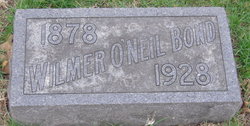
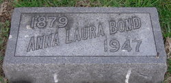
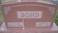
| Description | : | His parents were: Wilmer O'Neil and Anna Laura (Bemberger) Bond. He married Sept. 6, 1939 at Talmage, NE.at the St. John's United Church of Christ(McWilliams) to Laura Dierking. Earl moved to the Johnson-Otoe County area at the age of seven, and moved to Syracuse in 1978. He was a retired farmer and a member of the United Methodist Church in Syracuse. He enjoyed gardening. Survivors include his wife, Laura, two daughters, June and husband, Kenneth Kavanaugh of Syracuse and Carolyn and husband Howard Magill of St. Juliet, TN. five grandchildren and one great granddaughter, sister-in-law, Fern Bond of... Read More |
frequently asked questions (FAQ):
-
Where is Alonzo Earl Bond's memorial?
Alonzo Earl Bond's memorial is located at: Saint Mary of the Woods Cemetery, Whitesville, Daviess County, USA.
-
When did Alonzo Earl Bond death?
Alonzo Earl Bond death on 17 Mar 1991 in Syracuse, Otoe County, Nebraska, USA
-
Where are the coordinates of the Alonzo Earl Bond's memorial?
Latitude: 37.6605988
Longitude: -86.8711014
Family Members:
Parent
Spouse
Siblings
Flowers:
Nearby Cemetories:
1. Saint Mary of the Woods Cemetery
Whitesville, Daviess County, USA
Coordinate: 37.6605988, -86.8711014
2. Edge Cemetery
Whitesville, Daviess County, USA
Coordinate: 37.6491670, -86.8883330
3. Barnetts Knob Cemetery
Whitesville, Daviess County, USA
Coordinate: 37.6753006, -86.8578033
4. Cates Cemetery
Whitesville, Daviess County, USA
Coordinate: 37.6819000, -86.8574982
5. Howard Family Cemetery
Fordsville, Ohio County, USA
Coordinate: 37.6636900, -86.8398890
6. Hendrix Cemetery
Ohio County, USA
Coordinate: 37.6557800, -86.8402300
7. Passionist Monastery Cemetery
Whitesville, Daviess County, USA
Coordinate: 37.6674350, -86.9092460
8. Ellis Cemetery
Ohio County, USA
Coordinate: 37.6767006, -86.8191986
9. Hardin Family Cemetery North
Deanefield, Ohio County, USA
Coordinate: 37.6513888, -86.8136110
10. Hardin Cemetery
Deanefield, Ohio County, USA
Coordinate: 37.6450000, -86.8133330
11. Deanefield Cemetery
Deanefield, Ohio County, USA
Coordinate: 37.6611730, -86.8031970
12. Bellamy Cemetery
Ohio County, USA
Coordinate: 37.6397018, -86.8016968
13. Aetnaville Cemetery
Aetnaville, Ohio County, USA
Coordinate: 37.6780464, -86.7946315
14. Antioch Cemetery
Adaburg, Ohio County, USA
Coordinate: 37.5969300, -86.8624600
15. Friendship Baptist Church Cemetery
Philpot, Daviess County, USA
Coordinate: 37.6520600, -86.9565100
16. Adaburg Baptist Church Cemetery
Adaburg, Ohio County, USA
Coordinate: 37.5916800, -86.8524900
17. Haynesville Cemetery
Ohio County, USA
Coordinate: 37.6797890, -86.7846280
18. Karn Family Cemetery
Philpot, Daviess County, USA
Coordinate: 37.7097740, -86.9388123
19. Jackson Cemetery
Masonville, Daviess County, USA
Coordinate: 37.6397018, -86.9593964
20. Karn's Grove Baptist Church Cemetery
Philpot, Daviess County, USA
Coordinate: 37.7102000, -86.9390600
21. Panther Creek Baptist Church Cemetery
Whitesville, Daviess County, USA
Coordinate: 37.7180610, -86.8103000
22. Sugar Grove Baptist Church Cemetery
Fordsville, Ohio County, USA
Coordinate: 37.6169100, -86.7896500
23. Friendship Community Cemetery
Fordsville, Ohio County, USA
Coordinate: 37.6417230, -86.7751100
24. Kelley Cemetery
Ohio County, USA
Coordinate: 37.6241989, -86.7827988

