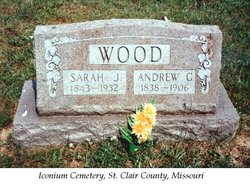
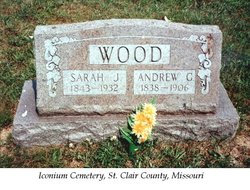
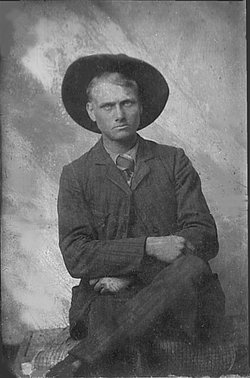
Andrew Green Wood
| Birth | : | Aug 1838 Morgan County, Missouri, USA |
| Death | : | Dec 1906 St. Clair County, Missouri, USA |
| Burial | : | Grove Cemetery, Holden, Worcester County, USA |
| Coordinate | : | 42.3520400, -71.8672700 |
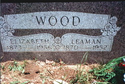
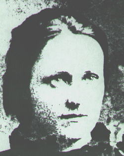
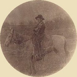
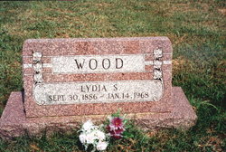
| Description | : | ANDREW and SARAH JANE WOOD; In 1858, Sarah Jane Harper, d/o Leman and Tabitha (Gover) Harper, married Andrew Green Wood, b: Aug. 1838. Andy Wood was elected Constable of Iconium, Mo., in 1874. He and Sarah Jane were the parents of nine children: George, a doctor, m: Mollie Souther; John, b: 1865, d: 1951, m: Nancy Copenhaver; Leman, b: 27-July-1870, m: Rachel Elizabeth Lewis; Ridley, m: Rose McClain: Charles, m: Ida Emery; Tennessee "Aunt Tenny", m: Earl Poling; Renda, m: John Matthews; Sallie, m: Ed Jackson; and Lydia, who never married.... Read More |
frequently asked questions (FAQ):
-
Where is Andrew Green Wood's memorial?
Andrew Green Wood's memorial is located at: Grove Cemetery, Holden, Worcester County, USA.
-
When did Andrew Green Wood death?
Andrew Green Wood death on Dec 1906 in St. Clair County, Missouri, USA
-
Where are the coordinates of the Andrew Green Wood's memorial?
Latitude: 42.3520400
Longitude: -71.8672700
Family Members:
Parent
Spouse
Siblings
Children
Flowers:
Nearby Cemetories:
1. Grove Cemetery
Holden, Worcester County, USA
Coordinate: 42.3520400, -71.8672700
2. Saint Mary Cemetery
Holden, Worcester County, USA
Coordinate: 42.3522400, -71.8684200
3. Park Avenue Cemetery
Holden, Worcester County, USA
Coordinate: 42.3514200, -71.8656900
4. Old Burying Ground
Holden, Worcester County, USA
Coordinate: 42.3505800, -71.8626000
5. Saint Francis Episcopal Church Memorial Garden
Holden, Worcester County, USA
Coordinate: 42.3522800, -71.8588700
6. Mooreland Cemetery
Paxton, Worcester County, USA
Coordinate: 42.3280800, -71.9321000
7. Worcester County Memorial Park
Paxton, Worcester County, USA
Coordinate: 42.3245697, -71.9308777
8. Smith Family Cemetery
Rutland, Worcester County, USA
Coordinate: 42.3946064, -71.9231169
9. Paxton Center Cemetery
Paxton, Worcester County, USA
Coordinate: 42.3128900, -71.9277700
10. Rutland Rural Cemetery
Rutland, Worcester County, USA
Coordinate: 42.3790100, -71.9447500
11. High Plains Cemetery
West Boylston, Worcester County, USA
Coordinate: 42.3889008, -71.7972031
12. Mount Vernon Cemetery
West Boylston, Worcester County, USA
Coordinate: 42.3634650, -71.7804030
13. Beaman Cemetery
West Boylston, Worcester County, USA
Coordinate: 42.3649590, -71.7803600
14. South Burying Ground
Princeton, Worcester County, USA
Coordinate: 42.4192009, -71.8957977
15. Old Burial Ground
Rutland, Worcester County, USA
Coordinate: 42.3756000, -71.9578000
16. Legg Cemetery
Sterling, Worcester County, USA
Coordinate: 42.4070020, -71.7986150
17. Elliot Hill Burial Ground
Leicester, Worcester County, USA
Coordinate: 42.2802200, -71.9145500
18. Putnam Farm Cemetery
Rutland, Worcester County, USA
Coordinate: 42.3484010, -71.9771420
19. Worcester Rural Cemetery
Worcester, Worcester County, USA
Coordinate: 42.2803001, -71.8035965
20. Saint Lukes Cemetery
West Boylston, Worcester County, USA
Coordinate: 42.3833008, -71.7568970
21. Adam El-Khishin Meditation Area
Worcester, Worcester County, USA
Coordinate: 42.2755600, -71.8090900
22. West Rutland Cemetery
Rutland, Worcester County, USA
Coordinate: 42.3561970, -71.9897170
23. Cookshire Cemetery
Sterling, Worcester County, USA
Coordinate: 42.4108500, -71.7734800
24. Quaker Cemetery
Leicester, Worcester County, USA
Coordinate: 42.2635600, -71.8960300

