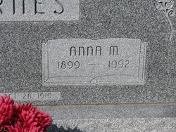
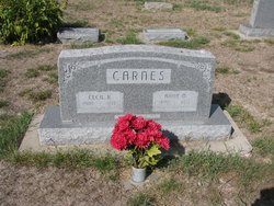
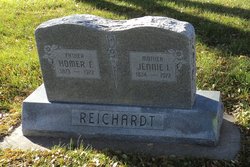
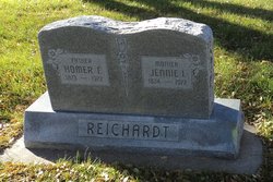
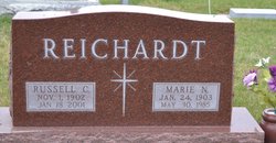
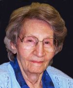
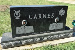
Anna Margaret Reichardt Carnes
| Birth | : | 29 Jun 1899 Seward County, Nebraska, USA |
| Death | : | 28 Apr 1992 Aurora, Hamilton County, Nebraska, USA |
| Burial | : | Atlantic County Veterans Cemetery, Estell Manor, Atlantic County, USA |
| Coordinate | : | 39.3882790, -74.7386017 |
| Description | : | Anna Carnes Funeral Services were held 10:00 A.M., Saturday, May 2, 1992 at the Aurora United Methodist Church. Interment was held in the Aurora Cemetery. OBITUARY: Anna M. Carnes Anna M. Carnes, the daughter of Homer and Ida (Miller) Reichardt, was born at Seward County, Nebraska, on June 29, 1899, and died at Aurora, Nebraska, on April 28, 1992, at the age of 92 years, 9 months, and 29 days. She lived in Seward County, then Kansas, Central City, Nebraska, and to a home north of Aurora in 1913. She attended school in Central City, and Aurora, High School. On October... Read More |
frequently asked questions (FAQ):
-
Where is Anna Margaret Reichardt Carnes's memorial?
Anna Margaret Reichardt Carnes's memorial is located at: Atlantic County Veterans Cemetery, Estell Manor, Atlantic County, USA.
-
When did Anna Margaret Reichardt Carnes death?
Anna Margaret Reichardt Carnes death on 28 Apr 1992 in Aurora, Hamilton County, Nebraska, USA
-
Where are the coordinates of the Anna Margaret Reichardt Carnes's memorial?
Latitude: 39.3882790
Longitude: -74.7386017
Family Members:
Parent
Spouse
Siblings
Children
Flowers:
Nearby Cemetories:
1. Atlantic County Veterans Cemetery
Estell Manor, Atlantic County, USA
Coordinate: 39.3882790, -74.7386017
2. Steelmans Creek Burial Ground
Estell Manor, Atlantic County, USA
Coordinate: 39.3878517, -74.7388687
3. Estellville Methodist Church Cemetery
Mays Landing, Atlantic County, USA
Coordinate: 39.3976900, -74.7477700
4. Methodist Burying Ground
Estellville, Atlantic County, USA
Coordinate: 39.3978615, -74.7480164
5. Old Burying Ground
Estellville, Atlantic County, USA
Coordinate: 39.3959680, -74.7518810
6. Smith-Ireland Burying Ground
Estellville, Atlantic County, USA
Coordinate: 39.4151800, -74.7329640
7. Catawba Church and Burying Ground
Atlantic County, USA
Coordinate: 39.4082794, -74.7136078
8. Union Cemetery
Mays Landing, Atlantic County, USA
Coordinate: 39.4373894, -74.7080536
9. Asbury Methodist Episcopal Church Cemetery
English Creek, Atlantic County, USA
Coordinate: 39.3621483, -74.6706314
10. Westcott Free Burying Ground
Mays Landing, Atlantic County, USA
Coordinate: 39.4526215, -74.7281189
11. Presbyterian Cemetery
Mays Landing, Atlantic County, USA
Coordinate: 39.4539185, -74.7269821
12. Bethlehem Evangelical Lutheran Cemetery
Dorothy, Atlantic County, USA
Coordinate: 39.4056396, -74.8247070
13. Estell Manor Community Church Cemetery
Estell Manor, Atlantic County, USA
Coordinate: 39.3763160, -74.8270490
14. Saint Bernard Clairvaux Roman Catholic Cemetery
Dorothy, Atlantic County, USA
Coordinate: 39.4073067, -74.8260803
15. Lincoln Memorial Park
Mays Landing, Atlantic County, USA
Coordinate: 39.4478493, -74.6872635
16. Palestine Bible Protestant Church Cemetery
Scullville, Atlantic County, USA
Coordinate: 39.3487091, -74.6608810
17. Holy Cross Cemetery and Chapel Mausoleum
Mays Landing, Atlantic County, USA
Coordinate: 39.4490395, -74.6839523
18. Carmantown Cemetery
Carmantown, Atlantic County, USA
Coordinate: 39.4483250, -74.6446000
19. Tuckahoe United Methodist Church Cemetery
Tuckahoe, Cape May County, USA
Coordinate: 39.2921500, -74.7546600
20. Head of the River Cemetery
Estell Manor, Atlantic County, USA
Coordinate: 39.3098259, -74.8210449
21. Zion Cemetery
Bargaintown, Atlantic County, USA
Coordinate: 39.3661390, -74.5885100
22. Zion United Methodist Church Cemetery
Egg Harbor Township, Atlantic County, USA
Coordinate: 39.3674200, -74.5880000
23. Old Weymouth Meeting House Cemetery
Weymouth, Atlantic County, USA
Coordinate: 39.5122070, -74.7802200
24. Steelmantown Cemetery
Steelmantown, Cape May County, USA
Coordinate: 39.2689514, -74.8033981

