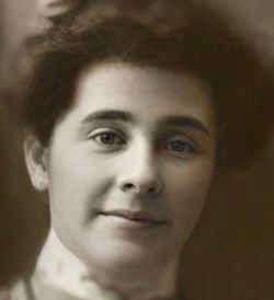
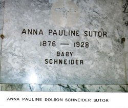
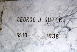
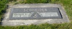
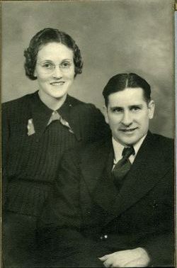
Anna Pauline Dalsin Schneider-Sutor
| Birth | : | 30 Jan 1876 Mendota, Dakota County, Minnesota, USA |
| Death | : | 30 May 1928 Waterville, Douglas County, Washington, USA |
| Burial | : | Waterville Cemetery, Waterville, Douglas County, USA |
| Coordinate | : | 47.6418500, -120.0685940 |
| Description | : | Mrs. Geo. Sutor who had been seriously ill with pneumonia at the Smith Hospital for two weeks, and just as her nurse and physician were hopeful for her recovery, on Wednesday morning at 7:30 she suffered a heart attack and die suddenly. Deceased had been a resident of Douglas County for 30 years. She was born in Minnesota in 1876, where she resided until coming to Douglas county. A short time before coming west she was united in marriage to Tony Schneider and when they first came to Douglas county they purchased the farm which in... Read More |
frequently asked questions (FAQ):
-
Where is Anna Pauline Dalsin Schneider-Sutor's memorial?
Anna Pauline Dalsin Schneider-Sutor's memorial is located at: Waterville Cemetery, Waterville, Douglas County, USA.
-
When did Anna Pauline Dalsin Schneider-Sutor death?
Anna Pauline Dalsin Schneider-Sutor death on 30 May 1928 in Waterville, Douglas County, Washington, USA
-
Where are the coordinates of the Anna Pauline Dalsin Schneider-Sutor's memorial?
Latitude: 47.6418500
Longitude: -120.0685940
Family Members:
Parent
Spouse
Siblings
Children
Flowers:
Nearby Cemetories:
1. Waterville Cemetery
Waterville, Douglas County, USA
Coordinate: 47.6418500, -120.0685940
2. Gate of Heaven Catholic Cemetery
Waterville, Douglas County, USA
Coordinate: 47.6382100, -120.0671690
3. Kummer Cemetery
Waterville, Douglas County, USA
Coordinate: 47.6559000, -120.0332000
4. Badger Mountain View Cemetery
Douglas County, USA
Coordinate: 47.6088000, -120.0476000
5. Douglas Lutheran Cemetery
Douglas County, USA
Coordinate: 47.6189003, -119.9614029
6. Orondo Community Cemetery
Orondo, Douglas County, USA
Coordinate: 47.6486015, -120.2136002
7. Brays Landing Cemetery
Douglas County, USA
Coordinate: 47.7364120, -120.1704660
8. Fletcher Cemetery
Douglas County, USA
Coordinate: 47.7430992, -119.9403000
9. Ballard Family Cemetery
Stayman, Chelan County, USA
Coordinate: 47.7811100, -120.1133300
10. Slack Cemetery
Douglas County, USA
Coordinate: 47.5283012, -119.9180984
11. Badger Mountain Cemetery
Douglas County, USA
Coordinate: 47.5063000, -120.1938000
12. Entiat Cemetery
Entiat, Chelan County, USA
Coordinate: 47.6755981, -120.3043976
13. Happy Home Cemetery
Farmer, Douglas County, USA
Coordinate: 47.6268997, -119.8125000
14. Evangelical Emanuel Cemetery
Douglas County, USA
Coordinate: 47.5764008, -119.8107986
15. Riverview Cemetery
Chelan, Chelan County, USA
Coordinate: 47.8335991, -119.9944000
16. Saint Andrews Episcopal Church
Chelan, Chelan County, USA
Coordinate: 47.8397460, -120.0183780
17. Mount Olivet Cemetery
Chelan, Chelan County, USA
Coordinate: 47.8451000, -119.9946000
18. Chelan Fraternal Cemetery
Chelan, Chelan County, USA
Coordinate: 47.8502998, -120.0081024
19. Saint Hubert Catholic Cemetery
Douglas County, USA
Coordinate: 47.5988880, -119.7481940
20. Valley View Cemetery
Douglas County, USA
Coordinate: 47.4730988, -120.2981033
21. Hamilton Cemetery
East Wenatchee, Douglas County, USA
Coordinate: 47.4336014, -120.2482986
22. Manson Indian Cemetery
Manson, Chelan County, USA
Coordinate: 47.8800000, -120.1300000
23. Sunnyslope Church of the Brethren Cemetery
Sunnyslope, Chelan County, USA
Coordinate: 47.4784431, -120.3465576
24. Evergreen Memorial Park
East Wenatchee, Douglas County, USA
Coordinate: 47.4216995, -120.2649994

