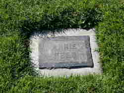
Annie Richards Rees
| Birth | : | 19 Oct 1847 Tamaqua, Schuylkill County, Pennsylvania, USA |
| Death | : | 17 Nov 1939 Pacific Grove, Monterey County, California, USA |
| Burial | : | Cheshunt Cemetery, Cheshunt, Broxbourne Borough, England |
| Coordinate | : | 51.7009840, -0.0563720 |
| Plot | : | Garden of Love (West Section), block 28, lot 1, space 2 |
| Description | : | Obituary of Annie (Richards) Rees; EXTRACT: Mrs. Annie Rees, Valley Pioneer Passes At Age Of Ninety-Two _____Was Oldest Member Of American Legion Auxiliary in Entire United States, Beloved of the entire community, bearing national distinction in the American Legion Auxiliary, widow of a Civil War veteran and mother of a World War veteran, and one of that rapidly diminishing group of real California pioneers who settled and developed the State, Mrs. Annie Rees passed away last Friday evening at the home of a daughter in Pacific Grove, a career of ninety-two active years coming to a peaceful end. _____Her passing was unexpected, although she had... Read More |
frequently asked questions (FAQ):
-
Where is Annie Richards Rees's memorial?
Annie Richards Rees's memorial is located at: Cheshunt Cemetery, Cheshunt, Broxbourne Borough, England.
-
When did Annie Richards Rees death?
Annie Richards Rees death on 17 Nov 1939 in Pacific Grove, Monterey County, California, USA
-
Where are the coordinates of the Annie Richards Rees's memorial?
Latitude: 51.7009840
Longitude: -0.0563720
Family Members:
Spouse
Children
Flowers:
Nearby Cemetories:
1. Cheshunt Cemetery
Cheshunt, Broxbourne Borough, England
Coordinate: 51.7009840, -0.0563720
2. St Mary the Virgin Church
Cheshunt, Broxbourne Borough, England
Coordinate: 51.7042420, -0.0489450
3. Adath Yisroel Cemetery
Cheshunt, Broxbourne Borough, England
Coordinate: 51.7015690, -0.0772910
4. Western Synagogue Cemetery
Cheshunt, Broxbourne Borough, England
Coordinate: 51.6850350, -0.0615410
5. St George Churchyard
Freezywater, London Borough of Enfield, England
Coordinate: 51.6738060, -0.0389670
6. Enfield Crematorium
Enfield, London Borough of Enfield, England
Coordinate: 51.6699829, -0.0544380
7. Waltham Abbey
Waltham Abbey, Epping Forest District, England
Coordinate: 51.6876010, -0.0034070
8. St. Laurence Churchyard
Wormley, Broxbourne Borough, England
Coordinate: 51.7352050, -0.0389350
9. Adath Yisroel Cemetery
Enfield, London Borough of Enfield, England
Coordinate: 51.6634740, -0.0669010
10. Waltham Holy Cross-New Cemetery
Waltham Abbey, Epping Forest District, England
Coordinate: 51.6822880, 0.0024510
11. Waltham Holy Cross Old Cemetery
Waltham Abbey, Epping Forest District, England
Coordinate: 51.6823480, 0.0027610
12. Lavender Hill Cemetery
Enfield, London Borough of Enfield, England
Coordinate: 51.6660423, -0.0944350
13. St. James' Churchyard
Enfield, London Borough of Enfield, England
Coordinate: 51.6558850, -0.0470570
14. Hertford Road Cemetery
Enfield, London Borough of Enfield, England
Coordinate: 51.6554120, -0.0449750
15. St Andrew Churchyard
Enfield, London Borough of Enfield, England
Coordinate: 51.6530210, -0.0821420
16. Saint Augustine's Churchyard
Broxbourne, Broxbourne Borough, England
Coordinate: 51.7445150, -0.0147810
17. Waltham Abbey Jewish Cemetery
Waltham Abbey, Epping Forest District, England
Coordinate: 51.6778780, 0.0389240
18. St. Thomas Churchyard
Upshire, Epping Forest District, England
Coordinate: 51.6898890, 0.0465860
19. Quaker Burial Ground, Hoddesdon, Hertfordshire
Hoddesdon, Broxbourne Borough, England
Coordinate: 51.7610213, -0.0139560
20. St Catherine and St Paul's Churchyard
Hoddesdon, Broxbourne Borough, England
Coordinate: 51.7625830, -0.0120670
21. Saint Mary
Bayford, East Hertfordshire District, England
Coordinate: 51.7629540, -0.1035070
22. Holy Innocents Churchyard
High Beach, Epping Forest District, England
Coordinate: 51.6617140, 0.0343380
23. Woollensbrook Crematorium
Hoddesdon, Broxbourne Borough, England
Coordinate: 51.7681805, -0.0280669
24. St. Andrew's Churchyard
Little Berkhamsted, East Hertfordshire District, England
Coordinate: 51.7547390, -0.1295270

