
| Memorials | : | 0 |
| Location | : | Broxbourne, Broxbourne Borough, England |
| Coordinate | : | 51.7445150, -0.0147810 |
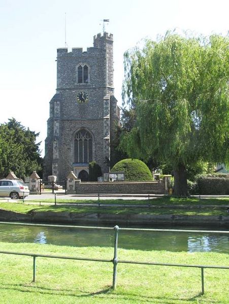
| Description | : | The church was entirely rebuilt and enlarged in the 15th century, and no detail now remains of the former nave and chancel, which appear to have been added to from time to time. The north aisle was the earliest addition, then the two east bays of the south aisle and the west bay of the south chapel; shortly afterwards the south aisle was extended westwards the full length of the nave and the south chapel eastwards to the east wall of the chancel; the west tower was erected about the close of the 15th century, the north chapel and vestry... Read More |
frequently asked questions (FAQ):
-
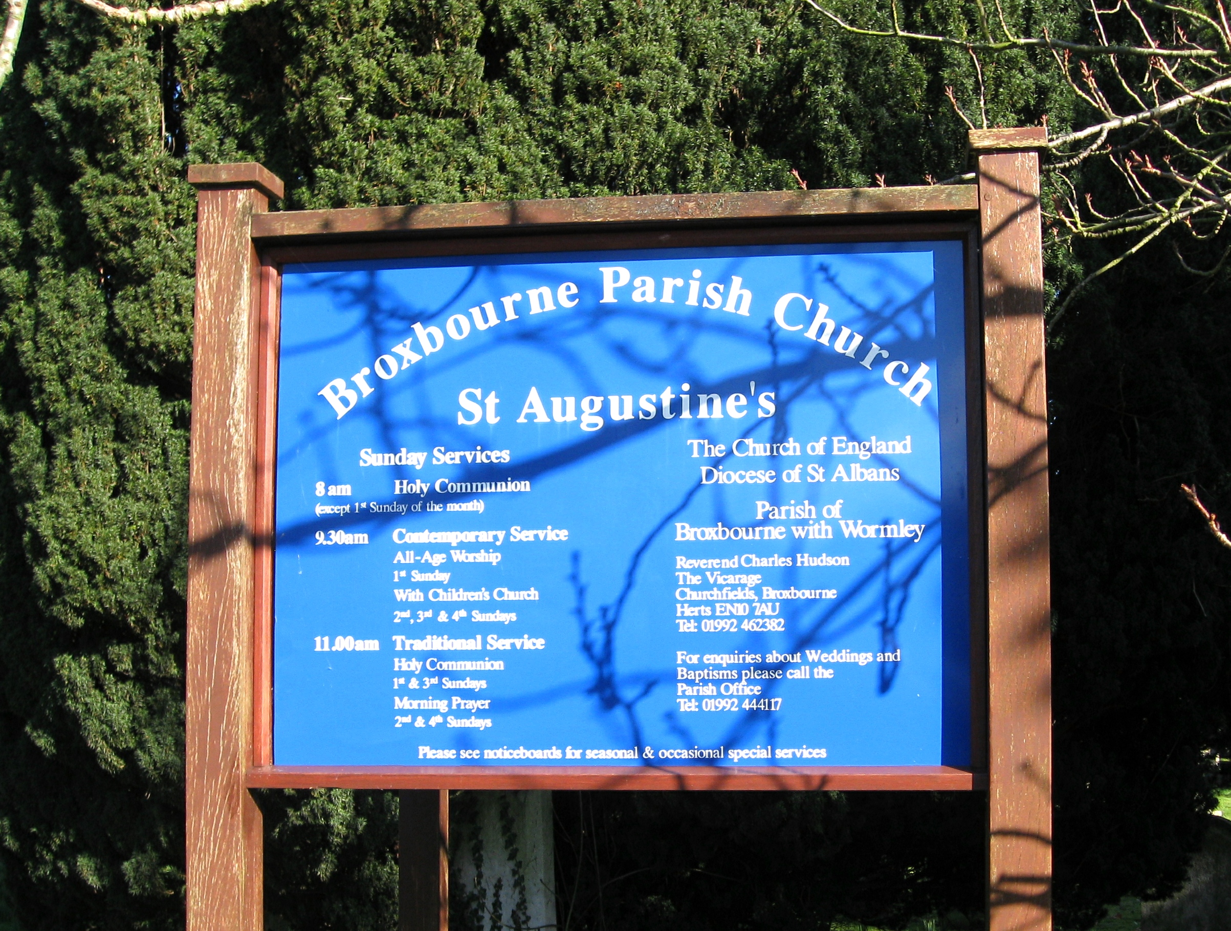
Where is Saint Augustine's Churchyard?
Saint Augustine's Churchyard is located at Churchfields Broxbourne, Broxbourne Borough ,Hertfordshire , EN10 7AUEngland.
-
Saint Augustine's Churchyard cemetery's updated grave count on graveviews.com?
0 memorials
-
Where are the coordinates of the Saint Augustine's Churchyard?
Latitude: 51.7445150
Longitude: -0.0147810
Nearby Cemetories:
1. Quaker Burial Ground, Hoddesdon, Hertfordshire
Hoddesdon, Broxbourne Borough, England
Coordinate: 51.7610213, -0.0139560
2. St. Laurence Churchyard
Wormley, Broxbourne Borough, England
Coordinate: 51.7352050, -0.0389350
3. St Catherine and St Paul's Churchyard
Hoddesdon, Broxbourne Borough, England
Coordinate: 51.7625830, -0.0120670
4. Woollensbrook Crematorium
Hoddesdon, Broxbourne Borough, England
Coordinate: 51.7681805, -0.0280669
5. Hoddesdon Cemetery
Hoddesdon, Broxbourne Borough, England
Coordinate: 51.7711490, -0.0156822
6. All Saints Churchyard
Nazeing, Epping Forest District, England
Coordinate: 51.7436140, 0.0464100
7. St. Margaret's Parish Churchyard
Stanstead St Margarets, East Hertfordshire District, England
Coordinate: 51.7857570, -0.0002631
8. St James' Churchyard
Stanstead Abbotts, East Hertfordshire District, England
Coordinate: 51.7806920, 0.0275950
9. St Mary the Virgin Church
Cheshunt, Broxbourne Borough, England
Coordinate: 51.7042420, -0.0489450
10. Holy Trinity Churchyard
Hertford Heath, East Hertfordshire District, England
Coordinate: 51.7865300, -0.0433980
11. Roydon United Reform Churchyard
Roydon, Epping Forest District, England
Coordinate: 51.7714050, 0.0460240
12. St John the Baptist Churchyard
Great Amwell, East Hertfordshire District, England
Coordinate: 51.7944320, -0.0123740
13. Cheshunt Cemetery
Cheshunt, Broxbourne Borough, England
Coordinate: 51.7009840, -0.0563720
14. St Mary the Virgin Churchyard
Great Parndon, Harlow District, England
Coordinate: 51.7605100, 0.0739860
15. Waltham Abbey
Waltham Abbey, Epping Forest District, England
Coordinate: 51.6876010, -0.0034070
16. Adath Yisroel Cemetery
Cheshunt, Broxbourne Borough, England
Coordinate: 51.7015690, -0.0772910
17. Saint Mary
Bayford, East Hertfordshire District, England
Coordinate: 51.7629540, -0.1035070
18. All Saints with Saint John Churchyard
Hertford, East Hertfordshire District, England
Coordinate: 51.7950040, -0.0757330
19. Waltham Holy Cross Old Cemetery
Waltham Abbey, Epping Forest District, England
Coordinate: 51.6823480, 0.0027610
20. Waltham Holy Cross-New Cemetery
Waltham Abbey, Epping Forest District, England
Coordinate: 51.6822880, 0.0024510
21. Parndon Wood Crematorium and Cemetery
Harlow, Harlow District, England
Coordinate: 51.7430160, 0.0898420
22. The Immaculate Conception and St Joseph
Hertford, East Hertfordshire District, England
Coordinate: 51.7988966, -0.0745293
23. Western Synagogue Cemetery
Cheshunt, Broxbourne Borough, England
Coordinate: 51.6850350, -0.0615410
24. Saint Andrew Churchyard
Hertford, East Hertfordshire District, England
Coordinate: 51.7960550, -0.0823520