

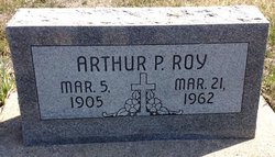
Arcelia Hebert Roy
| Birth | : | 4 Mar 1887 Cloud County, Kansas, USA |
| Death | : | 28 Oct 1952 Concordia, Cloud County, Kansas, USA |
| Burial | : | Saint Joseph Cemetery, Saint Joseph, Cloud County, USA |
| Coordinate | : | 39.5074941, -97.4022328 |
| Plot | : | Site A/5 |
| Inscription | : | Mother |
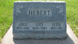
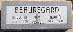
| Description | : | The Kansan, Concordia, Kansas Thursday, October 30, 1952 Mrs. Arcelia Roy Dies Mrs. Arcelia Roy, resident of Clyde, died at St. Joseph Hospital on Tuesday noon, shortly after being admitted to the hospital. Mrs. Roy was born near St. Joseph, Kansas on March 4, 1887 and was 65 years old at the time of her death. Survivors are her children: Arthur Roy, of Concordia; Mrs. Kenneth Selichlow, of Denver, Colo.; Mrs. Leon Vincent, of Spanish Fort, Utah, and Bernard Roy of Ness City; two sisters, Mrs. Albina Beauregard of Kankakee, Ill., and Mrs. Casper Cailteux of Clyde and one brother, Ovella Hebert of Compton,... Read More |
frequently asked questions (FAQ):
-
Where is Arcelia Hebert Roy's memorial?
Arcelia Hebert Roy's memorial is located at: Saint Joseph Cemetery, Saint Joseph, Cloud County, USA.
-
When did Arcelia Hebert Roy death?
Arcelia Hebert Roy death on 28 Oct 1952 in Concordia, Cloud County, Kansas, USA
-
Where are the coordinates of the Arcelia Hebert Roy's memorial?
Latitude: 39.5074941
Longitude: -97.4022328
Family Members:
Parent

Spouse
Siblings

Children
Flowers:


Nearby Cemetories:
1. Saint Joseph Cemetery
Saint Joseph, Cloud County, USA
Coordinate: 39.5074941, -97.4022328
2. Pleasant View Cemetery
Ames, Cloud County, USA
Coordinate: 39.5346985, -97.4431000
3. Cedar Grove Cemetery
Clyde, Cloud County, USA
Coordinate: 39.5494003, -97.4056015
4. Iwacura Cemetery
Morganville, Clay County, USA
Coordinate: 39.4550000, -97.3510000
5. French Presbyterian Church Cemetery
Cloud County, USA
Coordinate: 39.4395200, -97.4148290
6. Green Mound Cemetery
Rice, Cloud County, USA
Coordinate: 39.5248450, -97.5081630
7. Riverdale Cemetery
Clay County, USA
Coordinate: 39.5106010, -97.2930984
8. Mount Calvary Cemetery
Clyde, Cloud County, USA
Coordinate: 39.5917015, -97.4143982
9. Princeville Cemetery
Aurora, Cloud County, USA
Coordinate: 39.4672012, -97.5010986
10. Mount Hope Cemetery
Clyde, Cloud County, USA
Coordinate: 39.5969009, -97.4116974
11. Saint Peters Cemetery
Aurora, Cloud County, USA
Coordinate: 39.4763985, -97.5180969
12. Walnut Grove Cemetery
Cloud County, USA
Coordinate: 39.5699997, -97.4993973
13. Nelson Cemetery
Rice, Cloud County, USA
Coordinate: 39.5257988, -97.5410995
14. Bloom Cemetery
Morganville, Clay County, USA
Coordinate: 39.4519005, -97.2778015
15. Lincoln Cemetery
Clay Center, Clay County, USA
Coordinate: 39.4230995, -97.2930984
16. Sulphur Springs Cemetery
Aurora, Cloud County, USA
Coordinate: 39.4086610, -97.4986840
17. Rice Cemetery
Rice, Cloud County, USA
Coordinate: 39.5614014, -97.5552979
18. Sherman Cemetery
Morganville, Clay County, USA
Coordinate: 39.5316300, -97.2243700
19. Smith Grave
Miltonvale, Cloud County, USA
Coordinate: 39.3645300, -97.4308700
20. Hollis Cemetery
Cloud County, USA
Coordinate: 39.6383018, -97.5361023
21. Norwegian Lutheran Cemetery
Clay Center, Clay County, USA
Coordinate: 39.5027900, -97.1828200
22. Agenda Cemetery
Agenda, Republic County, USA
Coordinate: 39.6761017, -97.4336014
23. Morganville City Cemetery
Morganville, Clay County, USA
Coordinate: 39.4733009, -97.1819000
24. Miltonvale Cemetery
Miltonvale, Cloud County, USA
Coordinate: 39.3358002, -97.4447021