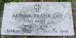
Arthur Frank Day
| Birth | : | 15 Mar 1890 Muscatine County, Iowa, USA |
| Death | : | 16 Aug 1946 Des Moines, Polk County, Iowa, USA |
| Burial | : | Cedar Crest Cemetery, Collbran, Mesa County, USA |
| Coordinate | : | 39.2369003, -107.9589005 |
| Description | : | DAY, Arthur Frank Arthur Day, former Muscatine resident, died at 2:15 a.m. today at the Veterans hospital at Des Moines, where he had been a patient for the past three months. Survivors include six brothers, Leslie, of Grandview; Earl, Elmus and Fred, of Muscatine; Stephen, of Madison, Wisc.; and Glen of Kansas City; one sister who resides at Clinton, and a number of nieces and nephews. He was preceded in death by his parents, one brother and two sisters. Funeral arrangements are indefinite. Muscatine Journal Saturday August 17, 1946 page 3 Submitted by Carolyn Hidlebaugh Funeral services for Arthur Day,... Read More |
frequently asked questions (FAQ):
-
Where is Arthur Frank Day's memorial?
Arthur Frank Day's memorial is located at: Cedar Crest Cemetery, Collbran, Mesa County, USA.
-
When did Arthur Frank Day death?
Arthur Frank Day death on 16 Aug 1946 in Des Moines, Polk County, Iowa, USA
-
Where are the coordinates of the Arthur Frank Day's memorial?
Latitude: 39.2369003
Longitude: -107.9589005
Family Members:
Parent
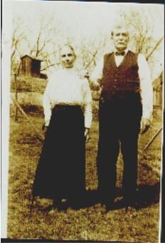
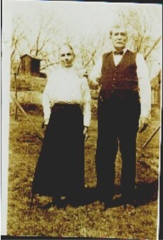
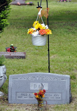
Siblings
Flowers:
Nearby Cemetories:
1. Cedar Crest Cemetery
Collbran, Mesa County, USA
Coordinate: 39.2369003, -107.9589005
2. Eagalite Cemetery
Plateau City, Mesa County, USA
Coordinate: 39.2228012, -107.9894028
3. Clover Cemetery
Collbran, Mesa County, USA
Coordinate: 39.2550011, -107.9227982
4. Blackman Ranch Cemetery
Collbran, Mesa County, USA
Coordinate: 39.2647420, -107.8554350
5. Molina Cemetery
Molina, Mesa County, USA
Coordinate: 39.1886000, -108.0629000
6. Mesa Cemetery
Mesa, Mesa County, USA
Coordinate: 39.1685982, -108.1188965
7. Battlement Cemetery
Parachute, Garfield County, USA
Coordinate: 39.4380989, -108.0291977
8. DeBeque Cemetery
Mesa County, USA
Coordinate: 39.3374060, -108.2138900
9. Russey-Hurlburt Cemetery
Parachute, Garfield County, USA
Coordinate: 39.4522018, -108.0575027
10. Rulison Cemetery
Rulison, Garfield County, USA
Coordinate: 39.4768000, -107.9357000
11. Rose Hill Cemetery
Rifle, Garfield County, USA
Coordinate: 39.5381012, -107.7742004
12. Union Divide Creek Cemetery
Silt, Garfield County, USA
Coordinate: 39.4508018, -107.6200027
13. Cedaredge Cemetery
Cedaredge, Delta County, USA
Coordinate: 38.8884470, -107.9287560
14. Palisade Cemetery
Palisade, Mesa County, USA
Coordinate: 39.0999000, -108.3980000
15. Eckert Cemetery
Eckert, Delta County, USA
Coordinate: 38.8466660, -107.9593110
16. Skyline Cemetery
Silt, Garfield County, USA
Coordinate: 39.5520060, -107.6575300
17. Cory Cemetery
Delta, Delta County, USA
Coordinate: 38.7905080, -107.9894160
18. Whitewater Cemetery
Whitewater, Mesa County, USA
Coordinate: 38.9818993, -108.4357986
19. Memorial Gardens
Grand Junction, Mesa County, USA
Coordinate: 39.0790329, -108.5022278
20. Bethlehem Cemetery
Paonia, Delta County, USA
Coordinate: 38.8638992, -107.6216965
21. Crim Cemetery
Delta County, USA
Coordinate: 38.7675018, -107.9477997
22. Cedar Hill Cemetery
Paonia, Delta County, USA
Coordinate: 38.8569050, -107.6022980
23. Saint Matthews Episcopal Church Memorial Garden
Grand Junction, Mesa County, USA
Coordinate: 39.1021440, -108.5422860
24. Veterans Memorial Cemetery of Western Colorado
Grand Junction, Mesa County, USA
Coordinate: 39.0631447, -108.5261002


