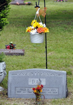
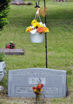
Fred Asa Day
| Birth | : | 20 Oct 1885 Rock Island County, Illinois, USA |
| Death | : | 1966 Muscatine, Muscatine County, Iowa, USA |
| Burial | : | Cedar Crest Cemetery, Collbran, Mesa County, USA |
| Coordinate | : | 39.2369003, -107.9589005 |
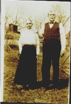
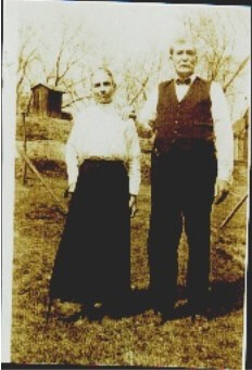
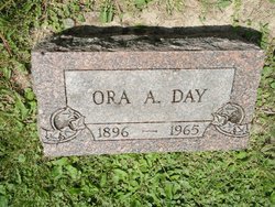
| Description | : | DAY, Fred Asa Fred A. Day, 81, died at 5:40 p.m. December 31, 1966, at the Lutheran Homes, following an extended illness. He had formerly resided at 1201 Wisconsin St. He was born Oct. 20, 1885, at Rock Island County, Ill., the son of Melzer and Margaret Thompson Day. He had been a Muscatine resident most of his life. He married Rosa Ann Smith in April, 1914 at Rock Island, Ill. Following her death he married Ora Alice Forbes in March, 1960, at Rock Island, Ill. She also preceded him in death. He is survived by five sons, Lloyd of... Read More |
frequently asked questions (FAQ):
-
Where is Fred Asa Day's memorial?
Fred Asa Day's memorial is located at: Cedar Crest Cemetery, Collbran, Mesa County, USA.
-
When did Fred Asa Day death?
Fred Asa Day death on 1966 in Muscatine, Muscatine County, Iowa, USA
-
Where are the coordinates of the Fred Asa Day's memorial?
Latitude: 39.2369003
Longitude: -107.9589005
Family Members:
Parent
Spouse
Siblings
Children
Flowers:
Nearby Cemetories:
1. Cedar Crest Cemetery
Collbran, Mesa County, USA
Coordinate: 39.2369003, -107.9589005
2. Eagalite Cemetery
Plateau City, Mesa County, USA
Coordinate: 39.2228012, -107.9894028
3. Clover Cemetery
Collbran, Mesa County, USA
Coordinate: 39.2550011, -107.9227982
4. Blackman Ranch Cemetery
Collbran, Mesa County, USA
Coordinate: 39.2647420, -107.8554350
5. Molina Cemetery
Molina, Mesa County, USA
Coordinate: 39.1886000, -108.0629000
6. Mesa Cemetery
Mesa, Mesa County, USA
Coordinate: 39.1685982, -108.1188965
7. Battlement Cemetery
Parachute, Garfield County, USA
Coordinate: 39.4380989, -108.0291977
8. DeBeque Cemetery
Mesa County, USA
Coordinate: 39.3374060, -108.2138900
9. Russey-Hurlburt Cemetery
Parachute, Garfield County, USA
Coordinate: 39.4522018, -108.0575027
10. Rulison Cemetery
Rulison, Garfield County, USA
Coordinate: 39.4768000, -107.9357000
11. Rose Hill Cemetery
Rifle, Garfield County, USA
Coordinate: 39.5381012, -107.7742004
12. Union Divide Creek Cemetery
Silt, Garfield County, USA
Coordinate: 39.4508018, -107.6200027
13. Cedaredge Cemetery
Cedaredge, Delta County, USA
Coordinate: 38.8884470, -107.9287560
14. Palisade Cemetery
Palisade, Mesa County, USA
Coordinate: 39.0999000, -108.3980000
15. Eckert Cemetery
Eckert, Delta County, USA
Coordinate: 38.8466660, -107.9593110
16. Skyline Cemetery
Silt, Garfield County, USA
Coordinate: 39.5520060, -107.6575300
17. Cory Cemetery
Delta, Delta County, USA
Coordinate: 38.7905080, -107.9894160
18. Whitewater Cemetery
Whitewater, Mesa County, USA
Coordinate: 38.9818993, -108.4357986
19. Memorial Gardens
Grand Junction, Mesa County, USA
Coordinate: 39.0790329, -108.5022278
20. Bethlehem Cemetery
Paonia, Delta County, USA
Coordinate: 38.8638992, -107.6216965
21. Crim Cemetery
Delta County, USA
Coordinate: 38.7675018, -107.9477997
22. Cedar Hill Cemetery
Paonia, Delta County, USA
Coordinate: 38.8569050, -107.6022980
23. Saint Matthews Episcopal Church Memorial Garden
Grand Junction, Mesa County, USA
Coordinate: 39.1021440, -108.5422860
24. Veterans Memorial Cemetery of Western Colorado
Grand Junction, Mesa County, USA
Coordinate: 39.0631447, -108.5261002

